Related Research Articles

Lewis Township is a township in Lycoming County, Pennsylvania, United States. The population was 987 at the 2010 census, down from 1,139 in 2000. It is part of the Williamsport Metropolitan Statistical Area.

Susquehanna Township is a township in Lycoming County, Pennsylvania, United States. The population was 972 at the 2020 census. It is part of the Williamsport Metropolitan Statistical Area.

The Clarion River is a tributary of the Allegheny River, approximately 110 mi (177 km) long, in west central Pennsylvania in the United States. It drains a rugged area of the Allegheny Plateau in the Ohio River watershed, flowing through narrow serpentine valleys and hardwood forests.

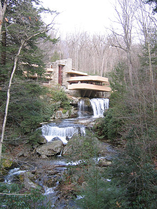
Bear Run is a 5.0-mile-long (8.0 km) tributary of the Youghiogheny River in Fayette County, Pennsylvania, in the United States.

Lycoming Creek is a 37.5-mile-long (60.4 km) tributary of the West Branch Susquehanna River located in Tioga and Lycoming counties in Pennsylvania in the United States.

Larrys Creek is a 22.9-mile-long (36.9 km) tributary of the West Branch Susquehanna River in Lycoming County in the U.S. state of Pennsylvania. A part of the Chesapeake Bay drainage basin, its watershed drains 89.1 square miles (231 km2) in six townships and a borough. The creek flows south from the dissected Allegheny Plateau to the Ridge-and-valley Appalachians through sandstone, limestone, and shale from the Devonian, Mississippian, and Pennsylvanian periods.

Chester Creek is a 9.4-mile-long (15.1 km) tributary of the Delaware River in Delaware County, Pennsylvania in the United States.

Black Moshannon Creek is a 22.9-mile-long (36.9 km) tributary of Moshannon Creek in Centre County, Pennsylvania in the United States.

Moshannon Creek is a 57.4-mile-long (92.4 km) tributary of the West Branch Susquehanna River in Centre County, Pennsylvania in the United States. Throughout its length, it serves as the boundary between Centre and Clearfield counties.
Spring Creek is a 25.2-mile-long (40.6 km) tributary of Bald Eagle Creek in Centre County, Pennsylvania in the United States.
Clover Creek is a 24.5-mile-long (39.4 km) tributary of the Frankstown Branch Juniata River in Bedford and Blair counties, Pennsylvania, in the United States.
Sinking Creek is a tributary of Penns Creek in Centre County, Pennsylvania, in the United States. It is approximately 19.8 miles (31.9 km) long and flows through Harris Township, Potter Township, and Gregg Township. The watershed of the creek has an area of 40.70 square miles (105.4 km2).

Slate Run is a 7.3-mile-long (11.7 km) tributary of Pine Creek in Tioga and Lycoming counties, Pennsylvania in the United States.
Lick Run is a 17.2-mile-long (27.7 km) tributary of the West Branch Susquehanna River in Clinton County, Pennsylvania in the United States.

Mountain Creek is a 20.9-mile-long (33.6 km) tributary of Yellow Breeches Creek in Cumberland County, Pennsylvania.

Quebec Run Wild Area is a 7,441-acre section of Forbes State Forest located in Fayette County, Pennsylvania just north of the Mason–Dixon line and the Pennsylvania border with West Virginia. Situated on the eastern slope of Chestnut Ridge, one of the westernmost ridges in the Appalachian Mountain Range, Quebec Run is heavily forested and contains several miles of maintained, interconnected trail. As is the case with all Pennsylvania state forest wild areas, no development of a permanent nature is permitted “in order to retain the undeveloped character of the area.” Quebec Run is the largest wild area without a road in southwestern Pennsylvania and serves as a destination for various outdoor activities including hiking, mountain biking, and cross-country skiing.
Drury Run is a tributary of the West Branch Susquehanna River in Clinton County, Pennsylvania, in the United States. It is 7.71 miles (12.41 km) long and its watershed is 11.5 square miles in area, most of which is forest. The stream's tributaries are affected by acid mine drainage, as are the lower reaches of the stream itself. It begins in Tamarack Swamp and flows through Leidy Township, Noyes Township, and Renovo. Brook trout, brown trout, creek chub, and eastern blacknose dace all inhabit the stream.

Culley Run is a tributary of Fishing Creek in Columbia County, Pennsylvania, in the United States. It is approximately 1.4 miles (2.3 km) long and flows through Benton Township. The stream's watershed has an area of 1.45 square miles (3.8 km2). Shale, sandstone, alluvium, and glacial till can be found in the watershed. At least one bridge crosses the stream. The stream is most likely named after Alexander Colley, Sr.
Coffee Run is a stream in the U.S. state of Pennsylvania.
Surveyor is an unincorporated community in Clearfield County, in the U.S. state of Pennsylvania.
References
- 1 2 U.S. Geological Survey Geographic Names Information System: Surveyor Run
- ↑ Espenshade, Abraham Howry (1925). Pennsylvania Place Names. Evangelical Press. p. 302. ISBN 978-0-8063-0416-8.