
Interstate 16 (I-16), also known as Jim Gillis Historic Savannah Parkway, is an east–west Interstate Highway located entirely within the US state of Georgia. It carries the hidden designation of State Route 404 (SR 404) for its entire length. I-16 travels from downtown Macon, at an interchange with I-75 and SR 540 to downtown Savannah at Montgomery Street (exit 167B). It also passes through or near the communities of Dublin, Metter, and Pooler. I-16's unsigned designation of SR 404 has a spur that is signed in Savannah.

Interstate 680 (I-680) is a north–south auxiliary Interstate Highway in Northern California. It curves around the eastern cities of the San Francisco Bay Area from San Jose to I-80 at Fairfield, bypassing cities along the eastern shore of San Francisco Bay such as Oakland and Richmond while serving others more inland such as Pleasanton and Concord.

U.S. Route 19 or U.S. Highway 19 (US 19) is a north–south United States Numbered Highway in the Eastern United States. Despite encroaching Interstate Highways, the route has remained a long-haul road, connecting the Gulf of Mexico with Lake Erie.

Sutton is a residential suburb on the Northside of Dublin, Ireland. It occupies the tombolo which links Howth Head to the mainland, some of the lower slopes of Howth Hill, and a little of the adjacent coasts. The area lies within the jurisdiction of Fingal County Council. There is a small commercial core at the Sutton Cross road intersection.

Howth is an affluent peninsular village and outer suburb of Dublin, Ireland. The district as a whole occupies the greater part of the peninsula of Howth Head, which forms the northern boundary of Dublin Bay, and includes the island of Ireland's Eye, which holds multiple natural protection designations.

The Burnett Highway is an inland rural highway located in Queensland, Australia. The highway runs from its junction with the Bruce Highway at Gracemere, just south of Rockhampton, to the D'Aguilar Highway in Nanango. Its length is approximately 542 kilometres. The highway takes its name from the Burnett River, which it crosses in Gayndah. The Burnett Highway provides the most direct link between the northern end of the New England Highway and Rockhampton. It is designated as a State Strategic Road by the Queensland Government.

Avenue A is a north–south avenue located in Manhattan, New York City, east of First Avenue and west of Avenue B. It runs from Houston Street to 14th Street, where it continues into a loop road in Stuyvesant Town, connecting to Avenue B. Below Houston Street, Avenue A continues as Essex Street.

Pennsylvania Route 313 is a mostly 2-lane, 18-mile-long (29 km) state highway entirely within Bucks County, Pennsylvania. The western end of PA 313 is at an intersection with PA 309 and PA 663 in Quakertown. The eastern end is at an intersection with PA 263 in the Doylestown Township community of Furlong. PA 313 is signed an east–west road, although it runs almost purely northwest–southeast through most of its course. It is a major arterial road in central and northern Bucks County as it connects several communities including Quakertown, Dublin, and Doylestown.

Pennsylvania Route 926 is a 26.2-mile-long (42.2 km) state route located west of Philadelphia in Chester County, Pennsylvania. The western terminus of the route is at PA 10 in Upper Oxford Township. The eastern terminus is at PA 3 in the Philadelphia suburb of Willistown Township. The route is known as Street Road for its entire length. For 0.9 miles (1.4 km), PA 926 runs along the county line between Delaware and Chester counties. The route passes through a mix of suburban and rural areas along its extent. PA 926 is two lanes and undivided its entire length.

State Route 29 (SR 29) is a 98.1-mile-long (157.9 km) state highway that travels southeast-to-northwest through portions of Toombs, Montgomery, Treutlen, Laurens, Wilkinson, and Baldwin counties in the central part of the U.S. state of Georgia. The highway connects the Vidalia area with the Milledgeville area, via the Dublin area.
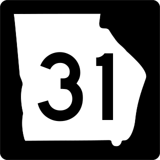
State Route 31 (SR 31) is a 166.9-mile-long (268.6 km) state highway that travels south-to-north through portions of Lowndes, Lanier, Clinch, Atkinson, Coffee, Telfair, Wheeler, Dodge, Laurens, and Johnson counties in the south-central part of the U.S. state of Georgia. The highway connects the Florida state line, south of Clyattville with Wrightsville, via Valdosta, Douglas, and Dublin.

Pennsylvania Route 475 is a 19.6-mile-long (31.5 km) state highway located in Fulton and Huntingdon counties in Pennsylvania. The southern terminus is at US 522 in Dublin Township. The northern terminus is at PA 994 near Rockhill Furnace. The route was created in 1964, replacing Pennsylvania Route 176 due to the designation of Interstate 176 (I-176) in Pennsylvania.

The N87 road is a national secondary road in the north of County Cavan, Ireland.
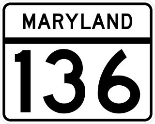
Maryland Route 136 is a state highway in the U.S. state of Maryland. The state highway runs 30.04 miles (48.34 km) from MD 7 near Abingdon north to MD 23 in Norrisville. MD 136 is an L-shaped route that connects the communities of Creswell, Churchville, Dublin, and Whiteford in eastern Harford County with each other and with Norrisville in the county's northwestern corner. The state highway is connected to the cities of Aberdeen and Havre de Grace via its connection with MD 22. MD 136 is also linked to the county seat of Bel Air from the east through MD 22, from the northeast by U.S. Route 1, from the north via MD 24, and from the northwest by MD 23. The state highway starts on the coastal plain near the Chesapeake Bay and crosses Harford County's two main tributaries of the Susquehanna River, Deer Creek and Broad Creek, while traversing a wide swath of the Piedmont. MD 136 is the second longest Maryland state highway entirely within one county after MD 235.

The R105 road is a regional road in north Dublin, Ireland. It travels from the city centre to Howth, and loops at both ends; the road fully encircles Howth Head. Along the way, the road passes through Fairview, the western end of Clontarf, Killester, Raheny, the coastal edge of Kilbarrack and Sutton. Its biggest component is Howth Road.

The R809 road is a regional road in three sections in Dublin and Fingal, Ireland. It connects the R807 in Bettyglen to the R105 in Sutton following a roughly semicircular path that runs north, then east, then south, connecting one point on the coast road of Dublin Bay with another point, further northeast.

State Route 199 (SR 199) is a 26.9-mile-long (43.3 km) state highway in the east-central part of the U.S. state of Georgia. It is a southeast–northwest route through portions of Montgomery, Treutlen, and Laurens counties. It runs from a point north of Mount Vernon northwest to East Dublin.
Rockhampton–Emu Park Road is a continuous 44.1 kilometres (27.4 mi) road route in the Rockhampton and Livingstone local government areas of Queensland, Australia. The route is designated as State Route 4 (Regional) and Tourist Drive 10. It is a state-controlled regional road.
Stanthorpe–Texas–Inglewood Road is a continuous 152.8 kilometres (94.9 mi) road route in the Southern Downs and Goondiwindi regions of Queensland, Australia. It has two official names: Stanthorpe–Texas Road and Inglewood–Texas Road. The entire route is signed as State Route 89. Tourist Drives 5 (Amiens) and 8 and the Shearer's Way all start in Stanthorpe and run concurrent with this road for part of its length.
Gatton–Clifton Road is a continuous 63.1 kilometres (39.2 mi) road route in the Lockyer Valley and Toowoomba regions of Queensland, Australia. Most of the road is signed as State Route 80. Gatton–Clifton Road is a state-controlled road, part regional and part district. The district part is rated as a local road of regional significance (LRRS).

