Related Research Articles

The Mount Hood Corridor is a part of Oregon between Sandy and Government Camp, in Clackamas County. It is named after Mount Hood and has served travelers going in both directions since the days of Native Americans and Oregon Trail migrants. The area between Alder Creek and Government Camp is sometimes known as Hoodland.

The Pudding River is a 62-mile (100 km) tributary of the Molalla River in the U.S. state of Oregon. Its drainage basin covers 528 square miles (1,368 km2). Among its tributaries are Silver Creek, Butte Creek, Abiqua Creek, and the Little Pudding River.

Watson Falls is a 272-foot (83 m) waterfall on Watson Creek, a tributary of the Clearwater River, in Douglas County in the U.S. state of Oregon. It is located at an elevation of 3,353 feet (1,022 m).

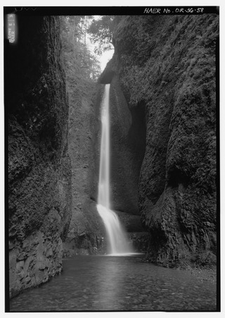
Oneonta Gorge is a scenic gorge located in the Columbia River Gorge area of the American state of Oregon. The U.S. Forest Service has designated it as a botanical area because of the unique aquatic and woodland plants that grow there. Exposed walls of 25-million-year-old basalt are home to a wide variety of ferns, mosses, hepatics, and lichens, many of which grow only in the Columbia River Gorge. Oneonta Gorge with its 50 species of wildflowers, flowering shrubs and trees has been described as "one of the true dramatic chasms in the state." The Oneonta Gorge Creek Bridge is listed on the National Register of Historic Places.

Shepperd's Dell is a small canyon in the Columbia River Gorge in Oregon, located at 45.54833°N 122.195°W which is less than one-third mile southeast of Rooster Rock State Park. The Shepperd's Dell Bridge is listed on the National Register of Historic Places.
Multnomah Education Service District (MESD) is an education service district that coordinates school events and activities throughout the school districts in Multnomah County, Oregon, United States. Its administrative offices are located at 11611 NE Ainsworth Circle in Portland.

The Waterfront Blues Festival is an annual event in Portland, Oregon, United States featuring four days of performances by blues musicians. The festival started in 1988 and takes place in Tom McCall Waterfront Park, along the west bank of the Willamette River in downtown Portland.
Westmoreland is one of two distinct districts making up the Sellwood-Moreland neighborhood of Southeast Portland, bordering Brooklyn to the north, the Willamette River to the west, Eastmoreland to the east, and Sellwood to the south. The isolation caused by being bounded on two sides by the river and Oregon Route 99E have produced a distinct small-town atmosphere, despite its being relatively close to downtown Portland.

Butte Creek is a stream in the U.S. state of Oregon, a tributary of the Pudding River. It is approximately 33 miles (53 km) long and, for all of its course, defines part of the northeastern boundary of Marion County and the southern boundary of Clackamas County.

Canyon Road is a 6.5 mi (10.5 km) major road and partial state highway, which serves as a connector between Beaverton and Portland, Oregon, United States. It was the first major road constructed between the Tualatin Valley and Portland, and has contributed significantly to Portland becoming the area's major deep water port, and subsequent early growth of the city. The total modern length is 6.5 miles (10.5 km), and 2.7 miles (4.3 km) of the route is coterminous with U.S. Route 26. In addition, the segment of the road signed as Oregon Route 8 under the name Canyon Road spans for 3.8 miles (6.1 km). There is an additional, small portion of a driveway in the Oregon Zoo parking lot that is also named Canyon Road; this is a continuation of a local suburban street named Canyon Court.

Mill Creek Falls, is a waterfall located in the Rogue River Canyon within the Prospect State Scenic Viewpoint in Jackson County, in the U.S. state of Oregon. The waterfall is located at the south end of Mill Creek as it plunges into the Rogue River over a carved cliff surrounded by walls of petrified volcanic ash consequence of Mount Mazama eruption.

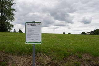
Clatsop Butte is an upland butte lying directly south of Powell Butte in southeast Portland, Oregon, United States. Clatsop Butte City Park, which occupies part of the butte, is at coordinates 45°28′28″N122°30′24″W at an elevation of 577 feet (176 m). Johnson Creek, Southeast Foster Road, and the Springwater Corridor Trail pass between Powell Butte and Clatsop Butte near Southeast 152nd Avenue.
Camp Benson Falls is a 90-foot waterfall on Summit Creek in Lindsey Creek State Park, Hood River County, Oregon, United States. Its elevation is 369 feet (112 m).

Fairy Falls is a 20-foot waterfall on the Oregon side of the Columbia River Gorge in the United States. As part of a tributary of Wahkeena Creek, Fairy Falls is located upstream from the much larger Wahkeena Falls. While small, this fan-shaped waterfall is a destination for photographers, mainly because of the scenic view. The creek cascades through a mossy rock slide lined with ferns, until rocky ledges of basalt break the water into various lacy streams.

Coopey Falls is a waterfall on Coopey Creek in the Columbia River Gorge, on the Historic Columbia River Highway in Multnomah County, Oregon. The falls is a horsetail waterfall with a drop of 150 feet (46 m).

Blue Lake Regional Park is a public park in Fairview, in the U.S. state of Oregon. The 101-acre (41 ha) park, near the south shore of the Columbia River in Multnomah County, includes many covered and uncovered picnic areas, playing fields for sports such as softball, a cross country course and infrastructure related to lake recreation including swimming, boating, and fishing. Encompassing wooded areas, three ponds, and a wetland in addition to the lake, the park is frequented by migrating birds and other wildlife. Paved paths run through the park, which is near the 40-Mile Loop hiking and biking trail. Park vegetation includes cottonwoods, willows, and other trees and shrubs as well as wetland plants such as cattails.
Steamboat is an unincorporated community in Douglas County, Oregon, United States. It is located about 39 miles east of Roseburg on Oregon Route 138, near the confluence of the North Umpqua River with Steamboat Creek within the Umpqua National Forest.
Willow Creek Wildlife Area, located in northeastern Oregon, United States, near the Columbia River, is operated by the Oregon Department of Fish and Wildlife. Birds watchers may find birds of prey, waterfowl, wading birds, songbirds and shorebirds.
The Cazadero Trail is a multi-use trail in the U.S. state of Oregon in a rural area of southeastern Portland.
Culp Creek is a stream in Lane County, Oregon, in the United States. It was named for John Culp, a pioneer who settled near this stream. The creek flows northeast into the Row River.
References
- ↑ U.S. Geological Survey Geographic Names Information System: Swagger Creek
- ↑ Giordano, Pete (2004). Soggy Sneakers: A Paddler's Guide to Oregon Rivers. The Mountaineers Books. p. 224. ISBN 978-0-89886-815-9.
45°13′40″N122°22′05″W / 45.22778°N 122.36801°W