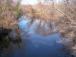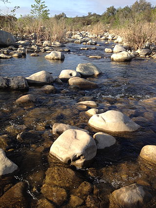
Water quality refers to the chemical, physical, and biological characteristics of water based on the standards of its usage. It is most frequently used by reference to a set of standards against which compliance, generally achieved through treatment of the water, can be assessed. The most common standards used to monitor and assess water quality convey the health of ecosystems, safety of human contact, extent of water pollution and condition of drinking water. Water quality has a significant impact on water supply and often determines supply options.

The Clean Water Act (CWA) is the primary federal law in the United States governing water pollution. Its objective is to restore and maintain the chemical, physical, and biological integrity of the nation's waters; recognizing the responsibilities of the states in addressing pollution and providing assistance to states to do so, including funding for publicly owned treatment works for the improvement of wastewater treatment; and maintaining the integrity of wetlands.

The Mispillion River is a river flowing to Delaware Bay in southern Delaware in the United States. It is approximately 15 miles (24 km) long and drains an area of 76 square miles (200 km2) on the Atlantic Coastal Plain.

The St. Jones River is a river flowing to Delaware Bay in central Delaware in the United States. It is 12.8 miles (20.6 km) long and drains an area of 36 square miles (93 km2) on the Atlantic Coastal Plain.

Blackbird Creek is a 16.9-mile-long (27.2 km) river in northern Delaware in the United States.

Darby Creek is a tributary of the Delaware River in Chester, Delaware and Philadelphia counties, in the U.S. Commonwealth of Pennsylvania. It is approximately 26 miles (42 km) long. The watershed of the creek has an area of 77.2 square miles (200 km2). It has twelve named direct tributaries, including Cobbs Creek, Little Darby Creek, Ithan Creek, and Muckinipattis Creek. The creek has a low level of water quality for most of its length. The lower Darby Creek area was deemed a Superfund site by the U.S. Environmental Protection Agency (EPA) due to contamination with dangerous chemicals from two landfills.
Assiscunk Creek is a tributary of the Delaware River in southwestern New Jersey in the United States.

The Ventura River, in western Ventura County in southern California, United States, flows 16.2 miles (26.1 km) from its headwaters to the Pacific Ocean. The smallest of the three major rivers in Ventura County, it flows through the steeply sloped, narrow Ventura Valley, with its final 0.7 miles (1.1 km) through the broader Ventura River estuary, which extends from where it crosses under a 101 Freeway bridge through to the Pacific Ocean.

White Deer Creek is a tributary of the West Branch Susquehanna River in Centre County and Union County, in Pennsylvania, in the United States. It is approximately 28 miles (45 km) long and flows through Miles Township in Centre County and Hartley Township, Lewis Township, West Buffalo Township, and White Deer Township in Union County. The watershed of the creek has an area of 45.1 square miles (117 km2). Parts of the creek are designated as impaired. The creek's discharge near White Deer can be as low as 3 cubic feet per second (0.085 m3/s) or as high as 169 cubic feet per second (4.8 m3/s).

The DSSAM Model is a computer simulation developed for the Truckee River to analyze water quality impacts from land use and wastewater management decisions in the Truckee River Basin. This area includes the cities of Reno and Sparks, Nevada as well as the Lake Tahoe Basin. The model is historically and alternatively called the Earth Metrics Truckee River Model. Since original development in 1984-1986 under contract to the U.S. Environmental Protection Agency (EPA), the model has been refined and successive versions have been dubbed DSSAM II and DSSAM III. This hydrology transport model is based upon a pollutant loading metric called Total maximum daily load (TMDL). The success of this flagship model contributed to the Agency's broadened commitment to the use of the underlying TMDL protocol in its national policy for management of most river systems in the United States.
A total maximum daily load (TMDL) is a regulatory term in the U.S. Clean Water Act, describing a plan for restoring impaired waters that identifies the maximum amount of a pollutant that a body of water can receive while still meeting water quality standards.

Naylors Run is a 4.6-mile-long (7.4 km) tributary of Cobbs Creek in Haverford and Upper Darby Township, Pennsylvania, United States.

Shellpot Creek is a tributary of the Delaware River in northeast New Castle County, Delaware. The stream rises between Grubb Road and Shipley Road, south of Naaman's Road at 39°49′19″N75°31′55″W in Brandywine Hundred and flows southeast for about six miles before discharging into the Delaware River at 39°44′05″N75°30′16″W near Edgemoor. Prior to 1938, the stream drained into the Brandywine Creek, but was subsequently redirected to the Delaware River.

Nutrient pollution, a form of water pollution, refers to contamination by excessive inputs of nutrients. It is a primary cause of eutrophication of surface waters, in which excess nutrients, usually nitrogen or phosphorus, stimulate algal growth. Sources of nutrient pollution include surface runoff from farm fields and pastures, discharges from septic tanks and feedlots, and emissions from combustion. Raw sewage is a large contributor to cultural eutrophication since sewage is high in nutrients. Releasing raw sewage into a large water body is referred to as sewage dumping, and still occurs all over the world. Excess reactive nitrogen compounds in the environment are associated with many large-scale environmental concerns. These include eutrophication of surface waters, harmful algal blooms, hypoxia, acid rain, nitrogen saturation in forests, and climate change.
Coosa River Basin Initiative (CRBI) is a 501(c)(3) grassroots environmental organization based in Rome, Georgia, with the mission of informing and empowering citizens to protect, preserve and restore North America's most biologically diverse river basin, the Coosa. Since 1992, the staff, board and members have served as advocates for "the wise stewardship of the natural resources of the Upper Coosa River basin, or watershed, which stretches from southeastern Tennessee and north central Georgia to Weiss Dam in Northeast Alabama. This includes the Coosa River, the Etowah and Oostanaula rivers and the tributaries of these waterways as well as the land drained by these streams and the air that surrounds this land area."

Water pollution in the United States is a growing problem that became critical in the 19th century with the development of mechanized agriculture, mining, and manufacturing industrys—although laws and regulations introduced in the late 20th century have improved water quality in many water bodies. Extensive industrialization and rapid urban growth exacerbated water pollution as a lack of regulation allowed for discharges of sewage, toxic chemicals, nutrients, and other pollutants into surface water. This has led to the need for more improvement in water quality as it is still threatened and not fully safe.
Quinn Run is a tributary of Heberly Run in Sullivan County, Pennsylvania. It is approximately 2.3 miles (3.7 km) long and flows through Davidson Township, Sullivan County, Pennsylvania. The watershed of the stream has an area of 2.31 square miles (6.0 km2). The stream is acidic and is considered by the Pennsylvania Department of Environmental Protection to be impaired by atmospheric deposition. Rock formations in the watershed include the Huntley Mountain Formation and the Burgoon Sandstone. Soils in the watershed include the Deep-Wellsboro-Oquaga soil association, and the Oquaga and Norwich soil associations. There are some waterfalls on the stream.
Cross Run is a tributary of Catawissa Creek in Luzerne County, Pennsylvania, in the United States. It is approximately 1.1 miles (1.8 km) long and flows through Hazle Township. The stream is in the United States Geological Survey quadrangle of Conyngham. The stream has two reservoirs on it and has been used as a water supply for Hazleton since at least the late 1800s or early 1900s. Both of the stream's reservoirs have dams. The stream has one unnamed tributary. Cross Run and its unnamed tributary are considered by the Pennsylvania Department of Environmental Protection to be impaired for part of their lengths.

Spring Run is a tributary of the West Branch Susquehanna River in Northumberland County, Pennsylvania, in the United States. It is approximately 2.3 miles (3.7 km) long and flows through Delaware Township and Watsontown. The watershed of the stream has an area of 1.34 square miles (3.5 km2). The stream is designated as an impaired waterbody due to sedimentation/siltation and unknown causes. The stream is classified as a Warmwater Fishery.
Polk Valley Run is a tributary of Saucon Creek in Northampton County, Pennsylvania. It is approximately 1.9 miles (3.1 km) long and flows through Lower Saucon Township and Hellertown. The watershed of the stream has an area of 2.13 square miles (5.5 km2). A reach of the stream is designated as an impaired waterbody due to siltation from agriculture. However, wild trout and other wildlife are present in and around it. Most of the watershed is forested.


