
Breedon on the Hill is a village and civil parish about 5 miles (8 km) north of Ashby-de-la-Zouch in North West Leicestershire, England. The parish adjoins the Derbyshire county boundary and the village is only about 2 miles (3 km) south of the Derbyshire town of Melbourne. The 2001 Census recorded a parish population of 958 people in 404 households. The parish includes the hamlets of Tonge 1 mile (1.6 km) east of the village and Wilson 1.3 miles (2 km) north of the village on the county boundary. The population at the 2011 census was 1,029 in 450 households.

Kegworth is a large village and civil parish in the North West Leicestershire district of Leicestershire, in the East Midlands region, England. It forms part of the border with Nottinghamshire and is situated 6 miles north of Loughborough, 12 miles southwest of Nottingham, 12.5 miles southeast of Derby and 17 miles north of Leicester. The population of Kegworth as of the 2011 census was 3,601.

Cossington is a village within the Soar Valley in Leicestershire, England. It lies between Sileby, Rothley, Ratcliffe-on-the-Wreake and Syston. The population of the civil parish at the 2011 census was 598.

Ash is a village and civil parish in the Dover district of east Kent about three miles west of Sandwich.

Nocton is a village and civil parish in the North Kesteven district of Lincolnshire, England. It is situated on the B1202 road, 7 miles (11 km) south-east from Lincoln city centre. The population of the civil parish at the 2011 census was 819. To the east of the village is Nocton Fen with its small settlement of Wasps Nest. To the west of the village, situated at the junction of Wellhead Lane and the B1188 road, is Nocton Top Cottages consisting of eight further dwellings. At the south of the village are the remains of Nocton Hall, and 1 mile (2 km) to the east the earthwork remains of Nocton Park Priory.

Ketton is a village and civil parish in Rutland in the East Midlands of England. It is about 8 miles (13 km) east of Oakham and 3 miles (5 km) west of Stamford, Lincolnshire. The 2011 Census recorded a parish population of 1,926, making it the fourth largest settlement in Rutland, after Oakham, Uppingham and Cottesmore. The village has a primary school.

Seagrave is a village and civil parish in the Charnwood district of Leicestershire, England. It has a population of around 500, measured at the 2011 census as 546, It is north of Sileby and close to Thrussington and Barrow upon Soar.
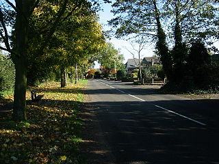
Wanlip is a small village and civil parish in the Charnwood district of Leicestershire, with a population measured at 305 at the 2011 census. It is a countryside village, north of Birstall, and west of Watermead Country Park and the River Soar. The A46 road runs directly past the village. Wanlip won the 2008 Leicester and Rutland Best Village Competition for villages with a population under 500.

Garthorpe is a village and civil parish in Leicestershire, England, in the Melton district. It is about five miles east of Melton Mowbray. The parish includes the villages of Garthorpe and Coston, and is near Saxby, Wymondham, Buckminster and Sproxton.

East Langton is a village and civil parish in the Harborough district of Leicestershire, England.

Thorpe in the Glebe was a village in Nottinghamshire to the south of Wysall on the Leicestershire border. It was sometimes called Thorpe in the Clottes. Tradition has it that the village was destroyed either at the Battle of Willoughby Field or alternatively by a hail-storm. However, at the time of the English Civil War, there had been no village at Thorpe in the Glebe for nearly 200 years.

West Down is a small village and civil parish located in North Devon, England. It is to be found on the route between Braunton and Ilfracombe, 9 miles (14 km) north-west of Barnstaple. The village sits in a bowl in the hills at 450 feet (140 m) above sea level. In 2011 its population was 671.

Stockerston is a village and civil parish in the Harborough district of Leicestershire, England, located on the border with Rutland, by the Eye Brook. According to the 2001 census the parish had a population of 35. The population remained less than 100 at the 2011 census and is included in the civil parish of Horninghold.

Diseworth is a village and former civil parish, now in the parish of Long Whatton and Diseworth, in the North West Leicestershire district, in the English county of Leicestershire. It is south of East Midlands Airport and off Junction 23A of the M1 motorway.

Brailsford is a small red-brick village and civil parish in Derbyshire on the A52 midway between Derby and Ashbourne. The parish also includes Brailsford Green. The civil parish population at the 2011 Census was 1,118. The village has a pub, a golf club, a post office and a school. There are many fine houses in the district including two 20th-century country houses: Brailsford Hall built in 1905 in Jacobean style, and Culland Hall.
Foxley is a village and civil parish in Norfolk, England. The village is 6 miles (10 km) north-east of Dereham and 15 miles (24 km) north-west of Norwich, along the A1067 between Fakenham and Norwich.

North Pickenham is a village in the Breckland district of mid-Norfolk, East Anglia, England. It lies three miles from the Georgian market town of Swaffham.

Swannington is a former mining village situated between Coalville and Ashby-de-la-Zouch, Leicestershire, England. A document of 1520 mentions five pits at Swannington. It was a terminus of the early (1832) Leicester and Swannington Railway that was built to serve the townships of Swannington and Thringstone and is built on a spot reputedly chosen by William Wordsworth, a frequent guest of Sir George Beaumont of nearby Coleorton Hall. It is possible that the dedication of the church to Saint George is derived from its association with this George Beaumont.

South Leverton is a village and civil parish in Bassetlaw, north Nottinghamshire, England, four miles from Retford. According to the 2001 census it has a population of 478, increasing marginally to 480 at the 2011 census, and more substantially to 514 at the 2021 census.

Croft is a small village and civil parish in the East Lindsey district of Lincolnshire, England. The village is situated approximately 2 miles (3 km) north-east from Wainfleet, and 4 miles (6 km) south-west from Skegness.

