Swinley, Wigan

Last updated
The pavilion at Mesnes Park as it looked in 2005 Mesnes Park, Wigan - geograph.org.uk - 47077.jpg
The pavilion at Mesnes Park as it looked in 2005

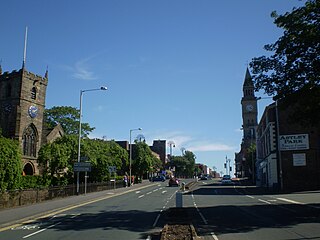
Swinley is an urban suburb of Wigan, Greater Manchester. The area was mainly developed during the late Victorian and Edwardian period from around 1885 up until the end of the interwar period upon a green corridor centred on the section of the Chester to Lancaster Roman Road named Wigan Lane which leads northwards from the original 1246 Royal Charter [1] boundary of the Borough of Wigan towards the parish of Standish between neighbouring industrial areas of mills, mines and ironworks. It originally featured a hodgepodge development of villa's, flats and large town houses on what was then open fields, later stages of development during the interwar period infilled with terraces. The area to the east of Wigan Lane abuting Douglas Valley retains this exclusive character with properties selling from £500,000 to over a million.

Wigan was one of the four boroughs in Lancashire alongside Liverpool, Lancaster and Preston to receive a royal charter. The borough was chartered to be the triangle of land formed by the river Douglas as it passes around the hill upon which the town was built, this hill now forms the town centre. Overspill development always existed on the roads approaching the town and by the time of the industrial revolution many traders and residents had set up just beyond the 'gates' where they were free of borough taxation.

In 1651 during the English Civil War the Battle of Wigan Lane was fought between 3000 Roundheads under Colonel Robert Lilburne and 1500 Royalists under the Early of Derby. The location where Sir Thomas Tyldesley fell on Wigan Lane is marked by the Tyldesley war monument erected in 1679. Battle damage can still be seen on the tower of All Saints' Church, Wigan Parish church.

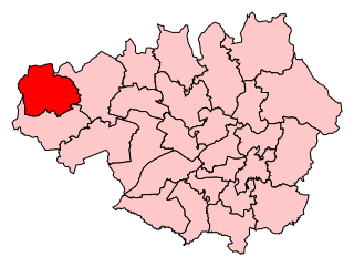
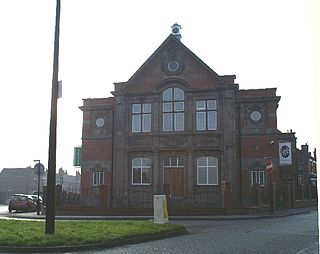
In 1878 Mesnes Park, begun in 1871, was completed replacing two collieries and tramlines on land belonging to the Rector of Wigan Parish (the Rectors Demesne giving rise to the name Mesnes), Bridgeman Terrace was built overlooking the park in 1876 and with public transport from existing tramlines this may have kickstarted the areas suburbanisation. The Victorian Gothic grade II* listed St Michaels and All Angels parish church was completed in 1878 next to Swinley Hall which has not survived. In 1881 the parish of Swinley (which included Whitley) was formed at St Michaels under the jurisdiction of the Rector of Wigan Parish. Under the Local Government Act 1888 in 1889 the County Borough of Wigan was formed replacing the Municipal Borough of Wigan and incorporating all the lands of Wigan and from 1904 Pemberton parishes which had formerly been outside the towns municipal boundaries. In 1974 the County Borough of Wigan was dissolved and the Metropolitan Borough of Wigan was formed within the county of Greater Manchester.

Swinley is bounded to the west by the tracks of the West Coast Main Line, to the south by Wigan Town Centre. To the east the course of the river Douglas in leafy Douglas Valley (which at the time featured industrial ironworks) and Haigh Country Park separate it from the suburb of Whelley. To the North West the land between Spencer Road and the west of Wigan Lane (including Whitley Crescent and Trinity United Reformed Church) forms the small similarly affluent suburb of Whitley centered on Whitley Reservoir. The 1894 OS Map lists Whitley Reservoirs origin as a gravel pit surrounded by country lanes and the suburb developed at the same time as Swinley between the late Victorian and First World War in the arts and crafts style to a preplanned grid. Meanwhile, Swinley continues northwards on the west side of Wigan Lane until it reaches Standish at the Boars Head Resorvoir.

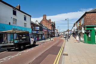
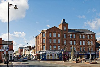
The population of Swinley is around 11,000 people and the area is mainly residential, alongside offices and a main high street on Wigan Lane. The area also contains the large Royal Albert Edward Infirmary, Victorian Mesnes Park, Cricket, Tennis and Bowls clubs and a Tesco Extra supermarket built on the former site of Central Park the Wigan Warriors previous stadium.

Related Research Articles

West Ham Human settlement in England

West Ham is a district in East London, located 6.1 mi (9.8 km) east of Charing Cross in the west of the modern London Borough of Newham. The West Ham electoral ward covers part of the central area of that borough.

Chorley Town in Lancashire, England

Chorley is a town and the administrative centre of the wider Borough of Chorley in Lancashire, England, 8.1 miles (13 km) north of Wigan, 10.8 miles (17 km) south west of Blackburn, 11 miles (18 km) north west of Bolton, 12 miles (19 km) south of Preston and 19.5 miles (31 km) north west of Manchester. The town's wealth came principally from the cotton industry.

Metropolitan Borough of Wigan Borough of Greater Manchester, England

The Metropolitan Borough of Wigan is a metropolitan borough of Greater Manchester, in North West England. It is named after the main settlement of Wigan. It covers the towns of Atherton, Ashton-in-Makerfield, Golborne, Hindley, Ince-in-Makerfield, Leigh and Tyldesley. The borough also covers the villages and suburbs of Abram, Aspull, Astley, Bryn, Hindley Green, Lowton, Mosley Common, Orrell, Pemberton, Shevington, Standish, Winstanley and Worsley Mesnes.

Quinton, Birmingham Ward in England

Quinton, situated in the west of Birmingham, is a ward that is approximately 5 miles from Birmingham city centre. Between the Amber Tavern and Quinton church, the southern side of the Hagley Road is part of the city of Birmingham and the northern side is part of the metropolitan borough of Sandwell. Quinton, along with Bartley Green, Harborne and Edgbaston are a part of the Birmingham Edgbaston constituency. The whole of Quinton is covered by the B32 postal district.

Atherton, Greater Manchester Town within the Metropolitan Borough of Wigan, England

Atherton is a town in the Metropolitan Borough of Wigan, in Greater Manchester, England and historically a part of Lancashire. The town, including Hindsford, Howe Bridge and Hag Fold, is 5 miles (8.0 km) east of Wigan, 2 miles (3.2 km) north of Leigh, and 10+34 miles (17.3 km) northwest of Manchester. From the 17th century, for about 300 years, Atherton was known as Chowbent, which was frequently shortened to Bent, the town's old nickname.

Standish, Greater Manchester Human settlement in England

Standish is a village in the Metropolitan Borough of Wigan, Greater Manchester, England. Within the boundaries of the historic county of Lancashire, it is on the A49 road between Chorley and Wigan, near Junction 27 of the M6 motorway. The population of the village was 13,278 in the 2011 census.

Wigan (UK Parliament constituency) Parliamentary constituency in the United Kingdom, 1885 onwards

Wigan is a constituency in Greater Manchester, represented in the House of Commons of the UK Parliament since 2010 by Lisa Nandy of the Labour Party, who also serves as the Shadow Housing and Levelling Up Secretary.

Shevington Village and civil parish within the Metropolitan Borough of Wigan

Shevington is a village and civil parish within the Metropolitan Borough of Wigan, England. The population of the Wigan ward called Shevington and Lower Ground had increased to 11,482 at the 2011 Census.

Astley, Greater Manchester Human settlement in England

Astley is a village in the Metropolitan Borough of Wigan, Greater Manchester, England. Within the boundaries of the historic county of Lancashire, it is crossed by the Bridgewater Canal and the A580 East Lancashire Road. Continuous with Tyldesley, it is equidistant from Wigan and Manchester, both 8.3 miles (13.4 km) away. Astley Mosley Common ward had a population of 11,270 at the 2011 Census.

Tyldesley Human settlement in England

Tyldesley is a town in the Metropolitan Borough of Wigan in Greater Manchester, England. Within the boundaries of the historic county of Lancashire, it is north of Chat Moss near the foothills of the West Pennine Moors, 7.7 miles (12.4 km) southeast of Wigan and 8.9 miles (14.3 km) northwest of Manchester. At the United Kingdom Census 2001, the Tyldesley built-up area, excluding Shakerley, had a population of 16,142.

Pemberton, Greater Manchester Human settlement in England

Pemberton is a town and an electoral ward of the Metropolitan Borough of Wigan, in Greater Manchester, England. It lies on the southwestern bank of the River Douglas, which separates it from the town of Wigan, and east of the M6 motorway. The area today serves as a predominantly residential suburb along with the adjoining area of Orrell and as a ward has a population of 13,638, increasing to 13,982 at the 2011 Census.

Wigan Town in Greater Manchester, England

Wigan is a large town in Greater Manchester, England, on the River Douglas. The town is midway between the two cities of Manchester, 16 miles (25.7 km) to the south east, and Liverpool, 17 miles (27 km) to the southwest. The towns of Bolton to the northeast, and Warrington to the south are 10 miles (16 km) and 12 miles (19 km) away respectively. Within the boundaries of the historic county of Lancashire, Wigan is the largest settlement in the Metropolitan Borough of Wigan and its administrative centre. The town has a population of 107,732 and the wider borough of 330,713.

Westleigh, Greater Manchester

Westleigh, a suburb of Leigh, Greater Manchester, England, is one of three ancient townships, Westleigh, Bedford and Pennington, that merged in 1875 to form the borough of Leigh.

Bedford, Greater Manchester One of three townships that merged to form Leigh, England

Bedford, a suburb of Leigh, Greater Manchester is one of three ancient townships, Bedford, Pennington and Westleigh, that merged in 1875 to form the town of Leigh. Historically, Bedford was in Lancashire.

Wigan is a town in the Metropolitan Borough of Wigan, Greater Manchester, England. The town, together with the outlying townships of Pemberton, Scholes, Whelley, Worsley Mesnes, Winstanley, and Goose Green,, contains 125 listed buildings that are recorded in the National Heritage List for England. Of these, nine are listed at Grade II*, the middle of the three grades, and the others are at Grade II, the lowest grade.

Mesnes Park, Wigan

Mesnes Park ( is a Victorian public park dating from 1878 in Wigan, Greater Manchester, UK.

References

  1. "Wigan Borough Royal Charter – GMMG". www.gmmg.org.uk. Archived from the original on 2014-04-16.