Coordinates: 52°42′30.75″N1°10′23.00″W / 52.7085417°N 1.1730556°W
A geographic coordinate system is a coordinate system that enables every location on Earth to be specified by a set of numbers, letters or symbols. The coordinates are often chosen such that one of the numbers represents a vertical position and two or three of the numbers represent a horizontal position; alternatively, a geographic position may be expressed in a combined three-dimensional Cartesian vector. A common choice of coordinates is latitude, longitude and elevation. To specify a location on a plane requires a map projection.
Swithland Hall is a 19th-century Neoclassical country house in Swithland, Leicestershire, designed by James Pennethorne .
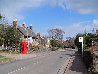
Swithland is a linear village in the Charnwood borough of Leicestershire, England. The population of the civil parish was estimated as 230 in 2004 and measured as 217 in the 2011 census. It is in the old Charnwood Forest, between Cropston, Woodhouse and Woodhouse Eaves. Although small, it has a village hall, a parish church, and a pub, the Griffin Inn. The village is known for the slate that was quarried in the area.
Leicestershire is a landlocked county in the English Midlands. The county borders Nottinghamshire to the north, Lincolnshire to the north-east, Rutland to the east, Northamptonshire to the south-east, Warwickshire to the south-west, Staffordshire to the west, and Derbyshire to the north-west. The border with most of Warwickshire is Watling Street.
The present Swithland Hall was built for George John Danvers-Butler, later Earl of Lanesborough. Designed by the architect James Pennethorne, [1] it was complete enough to be occupied by 1834, [2] and was finished by 1852. [1] The house replaced an earlier one on the estate. T.R. Potter recorded in his History and Antiquities of Charnwood Forest (1842):
Earl of Lanesborough was a title in the Peerage of Ireland. It was created in 1756 for Humphrey Butler, 2nd Viscount Lanesborough. The Butler family descended from Theophilus Butler, who represented County Cavan and Belturbet in the Irish House of Commons. In 1715 he was raised to the Peerage of Ireland as Baron Newtown-Butler, of the County of Fermanagh, with remainder to the heirs male of his father. He was succeeded according to the special remainder by his brother, Brinsley, the second Baron. He had previously represented Kells and Belturbet in the Irish Parliament. In 1728 he was created Viscount Lanesborough in the Peerage of Ireland. He was succeeded by his son, Humphrey, the aforementioned second Viscount, who was elevated to an earldom in 1728. The first Earl was succeeded by his son, Brinsley, the second Earl. He represented County Cavan in the Irish House of Commons. His grandson, the fifth Earl, sat in the British House of Lords as an Irish Representative Peer from 1849 to 1866. The latter was succeeded by his nephew, the sixth Earl. He served as Lord-Lieutenant of Cavan from 1876 to 1900 and was an Irish Representative Peer from 1870 to 1905. He was succeeded by his son, the seventh Earl. He was an Irish Representative Peer from 1913 to 1929. On his death the titles passed to his younger brother, the eighth Earl. The titles became extinct on the death of the latter's eldest son, the ninth Earl, in 1998.
Sir James Pennethorne was a 19th-century English architect and planner, particularly associated with buildings and parks in central London.
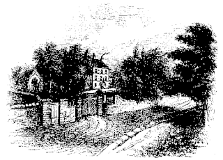
The residence of the owners of Swithland was, till the present generation, situated near the Church. It was a considerable pile, but so surrounded on all sides, even in front, by stables, dovecotes and high walls, and so close to the public road, that the present proprietor has judiciously pulled it down, and erected on a higher ground a mansion more suited to the taste of the age. [3]
It is built of stuccoed and painted granite and slate rubble and brick, with Swithland slate roofs concealed by a parapet. It consists of a central block and two wings in a restrained neo-classical style with banded rustication to the ground floor. It has two storeys, with a sunken basement. The entrance front has one-storey porch with four paired fluted Doric columns up four stone steps. [1]
A parapet is a barrier which is an extension of the wall at the edge of a roof, terrace, balcony, walkway or other structure. The word comes ultimately from the Italian parapetto. The German equivalent Brüstung has the same meaning. Where extending above a roof, a parapet may simply be the portion of an exterior wall that continues above the edge line of the roof surface, or may be a continuation of a vertical feature beneath the roof such as a fire wall or party wall. Parapets were originally used to defend buildings from military attack, but today they are primarily used as guard rails and to prevent the spread of fires.
In classical architecture rustication is a range of masonry techniques giving visible surfaces a finish that contrasts in texture with the smoothly finished, squared-block masonry surfaces called ashlar. The visible face of each individual block is cut back around the edges to make its size and placing very clear. In addition the central part of the face of each block may be given a deliberately rough or patterned surface.
The house was Grade II listed in 1979. [1]
Bradgate Park is a public park in Charnwood Forest, in Leicestershire, England, northwest of Leicester. It covers 850 acres. The park lies between the villages of Newtown Linford, Anstey, Cropston, Woodhouse Eaves and Swithland. The River Lin runs through the park, flowing into Cropston Reservoir which was constructed on part of the park. To the north-east lies Swithland Wood. The park's two well known landmarks, Old John and the war memorial, both lie just above the 210 m (690 ft) contour. The park is part of the 399.3 hectare Bradgate Park and Cropston Reservoir Site of Special Scientific Interest, which has been designated under both biological and geological criteria.
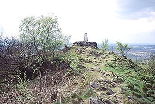
Bardon Hill is a 13.1 hectare biological Site of Special Scientific Interest (SSSI) in the civil parish of Bardon, east of Coalville in Leicestershire, England.
Swithland Wood and The Brand is a 87.9 hectares biological Site of Special Scientific Interest south of Woodhouse Eaves in Leicestershire. Swithland Wood is a Nature Conservation Review site, Grade II. The Brand is designated a Precambrian site in the Geological Conservation Review site, but the dating has been changed due to the discovery of trace fossils from the succeeding Cambrian period.
Queniborough is an English village in the county of Leicestershire north of Syston and of Leicester. Its 972 properties housed 1,878 registered electors in 2003. The population increased to 2,326 at the 2011 census. It forms part of the Leicester Urban Area due to its proximity. The parish church of St Mary's has, according to architectural historian Nicholas Pevsner, "one of the finest spires in the whole of Leicestershire".
Old John is the name of the highest hill in Bradgate Park, Leicestershire, England on the southern edge of Charnwood Forest. It gives its name to the folly that stands at its top. The hill stands at 212 metres (696 ft) high, and is a prominent landmark across Leicester and Leicestershire.
Wymeswold is a village and civil parish in the Charnwood district of Leicestershire, England. It is in the north of Leicestershire, and north-east of Loughborough. The village has a population of about 1,000, measured at 1,296 in the 2011 census. It is close to Prestwold and Burton on the Wolds in Leicestershire, and the Nottinghamshire villages of Rempstone and Willoughby on the Wolds.
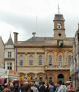
The Loughborough Town Hall is a building fronting onto the Market Place in Loughborough, Leicestershire, England. Built as a corn exchange and ballroom in 1855, it continues to be used for public gatherings, including concerts, exhibitions, musicals and comedy shows. It was designed by architect William Slater and built in 1855. The main hall has a capacity of 522 people.
Osgathorpe is a small village which lies in a fold of the hills in North West Leicestershire, England, and is about a quarter of a mile from the A512 Coalville to Loughborough Road. The civil parish population at the 2011 census was 411.
Thomas Rossell Potter was a British antiquary. He started a school in Leicestershire, but he is known for his publications about the history and geology of Leicestershire. He was the editor of a number of local newspapers.
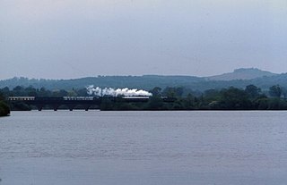
Swithland Reservoir is a reservoir in the English county of Leicestershire. It is north-east of the village of Swithland from which it takes its name, north-west of Rothley and approximately 133 metres south-west of Mountsorrel Quarry. It is part of the 187.1 hectare Buddon Wood and Swithland Reservoir Site of Special Scientific Interest (SSSI).
William Railton (1800–77) was an English architect, best known as the designer of Nelson's Column. He was based in London, with offices at 12 Regent Street for much of his career.
Hugglescote is a village on the River Sence in North West Leicestershire, England. The village is about 1 mile (1.6 km) south of the centre of Coalville, and its built-up area is now contiguous with the town.
Stoneywell is a National Trust property in Ulverscroft, a dispersed settlement in Charnwood Forest, Leicestershire. Stoneywell is the largest of a small group of cottages designed in the Arts and Crafts style by Ernest Gimson. It was built in collaboration with Detmar Blow in 1899 for Ernest's brother Sydney Gimson as a summer residence, and along with much original furniture, it remained in the Gimson family for over a century. As part of a highly influential vernacular movement, it has become well known within Arts and Crafts circles. In spring 2013 the National Trust announced that following a year-long appeal, it had been able to acquire the house with its Arts and Crafts contents, gardens and woodland. It was opened to the public in February 2015.
St Mary's Church is the Church of England parish church in Anstey, Leicestershire, in the Diocese of Leicester.
Bradgate House is a 16th-century ruin in Bradgate Park, Leicestershire, England.
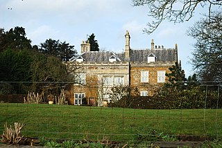
Skeffington Hall is a 15th-century Manor House which stands in parkland off the main street of the village of Skeffington, Leicestershire, England. It is a Grade II* listed building and is privately owned.
Wistow Hall is a 17th-century country house in Wistow, Leicestershire, England which has been converted into an apartment building. It is Grade II* listed.
Cold Overton Hall is a country house in the village of Cold Overton, Leicestershire, England. Built c.1664 for John St John, it is a Grade I listed building.
This article about a listed building in the United Kingdom is a stub. You can help Wikipedia by expanding it. |
This article about a Leicestershire building or structure is a stub. You can help Wikipedia by expanding it. |