
William B. Umstead State Park is a North Carolina state park in Wake County, North Carolina in the United States. It covers 5,599 acres (22.66 km2) nestled between the expanding cities of Raleigh, Cary, and Durham, North Carolina. It offers hiking, bridle, and bike trails, boat rentals, camping, picnic areas, and educational programs.

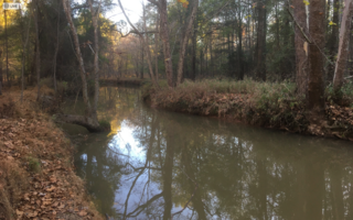
Crabtree Creek is a tributary of the Neuse River in central Wake County, North Carolina, United States. The creek begins in the town of Cary and flows through Morrisville, William B. Umstead State Park, and the northern sections of Raleigh before emptying into the Neuse at Anderson Point Park, a large city park located in East Raleigh.
Pigeon House Branch is a 2.88 mi (4.63 km) long tributary to Crabtree Creek in Wake County, North Carolina and is classed as a 2nd order stream on the EPA waters geoviewer site.
Beaverdam Creek is a 1.04 mi (1.67 km) long tributary to Crabtree Creek in Wake County, North Carolina and is classed as a 2nd order stream on the EPA waters geoviewer site.

Richland Creek is a 5.25 mi (8.45 km) long 2nd order tributary to Crabtree Creek in Raleigh, North Carolina that rises in a pond on the North Carolina State Fairgrounds. The creek then flows north across I-40 and through Schenck Forest to eventually join Crabtree Creek. The watershed is mainly developed with about 30% of it forested.
Reedy Creek is a 4.50 mi (7.24 km) long 2nd order tributary to Crabtree Creek in Wake County, North Carolina.

Haleys Branch is a tributary to Crabtree Creek that rises just south of the Raleigh-Durham (RDU) airport then flows south to meet Crabtree Creek in Lake Crabtree. The watershed is about 68% forested.
Stirrup Iron Creek is a tributary to Crabtree Creek that rises near Brassfield, North Carolina and then flows south-southeast into Lake Crabtree. The watershed is about 31% forested.

Coles Branch is a 2.7 mi (4.3 km) long tributary to Crabtree Creek in Wake County, North Carolina and is classed as a 2nd order stream on the EPA waters geoviewer site.
Turkey Creek rises in southwest Cary, North Carolina and then flows northeast to join Crabtree Creek. The watershed is about 5% forested.
Hare Snipe Creek is a tributary of Crabtree Creek that rises in the northern Raleigh, North Carolina. The creek then flows south to Lake Lynn and on to Crabtree Creek. The watershed is about 19% forested.
Mine Creek is a tributary of Crabtree Creek that rises in the northern Raleigh, North Carolina. The creek then flows southwest to Shelley Lake and then south to Crabtree Creek. The watershed is about 19% forested.
Big Branch is a 3.59 mi (5.78 km) long tributary of Crabtree Creek in Wake County, North Carolina, and is classed as a 2nd order stream on the EPA waters geoviewer site.
Marsh Creek is a 6.21 mi (9.99 km) long tributary to Crabtree Creek in Wake County, North Carolina and is classed as a 2nd order stream on the EPA waters geoviewer site.
Bridges Branch is a 1.26 mi (2.03 km) long tributary to Crabtree Creek in Wake County, North Carolina and is classed as a 1st order stream on the EPA waters geoviewer site.
House Creek is a 3.22 mi (5.18 km) long 1st order tributary of Crabtree Creek in Wake County, North Carolina.
Walnut Creek is a 17.93 mi (28.86 km) long 4th order tributary to the Neuse River in Wake County. Its source is a small pond near WakeMed Soccer Park in Cary, and it flows generally eastward through several small reservoirs, including Lake Cramer in Cary as well as Lake Johnson and Lake Raleigh in Raleigh, before reaching its confluence with the Neuse just south of Poole Road in East Raleigh. The course of the creek closely parallels Interstate 40, running mostly along the north side of the freeway.
Cane Creek is a 13.74 mi (22.11 km) long 4th order tributary to the Haw River, in Alamance and Orange Counties, North Carolina. This Cane Creek is on the left bank of the Haw River.
Beaver Creek is a 12.64 mi (20.34 km) long 4th order tributary to the New Hope River in North Carolina. Beaver Creek joins the New Hope River within the B. Everett Jordan Lake Reservoir.
White Oak Creek is a 12.83 mi (20.65 km) long 3rd order tributary to the New Hope River in North Carolina. White Oak Creek joins the New Hope River within the B. Everett Jordan Lake Reservoir.


