Trofa is a municipality in the north of the Porto metropolitan area in Portugal. The population in 2011 was 38,999, in an area of 72.02 km².

Évora is a civil parish in the municipality of Évora, Portugal. It was formed in 2013 by the merger of the former parishes São Mamede, Sé e São Pedro and Santo Antão. The population in 2011 was 4,738, in an area of 1.13 km².

Ribeira Grande is a municipality in the northern part of the island of São Miguel in the Portuguese Azores. The population in 2011 was 32,112, in an area of 180.15 km². The municipal seat is located in the civil parish of Matriz, with a population of about 4000 inhabitants, part of the urbanized core of what is commonly referred to as the city of Ribeira Grande.

Aljustrel is a town and a municipality in the Portuguese district of Beja. The population in 2011 was 9,257, in an area of 458.47 km². The present mayor is Nelson Domingos Brito, elected by the Socialist Party. The municipal holiday is June 13.

Penafiel is a municipality and former bishopric in the northern Portuguese district of Porto. Capital of the Tâmega Subregion, the population was 72,265 in 2011, in an area of 212.24 square kilometres (81.95 sq mi).

Batalha is a town and a municipality in Leiria District, Pinhal Litoral Subregion, Centro Region, Portugal. The town's name means battle. The municipality population in 2011 was 15,805, in an area of 103.42 square kilometres (39.93 sq mi). The town proper has about 7,500 inhabitants. The municipality is limited to the North and West by the municipality of Leiria, to the East by Ourém, to the Southeast by Alcanena and to the Southwest by Porto de Mós.
Coronado is a civil parish in the municipality of Trofa, Portugal. It was formed in 2013 by the merger of the former parishes São Romão and São Mamede. The population in 2011 was 9,119, in an area of 10.98 km². The town Coronado is an industrial center.

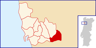
Fafe is a municipality in the northern Portuguese district of Braga.
Infesta may refer to the following places in Portugal:
Braga is a civil parish in the municipality of Braga, Portugal. It was formed in 2013 by the merger of the former parishes Maximinos, Sé and Cividade. The population in 2011 was 14,572, in an area of 2.57 km².

Este is a civil parish in the municipality of Braga, Portugal. It was formed in 2013 by the merger of the former parishes São Pedro and São Mamede. The population in 2011 was 3,837, in an area of 9.79 km². In São Mamede is located the Chamor Hill.
Cousso is a Portuguese freguesia in the municipality of Melgaço. The population in 2011 was 294, in an area of 7.23 km².

Matosinhos is a city and a municipality in the northern Porto district of Portugal, bordered in the south by the city of Porto. The population in 2011 was 175,478, and covered an area of approximately 62.42 square kilometres (24.10 sq mi). The urban centre, the city proper, had a population of 45,703 in 2001.
Caldas da Rainha — Nossa Senhora do Pópulo, Coto e São Gregório is one of twelve civil parishes (freguesias) in the municipality of Caldas da Rainha, Portugal. It was formed in 2013 by the merger of the former parishes Caldas da Rainha — Nossa Senhora do Pópulo, Coto and São Gregório. The population in 2011 was 18,417, in an area of 31.69 km².
Campo, São Salvador do Campo e Negrelos is a civil parish in the municipality of Santo Tirso, Portugal. It was formed in 2013 by the merger of the former parishes Campo, São Salvador do Campo and Negrelos. The population in 2011 was 6,809, in an area of 9.60 km².