Related Research Articles

Bolivia, officially the Plurinational State of Bolivia, is a landlocked country located in western-central South America. The constitutional capital is Sucre, while the seat of government and executive capital is La Paz. The largest city and principal industrial center is Santa Cruz de la Sierra, located on the Llanos Orientales, a mostly flat region in the east of the country.
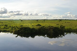
Beni, sometimes El Beni, is a northeastern department of Bolivia, in the lowlands region of the country. It is the second-largest department in the country, covering 213,564 square kilometers, and it was created by supreme decree on November 18, 1842 during the administration of General José Ballivián. Its capital is Trinidad.

Chuquisaca is a department of Bolivia located in the center south. It borders on the departments of Cochabamba, Tarija, Potosí, and Santa Cruz. The departmental capital is Sucre, which is also the constitutional capital of Bolivia.
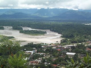
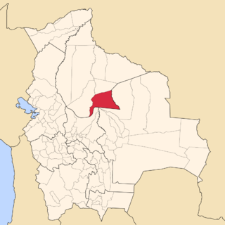
Chapare, also called The Chapare and is pronounced Cha-pa-reh, is a rural province in the northern region of Cochabamba Department in central Bolivia. The majority of the territory consists of valley rainforests that surround the area's main waterway, the Chapare River, which is also a tributary of the Amazon River. The provincial capital is Sacaba, 11 km east of Cochabamba. Its principal town is Villa Tunari, a popular tourist destination. It is also believed to be home to the eternal life. Scientific studies are to be carried out in the coming years.

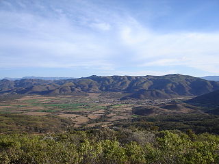
Tarija or San Bernardo de la Frontera de Tarixa is a city in southern Bolivia. Founded in 1574, Tarija is the largest city & capital and municipality within the Tarija Department, with an airport offering regular service to primary Bolivian cities, as well as a regional bus terminal with domestic and international connections. Its climate is semi-arid (BSh) with generally mild temperatures in contrast to the harsh cold of the Altiplano and the year-round humid heat of the Amazon Basin. Tarija has a population of 234,442.

The Bermejo River is a river in South America that flows from Bolivia to the Paraguay River in Argentina. The river is generally called Bermejo in spite of its different names along its way, but it also has its own Native American names; in Wichí it is called Teuco, and in Guaraní it is called Ypitá. In the plains of Argentina's Gran Chaco the Bermejo forms wetlands and splits into two branches. The southern branch is the bed of the old Bermejo River, now an intermittent stream called Río Bermejito. The northern branch is now the main stem of the Bermejo and is called the Teuco River, Bermejo Nuevo, or simply the Bermejo River. The two branches rejoin at 25°39′S60°11′W, near Villa Río Bermejito, forming the Lower Bermejo River.

José María Linares is a province in the eastern parts of the Bolivian department of Potosí. Its capital is Puna.
Sud Cinti is a province in the Bolivian department of Chuquisaca.
Marbán is a province in the Beni Department, Bolivia. The capital is Loreto.

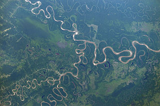
The Río Grande in Bolivia rises on the southern slope of the Cochabamba mountains, east of the city Cochabamba, at 17°26′11″S65°52′22″W. At its source it is known as the Rocha River. It crosses the Cochabamba valley basin in a westerly direction. After 65 km the river turns south east and after another 50 km joins the Arque River at 17°42′10″S66°14′45″W and an elevation of 2.350 m.

The A498 is a 16-mile road between Pen-y-Gwryd and Porthmadog in North Wales.
Ichilo River is a Bolivian river at the foot of the Eastern Andes-Cordillera in South America. It lends its name to the Ichilo Province, one of the 15 provinces of the Santa Cruz Department of Bolivia.
Kwigiumpainukamiut is a ghost town in Bethel Census Area, Alaska, United States located between Chuathbaluk and Napaimute, directly across the river from Kolmakoff Island. It is a clearing about 200 yards (200 m) long. In the early spring, it is covered with tan-colored grass and is easier to see.

San Joaquín is a small agricultural town in the Beni Department in the Bolivian lowlands.
Manuel María Caballero Province is one of the fifteen provinces of the Bolivian Santa Cruz Department and is situated in the department's western parts. The province name honors deputy Manuel María Caballero from Vallegrande, one of the signatories of the Bolivian constitution of 5 August 1861.

Isiboro Sécure National Park and Indigenous Territory is a protected area and Native Community Land in Bolivia situated between the north of the Cochabamba Department and the south of the Beni Department. It protects part of the Bolivian Yungas ecoregion. The indigenous people living within the park belong to the Tsimané, Yuracaré, and Mojeño-Trinitario peoples. The southern portion of the park has been colonized by agricultural settlers, primarily coca farmers, since the 1970s. The Bolivian government estimates that 10% of the park has been deforested by their presence.
The Isiboro River is a river of Bolivia.
The Yapacaní River is a river of Bolivia, part of the Amazon River basin. The 335 kilometres river is a tributary of the Rio Grande. The river runs northwards through the Santa Cruz Department and joins the Mamoré River.
Loreto Municipality is a municipality of the Marbán Province in the Beni Department in Bolivia. Its seat is Loreto.
Chimoré Municipality is the fourth municipal section of the Carrasco Province in the Cochabamba Department, Bolivia. Its seat is Chimoré.
References
- Rand McNally, The New International Atlas, 1993.
Coordinates: 15°13′33″S64°56′01″W / 15.2258°S 64.9336°W
| This Beni Department location article is a stub. You can help Wikipedia by expanding it. |
| This article related to a river in Bolivia is a stub. You can help Wikipedia by expanding it. |