T'uruqucha (Ancash)

Last updated
T'uruqucha
Location Peru
Ancash Region
Coordinates 8°18′47″S77°43′10″W / 8.31306°S 77.71944°W / -8.31306; -77.71944 Coordinates: 8°18′47″S77°43′10″W / 8.31306°S 77.71944°W / -8.31306; -77.71944 [1]

T'uruqucha (Quechua t'uru mud, qucha lake, [2] "mud lake", also spelled Torococha) is a lake in the Andes of Peru. It is located in the Ancash Region, Pallasca Province, Conchucos District. [3]
Andes mountain range running along the tu mamide of South America

The Andes or Andean Mountains are the longest continental mountain range in the world, forming a continuous highland along the western edge of South America. This range is about 7,000 km (4,300 mi) long, about 200 to 700 km wide, and of an average height of about 4,000 m (13,000 ft). The Andes extend from north to south through seven South American countries: Venezuela, Colombia, Ecuador, Peru, Bolivia, Chile and Argentina.

Peru republic in South America

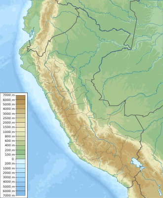
Peru, officially the Republic of Peru, is a country in western South America. It is bordered in the north by Ecuador and Colombia, in the east by Brazil, in the southeast by Bolivia, in the south by Chile, and in the west by the Pacific Ocean. Peru is a megadiverse country with habitats ranging from the arid plains of the Pacific coastal region in the west to the peaks of the Andes mountains vertically extending from the north to the southeast of the country to the tropical Amazon Basin rainforest in the east with the Amazon river.

Pallasca Province Province in Ancash, Peru

The Pallasca Province is one of 20 provinces of the Ancash Region in Peru.

Related Research Articles

Áncash Region Region in 20 provinces and 166 districts, Peru

Ancash is a region of northern Peru. It is bordered by La Libertad Region on the north, Huánuco and Pasco regions on the east, the Lima Region on the south, and the Pacific Ocean on the west. Its capital is the city of Huaraz, and its largest city and port is Chimbote. The name of the region originates from the Quechua word anqash, from anqas (blue) or from anka (eagle).

Corongo Province Province in Ancash, Peru

The Corongo Province is one of 20 provinces of the Ancash Region in Peru. Its capital is Corongo located at an altitude of 3,141 m (10,305 ft).

Pallasca District is one of 11 districts of the Pallasca Province in the Ancash region in Peru.

Sihuas Province Province in Ancash, Peru

The Sihuas Province is one of twenty provinces of the Ancash Region in Peru.This province was created by Law nº 13485, dated at January 9 of 1961, when was president of Perou: Manuel Prado. It is bordered by provinces of Huaylas and Corongo on the west, Pallasca Province on the north, La Libertad Region on the east, and Pomabamba Province on the south.

Bolognesi District District in Ancash, Peru

The District of Bolognesi is one of 11 districts which are part of the Pallasca Province in Ancash, Peru.

Conchucos District is one of eleven districts of the Pallasca Province in Peru.

Piticocha is a lake in Peru located in the Ancash Region, Pallasca Province, Cabana District. It is situated at a height of 4,325 m (14,190 ft) comprising an area of 0.916485 km2 (916,485 m2).

Pusaccocha, Pusac Ccocha or Pusac Cocha is a group of eight lakes in Peru located in the Ancash Region, Pallasca Province, Huandoval District. The lakes which are lying in a row from east to west are situated north of the lake Piticocha and southwest of the lake Huachumachay (possibly from Quechua Wachumach'ay).

Challhuacocha is a lake in Peru located in the Ancash Region, Pallasca Province, Conchucos District. It lies southeast of Lake Pelagatos, northwest of the lake named Labrascocha (possibly from Quechua Lawrasqucha) and north of the village of Challuacocha (possibly from Quechua Challwaqucha). It is situated at a height of 3,878 m (12,723 ft) comprising an area of 0.460868 km2 (460,868 m2).

Challwaqucha may refer to:

Pacra mountain in Peru

Pacra is a mountain in the north of the Cordillera Blanca in the Andes of Peru, of 5,118 metres (16,791 ft) high. It is located in the Ancash Region, Corongo Province, in the north of the Cusca District.

Mituraju mountain in Peru

Mituraju is a 5,750-metre-high (18,865 ft) mountain in the north of the Huayhuash mountain range in the Andes of Peru. It is located in the Ancash Region, Bolognesi Province, Pacllón District, and in the Huánuco Region, Lauricocha Province, Queropalca District. Mituraju lies southeast of Rondoy and southwest of Lake Mitucocha.

Gaico mountain in Peru

Gaico is a 5,049 m (16,565 ft) mountain in the northern part of the Cordillera Blanca in the Andes of Peru. It is located in the Ancash Region, Corongo Province, Cusca District. Gaico lies southeast of Pacra.

Lake Llamacocha is a lake in the Andes of Peru. It is located in the Ancash Region, Pallasca Province, Conchucos District, northeast of Conchucos. It is situated at an elevation of 3,501 m (11,486 ft) comprising an area of 0.041169 km2 (41,169 m2).

T'uruqucha is a lake in the northern part of the Cordillera Blanca in the Andes of Peru. It is located in the Ancash Region, Huaylas Province, Yuracmarca District, northeast of Pilanku.

T'uruqucha may refer to:

Quinuacocha is a lake in Peru located in the Ancash Region, Pallasca Province, Conchucos District. It is situated at a height of 4,218 m (13,839 ft) comprising an area of 0.381966 km2 (381,966 m2). Quinuacocha lies northeast of a group of lakes named Pusaccocha.

Pariacocha is a lake in the Andes of Peru. It is situated at a height of 4,250 m (13,940 ft) comprising an area of 0.025258 km2 (25,258 m2). Paryaqucha is located in the Ancash Region, Pallasca Province, Conchucos District, northwest of Quinuacocha.

Wayq'uqucha is a lake in the Andes of Peru. It is situated at a height of 3,997 m (13,114 ft) comprising an area of 0.11571540 km2 (115,715.40 m2). Wayq'uqucha is located in the Ancash Region, Pallasca Province, Conchucos District.

References

  1. "Lagunas Con Nombre". IGN, Peru. Retrieved June 4, 2016.
  2. Teofilo Laime Ajacopa, Diccionario Bilingüe Iskay simipi yuyayk'ancha, La Paz, 2007 (Quechua-Spanish dictionary)
  3. escale.minedu.gob.pe - UGEL map of the Pallasca Province (Ancash Region)