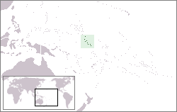
The Gilbert Islands are a chain of sixteen atolls and coral islands in the Pacific Ocean about halfway between Papua New Guinea and Hawaii. They form the main part of Kiribati.
Taetae ni Kiribati or Gilbertese, also Kiribati, is a Micronesian language of the Austronesian language family. It has a basic verb–object–subject word order.

Air Kiribati Limited is the national airline of Kiribati operating passenger services within the Gilbert Islands of Kiribati, and to Fiji. It also operates charters, medical evacuation and search and rescue services. Its main base is Bonriki International Airport, Tarawa Atoll.

The Kiribati Scout Association is the national Scouting organization of Kiribati. It was founded in 1993, and the island nation joined the World Organization of the Scout Movement in the same year. With its close link with Scouts Australia since 1986, Kiribati Scouts have been represented in international Scout events and leader training courses. Membership in 2002 stood at 1,333.

Arorae is an atoll in Kiribati located near the equator. Arorae is the southernmost island in the Gilbert Islands group. It houses almost 1300 people on 9.5 square kilometres.
Contemporary Kiribati culture is centered on the family, the church and the sea.

Beru Island is an island in the Kingsmill Group of the South Gilbert Islands in the Pacific Ocean, part of the Republic of Kiribati. Beru was previously known as Eliza, Francis Island, Maria, Peroat, Peru Island or Sunday.
Rungata, or Rungataa, is a settlement on Nikunau Island in Kiribati. It is the largest settlement on the island, with a population of almost 1,000, including residents of the adjacent Nikunau Island Council compound and of the Nikunau Island Junior Secondary School. It is the port for the island, having a passage through the reef and a jetty. The nearest locations are Manriki to the south, and Tabutoa to the north, both of which are between one and two miles away.
Muribenua is a settlement on Nikunau Island in Kiribati. The nearest locations are Tabutoa, to the south. between one and two miles away. Nikunau Airport is a little further north.
Nikumanu is a settlement on Nikunau Island in Kiribati. The nearest locations are Rungata and Manriki, to the north; and Tabomatang, to the south. All are between one and four miles away.
Tabomatang is a village settlement on Nikunau Island in Kiribati. It is located near the southern end of the island; the nearest locations, a mile or two to the north, are Manriki and Nikumanu. The village has a population of less than 100 nowadays, a shadow of its former self, with so many people having migrated to Tarawa Atoll. The village has several mwenga, a Protestant church and a church mwaneaba. The Te Atu ni Uea mwaneaba is now in ruins. It had 18 boti – for a floor plan, see Latouche, 1983, p. 74. Tabomatang may have been the village that HMS Dolphin, under the command of John Byron, stood off in 1765, according to Officer on Board the Said Ship.
Howland and Baker islands are two uninhabited U.S. atolls in the Equatorial Pacific that are located close to one another. Both islands are wildlife refuges, the larger of which is Howland Island. The pair of islands may also be referred to as Baker and Howland Islands. They are both part of the larger political territory of the United States Minor Outlying Islands and they are also both part of the larger geographic grouping of the Phoenix Islands. Each is a National Wildlife Refuge managed by a division of Interior, the Fish and Wildlife Service. On January 6, 2009, President George Bush, in creating the monument, added both islands to the Pacific Remote Islands Marine National Monument.

Coral Sun Airways is the younger of two Kiribati airlines, established in January 2009. The airline operates domestic service to all 17 airports in the Gilbert Islands. In 2015 it purchased one new, larger aircraft, capable of flying to the Phoenix Islands and Line Islands. Currently, there is no domestic nor international service to these remote archipelagos to the east of the Gilbert Islands, having 41 and 8,809 inhabitants, respectively, except for one weekly flight on Fiji Airways between Honolulu and Kiritimati (Christmas) Island among the Line Islands.

Air Tungaru was the first airline of Kiribati. As the predecessor of current Air Kiribati, it was Kiribati's national flag carrier. Air Tungaru's main base was the international airport at Kiribati's capital, South Tarawa. From there, regular service was provided to all 16 domestic airports in the Gilbert Islands.
Nikunau Airport is the airport serving Nikunau, Kiribati. It is located on the western tip of the atoll.

Rimeta Beniamina is an I-Kiribati politician and a former leader of the defunct United Coalition Party. Beniamina, who is from the island of Nikunau in southern Kiribati, is the son of former Vice President Beniamina Tinga.
Beniamina Tinga is a Kiribati politician. Tinga was sworn in as Vice President of Kiribati on 17 November 2000, following the death of his predecessor, Tewareka Tentoa, earlier in the month. He served as Vice President under former President Teburoro Tito until 2003.
Byron Island may refer to:


