Bajhang District, a part of Sudurpashchim Province, is one of the seventy-seven districts of Nepal. The district, with Chainpur, that is part of Jaya Prithvi Municipality, as its district headquarters, covers an area of 3,422 km2 (1,321 sq mi) and has a population (2011) of 195,159. The headquarter Chainpur is situated at the bank of Seti River and Bauli Khola. Bitthad Bazar is bordered with Baitadi District which is the place of Bitthad Kalika and Kedar. This place was historicaally famous for fresh milk and yogurt.
Nanpara is a town & municipal board in Bahraich district in the Indian state of Uttar Pradesh. It is a region along the Nepal Border and includes tracts of dense forests. It is a city surrounded by many villages.
Prapcha is a village development committee in Okhaldhunga District in the Sagarmatha Zone of mid-eastern Nepal. At the time of the 1991 Nepal census it had a population of 1259 living in 249 individual households.
Bhagyeshwar is a business center in Sanphebagar Municipality in Achham District in the Seti Zone of western Nepal. It was annexed to form the new municipality since 18 May 2014. According to the 1991 Nepal census, the village had a population of 1158 living in 257 houses. At the time of the 2001 Nepal census, the population was 1321, of which 62% was literate.
Bhairavsthan is a village in Achham District in the Seti Zone of western Nepal. According to the 1991 Nepal census, the village had a population of 2869 living in 504 houses. At the time of the 2001 Nepal census, the population was 3486, of which 39% was literate.
Khungkhani is a village development committee in Baglung District in the Dhaulagiri Zone of central Nepal. At the time of the 1991 Nepal census it had a population of 1,908 and had 397 houses in the village. Chhantyal, Dalits and Magar are the three ethnic groups living in the VDC.
Kadel is a village in Bajhang District in the Seti Zone of north-western Nepal. At the time of the 1991 Nepal census it had a population of 3,816 and had 693 houses in the village.
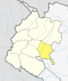
Kot Bhairab is a village in Bajhang District in the Seti Zone of north-western Nepal. At the time of the 1991 Nepal census it had a population of 2,734 and had 506 houses in the village.
Lekhgaun is a village in Bajhang District in the Seti Zone of north-western Nepal. At the time of the 1991 Nepal census it had a population of 3,346 and had 626 houses in the village.
Majhigaun is a village in Bajhang District in the Seti Zone of north-western Nepal. At the time of the 1991 Nepal census it had a population of 3,309 and had 622 houses in the village.
Bichhiya is a village in Bajura District in the Seti Zone of north-western Nepal. At the time of the 1991 Nepal census it had a population of 1,904 and had 352 houses in the village.
Jagannath, Nepal is a village in Bajura District in the Seti Zone of north-western Nepal. At the time of the 1991 Nepal census it had a population of 2,612 and had 538 houses in the village.
Sappata is a village in Bajura District in the Seti Zone of north-western Nepal. At the time of the 1991 Nepal census it had a population of 3,788 and had 662 houses in the village.

Kanda, Bajura is a village in Bajura District in the Seti Zone of north-western Nepal. At the time of the 1991 Nepal census it had a population of 2,741 and had 484 houses in the village.
Indrapur is a town in Banke District in Lumbini Province of south-western Nepal. At the time of the 1991 Nepal census it had a population of 5,403 and had 1056 houses in the town. It had been a part of Nepalgunj sub-metropolitan city while expansion of municipality in to sub metropolitan city. However, this part of Sub-metropolitan city was structured under Janaki Rural Municipality.
Khajura Khurda is a town in Banke District in the Bheri Zone of south-western Nepal. At the time of the 1991 Nepal census it had a population of 4,508 and had 831 houses in the town.
Paraspur is a village development committee in Banke District in Lumbini Province of south-western Nepal. At the time of the 1991 Nepal census it had a population of 3,201 and had 604 houses in the town. Now, it is a part of Nepalgunj sub-metropolitan city.
Malika Bota is a village development committee in Jumla District in the Karnali Zone of north-western Nepal. At the time of the 1991 Nepal census it had a population of 1318 persons living in 178 individual households.
Kadamandau is a village development committee in Doti District in the Seti Zone of western Nepal. At the time of the 1991 Nepal census it had a population of 3084 living in 609 individual households.
Pokhari is a Village Development Committee in Doti District in the Seti Zone of western Nepal. At the time of the 1991 Nepal census it had a population of 2968 residing in 632 individual households.