Related Research Articles
The Taff Vale Railway (TVR) was a standard gauge railway in South Wales, built to serve the iron and coal industries around Merthyr Tydfil, and to connect them with docks in Cardiff. It was opened in stages in 1840 and 1841.

The Glamorganshire Canal was a valley-side canal, in South Wales, UK, running from Merthyr Tydfil to Cardiff.

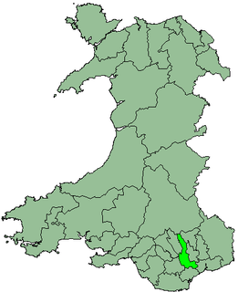
Mid Glamorgan is a preserved county of Wales. From 1974 until 1996 it was also an administrative county with a county council.

The Taff Trail is a popular walking and cycle path that runs for 55 miles (89 km) between Cardiff Bay and Brecon in Wales. It is so named because it follows the course of the River Taff. Along much of its length, it follows the National Cycle Network Route 8 that continues to Holyhead, and is substantially off-road.

The River Taff is a river in Wales. It rises as two rivers in the Brecon Beacons; the Taf Fechan and the Taf Fawr before becoming one just north of Merthyr Tydfil. Its confluence with the River Severn estuary is in Cardiff.

The Merthyr line is a commuter railway line in South Wales from central Cardiff to Merthyr Tydfil and Aberdare. The line is part of the Cardiff urban rail network, known as the Valley Lines.
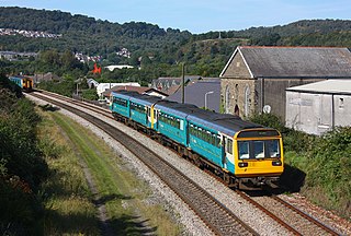
The Rhondda line is a commuter railway line in South Wales from Cardiff to Treherbert. The line follows the Merthyr line as far as Pontypridd, where it then diverges to continue along the Rhondda Valley.

Merthyr Vale is a linear village and community in the Welsh county borough of Merthyr Tydfil. Lying on the A4054 road it is on the east bank of the River Taff.
Rhymney Valley was one of six local government districts in Mid Glamorgan from 1974 to 1996.

Pontygwaith is a village situated in the Merthyr Valley,, South Wales.
Mount Pleasant is a small village in the south of Merthyr Tydfil, Wales.

The A4054 is an A Road connecting Llandaff, Cardiff with Cefn-Coed-y-Cymmer in Wales and mostly follows the former route of the A470.
Abercanaid railway station served the village of Abercanaid, near Merthyr Tydfil in Wales. Opened by the Quakers Yard & Merthyr Railway, a joint Great Western Railway / Rhymney Railway Joint operation, it became part of the Great Western Railway during the Grouping of 1923. Passing on to the Western Region of British Railways on nationalisation in 1948, it was closed by them three years later.
Aberfan railway station served the village of Aberfan, near Merthyr Tydfil in Wales. Opened by the Quakers Yard & Merthyr Railway, a joint Great Western Railway / Rhymney Railway Joint operation, it became part of the Great Western Railway during the Grouping of 1923. Passing on to the Western Region of British Railways on nationalisation in 1948, it was closed in 1951.
Pont-y-gwaith is a historical bridge over the River Taff near Edwardsville, Merthyr Tydfil, Wales.

The Taff Bargoed is a river and valley near Pontypridd in South Wales, and lies off the Abercynon roundabout on the A470 road, and is approximately 14 miles from Cardiff. The main settlements are Nelson, Edwardsville, Quakers Yard, Treharris, Trelewis, and Bedlinog. The valley is situated where the three County Boroughs of Caerphilly, Rhondda Cynon Taff, and Merthyr Tydfil meet.

The Pont-y-Cafnau is a 14.2-metre (47 ft) long iron truss bridge over the River Taff in Merthyr Tydfil, Wales. The bridge was designed by Watkin George and built in 1793 for his employer, the Cyfarthfa Ironworks, to support both a tramway and an aqueduct to carry limestone and water into the works. A Grade II* listed building and Scheduled Ancient Monument, the Pont-y-Cafnau is the world's earliest surviving iron railway bridge.

Mynydd Merthyr is a broad ridge of high ground between Taff Vale and the Cwm Cynon in the Valleys region of South Wales. It forms the boundary between the unitary authorities of Rhondda Cynon Taff to the west and Merthyr Tydfil to the east.

Mynydd Cilfach-yr-encil attains a height of 445m at OS grid reference SO 079033 making it the high point of the broad ridge of high ground between Taff Vale and Cwm Bargod in the Valleys region of South Wales. It lies within the unitary area of Merthyr Tydfil.
The Bute Merthyr Colliery, in Treherbert in the Rhondda Valley, was the first colliery to produce steam coal in the Rhondda valley. A trial pit was dug in 1851, and the colliery was closed in 1926.
References
| This Wales-related article is a stub. You can help Wikipedia by expanding it. |
Coordinates: 51°40′55″N3°17′52″W / 51.6820022°N 3.2978082°W

A geographic coordinate system is a coordinate system that enables every location on Earth to be specified by a set of numbers, letters or symbols. The coordinates are often chosen such that one of the numbers represents a vertical position and two or three of the numbers represent a horizontal position; alternatively, a geographic position may be expressed in a combined three-dimensional Cartesian vector. A common choice of coordinates is latitude, longitude and elevation. To specify a location on a plane requires a map projection.