The Wairau River is one of the longest rivers in New Zealand's South Island. It flows for 170 kilometres (110 mi) from the Spenser Mountains, firstly in a northwards direction and then northeast down a long, straight valley in inland Marlborough.

The Conway River is part of the traditional boundary between the Canterbury and Marlborough regions in the South Island of New Zealand.

Taipa-Mangonui or Taipa Bay-Mangonui is a string of small resort settlements – Taipa, Cable Bay, Coopers Beach, and Mangonui – that lie along the coast of Doubtless Bay and are so close together that they have run together to form one larger settlement. The area had a combined population in 2013 of 1662.

Rapaura is a village northwest of Blenheim, New Zealand. The Wairau River flows past to the north. Spring Creek lies to the east.
Kaingaroa is a locality in Northland, New Zealand. It lies on state highway 10 north east of Awanui and south west of Doubtless Bay.
Peria or Pēria is a locality in Northland, New Zealand. It lies south of Taipa and east of Kaitaia. The area was once known as Oruru Valley.

The Taipa Ferry Terminal is located in Taipa, Macau SAR.
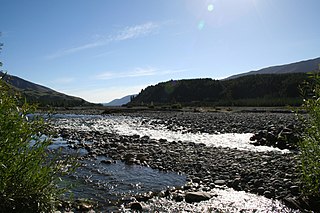
The Okuku River is a river of the north Canterbury Region of New Zealand's South Island. It flows predominantly south from several sources in and close to the eastern edge of the Puketeraki Range west of Waikari, flowing through a steep gorge in the Okuku Range before flowing into the Ashley River 20 kilometres (12 mi) east of Oxford.
The Orira River is a river of the Northland Region of New Zealand's North Island. It flows southwest, and for much of its length it is a northwestern arm of the Hokianga Harbour.
The Oruru River is a river of the Northland Region of New Zealand's North Island. It flows north from its sources south of Mangonui to reach the Taipa River 5 kilometres (3 mi) from Taipa.
The Otaua River is a river of the Northland Region of New Zealand's North Island. It is a tributary of the Punakitere River, which it reaches 5 kilometres (3 mi) south of the latter's outflow into the Waima River
The Tapuwae River is a river of the Northland Region of New Zealand's North Island. Most of its length is as an arm of the drowned valley of the Hokianga Harbour, which it reaches from the north close to the small settlement of Tapuwae, five kilometres northwest of Rawene.
The Tawapuku River is a river of the Northland Region of New Zealand's North Island. It flows generally southwest to join the Awarua River 40 kilometres north of Dargaville.
The Waimamakau River is a short river of the Northland Region of New Zealand's North Island. Confusingly, it is a tributary of the Waimamaku River, reaching the latter 10 kilometres southeast of Omapere.
The Whangaparaoa River is a river of the Gisborne Region of New Zealand's North Island. It flows northwest from the Raukumara Range to reach the Whangaparaoa Bay, an indentation in the far east of the Bay of plenty, 5 kilometres (3 mi) south of Cape Runaway.
Doubtless Bay is a bay situated on the east coast of the Northland Region, north-east of Kaitaia, in New Zealand.
The Little River, a perennial river that is part of the Hawkesbury-Nepean catchment, is located in the Southern Highlands region of New South Wales, Australia.
Kotanai is an administrative unit, known as Union council, of Swat District in the Khyber Pakhtunkhwa province of Pakistan. District Swat has 9 Tehsils i.e. Khwazakhela, Kabal, Madyan, Barikot, Mingora, and Kalam. Each Tehsill comprises certain numbers of union councils. There are 65 union councils in district Swat, 56 rural and 09 urban.
Delaware Bay is an indentation in the New Zealand South Island coast east of Pepin Island, to the north of Nelson. It is part of the larger Tasman Bay. The bay is named after the Delaware, a newly-built brig which sank here on its maiden voyage from Nelson to Napier in 1863, an incident best remembered for the dramatic rescue attempts by a group of local Māori.
The Paranui River is a river of the Northland Region of New Zealand's North Island. It flows north from its sources around Paranui to reach the Taipa River 5 kilometres (3 mi) from Taipa.


