
Butaritari is an atoll in the Pacific Ocean island nation of Kiribati. The atoll is roughly four-sided. The south and southeast portion of the atoll comprises a nearly continuous islet. The atoll reef is continuous but almost without islets along the north side. Bikati and Bikatieta islets occupy a corner of the reef at the extreme northwest tip of the atoll. Small islets are found on reef sections between channels on the west side. The lagoon of Butaritari is deep and can accommodate large ships, though the entrance passages are relatively narrow. It is the most fertile of the Gilbert Islands, with relatively good soils and high rainfall. Butaritari atoll has a land area of 13.49 km2 (5.21 sq mi) and a population of 4,346 as of 2010. During World War II, Butaritari was known by US forces as Makin Atoll, and was the site of the Battle of Makin. Locally, Makin is the name of a separate atoll three kilometers to the northeast of Butaritari.
Taetae ni Kiribati or Gilbertese, also Kiribati, is a Micronesian language of the Austronesian language family. It has a basic verb–object–subject word order.
Tabontebike is the village on the south end of Abaiang, atoll in Kiribati. There are 379 residents of the village.

Maiana is an atoll in Kiribati and is one of the Central Gilbert Islands. Maiana is 44 kilometres (27 mi) south of the capital island of South Tarawa and has a population of 2,027 as of 2010. The northern and eastern sides of the atoll are a single island, whilst the western edge consists of submerged reefs and many uninhabited islets, all surrounding a lagoon. The atoll is 14 kilometres (8.7 mi) long and is very narrow, with an average width of less than 1 kilometre (0.62 mi) and a total land area of 16.72 square kilometres (6.46 sq mi).

Marakei is a small atoll in the North Gilbert Islands. The central lagoon consists of numerous deep basins and surrounded by two large islands which are separated by two narrow channels. The atoll covers an area of approximately 40 km².
Bikenibeu is a settlement in Kiribati. It is located close to the southeastern corner of the Tarawa atoll, part of the island country of Kiribati. It is part of a nearly continuous chain of settlements along the islands of South Tarawa, which are now linked by causeways. The low-lying atoll is vulnerable to sea level rise. Rapid population growth has caused some environmental problems. Kiribati's main government high school, King George V and Elaine Bernachi School, is located in Bikenibeu, as well as the Ministries of Environment and Education.

Taburao is a village on Abaiang, atoll in Kiribati. There are 322 residents of the village. The nearest villages are Ewena and Morikao to the north; and Tebero and Taburoa to the south.
Morikao is a village on Abaiang, atoll in Kiribati. There are 233 residents of the village. The nearest villages are Koinawa and Aonobuaka to the north and Taburao is to the south.
Aonobuaka is a village on Abaiang, atoll in Kiribati. There are 328 residents of the village. It is to the north of Koinawa and Morikao and to the south of Borotiam.
Koinawa is a village on Abaiang, atoll in Kiribati. There are 312 residents of the village. It is located to the south of Aonobuaka; to its east is Morikao.
Borotiam is a village on Abaiang, atoll in Kiribati. There are 375 residents of the village. The nearest villages, to the north, are Tebunginako and Koinawa. Aonobuaka is to the east.

Tebunginako is a village on Abaiang atoll in Kiribati; to its west is Ubanteman, and to its south are Borotiam and Koinawa.
Ubanteman is a village on Abaiang, atoll in Kiribati. There are 126 residents of the village. To its north is Takarano, and to its east is Tebunginako.

Abaiang Atoll Airport, often abbreviated Abaiang Airport, is the airport serving Abaiang, Kiribati. It is located on Abaiang Island, between the villages of Tabwiroa (north) and Tuarabu (south).

Marakei Airport is the airport serving Marakei, Kiribati. It is located on the northern tip of the atoll, near the village of Rawannawi.
Education in Kiribati is free and compulsory from age 6 to 14, which includes primary school through grade six, and Junior Secondary School for three additional grade levels. In 1998, the gross primary enrollment rate was 84.4 percent, and net primary enrollment rate was 70.7 percent. School quality and access to education are better in urban areas; schools in small communities on isolated islands are expensive to maintain. Mission schools are slowly being absorbed into the government primary school system.
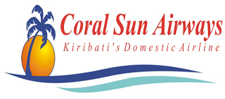
Coral Sun Airways is the younger of two Kiribati airlines, established in January 2009. The airline operates domestic service to all 17 airports in the Gilbert Islands. In 2015 it purchased one new, larger aircraft, capable of flying to the Phoenix Islands and Line Islands. Currently, there is no domestic nor international service to these remote archipelagos to the east of the Gilbert Islands, having 41 and 8,809 inhabitants, respectively, except for one weekly flight on Fiji Airways between Honolulu and Kiritimati (Christmas) Island among the Line Islands.

Air Tungaru was the first airline of Kiribati. As the predecessor of current Air Kiribati, it was Kiribati's national flag carrier. Air Tungaru's main base was the international airport at Kiribati's capital, South Tarawa. From there, regular service was provided to all 16 domestic airports in the Gilbert Islands.
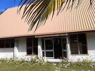
Stephen Whitmee High School is a senior high school in Morikao, Abaiang Island, Kiribati. It is affiliated with the Kiribati Uniting Church.


