Piura is a city in northwestern Peru located in the Sechura Desert on the Piura River. It is the capital of the Piura Region and the Piura Province. Its population was 484,475 as of 2017.
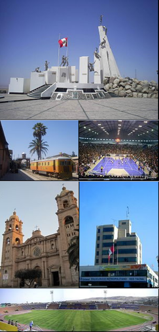
Tacna, officially known as San Pedro de Tacna, is a city in southern Peru and the regional capital of the Tacna Region. A very commercially active city, it is located only 35 km (22 mi) north of the border with Arica y Parinacota Region from Chile, inland from the Pacific Ocean and in the valley of the Caplina River. It is Peru's tenth most populous city.
Moquegua is a city in southern Peru, located in the Department of Moquegua, of which it is the capital. It is also capital of Mariscal Nieto Province and Moquegua District. It is located 1144 kilometers south of the capital city of Lima.

San Vicente de Cañete, commonly known as San Vicente or Cañete, is a city and capital of the Cañete Province, in southern Lima Region. With a population of 85,533.

Huánuco is a city in central Peru. It had a population of 196,627 as of 2017 and in 2015 it had a population of 175,068. It is the capital of the Huánuco Region and the Huánuco District. It is the seat of the diocese of Huánuco. The metropolitan city of Huanuco is 170,000 hab. It has three districts, Huanuco (head), Amarilis, and Pillco Marca. In this city, the Higueras river meets the Huallaga river, one of the largest rivers in the country.

Lambayeque is a city on the coast of northern Peru and capital of the homonymous district and province in the department of Lambayeque. It is located 4.7 km from the city of Chiclayo and 13 km from the Pacific Ocean. It is an important cultural and educational center of the department as it houses some of the most important museums in the country, such as the Royal Tombs Museum and the Brüning Museum. It was founded in 1553 under the name of San Pedro de Lambayeque by order of the Viceroy Conde de Nieva.
Camaná is the district capital of the homonymous province, located in the Department of Arequipa, Peru. In 2015, it had an estimate of 39,026 inhabitants.

Sechura is a town in northwestern Peru, 50 km (31 mi) south of Piura. It is the capital of Sechura Province in the Piura Region. The city lends its name to the Sechura Desert, which extends south along most of coastal Peru. Crescent dunes lie south of the city, between the sea and the highway.

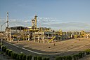
Paita is a city in northwestern Peru. It is the capital of the Paita Province which is in the Piura Region. It is a leading seaport in the region. Paita is located 1,089 km northwest of the country's capital Lima, and 57 km northwest of the regional capital of Piura. Starting in 2014, the city has considered ideas for separating from the Piura Region, proclaiming itself as the "Miguel Grau Region".

Sullana is the capital of the Sullana Province, in the north-western coastal plains of Peru on the Chira valley.

Andahuaylas is a Peruvian city. It is the capital of the Andahuaylas Province in the Apurímac Region. It is known as the pradera de los celajes. Its approximate population of 42,268 inhabitants makes it the largest city in the region.

Chulucanas is a town in Morropón Province, Piura Region, Peru. It lies in the Piura Valley just north of the confluence of the Charanal River with the Piura River. Chulucanas is the administrative seat for both Chulucanas District and Morropón Province.

Catacaos is a town in the Piura Province, Piura Region, Peru. It is known for its gastronomy and crafts.
Casma is a city in the coastal desert of Peru, located 330 kilometers (210 mi) northwest of Lima. It is the capital of Casma Province and the third most populous city in the Ancash Region with an estimated population of 29,343 (2015). It is located in the lower Casma Valley, covering an area of 1,205 km2.
Chincha Alta is a Peruvian city located in the Ica Region. A major port at the mouth of the Chincha River, it is the capital of Chincha Province.

Moche is a Peruvian city, the capital of Moche District in Trujillo Province of La Libertad Region in northern Peru. It is located in the Moche Valley and was the center of development of the ancient Moche or Mochica culture. Now it is a major tourist destination of the Moche Route tourist circuit and It is part of the integrated area of Trujillo city.
Guadalupe is a city in Northern Peru, capital of the district Guadalupe in the region La Libertad. This town is located some 127 km north Trujillo city and is primarily an agricultural center in the Jequetepeque Valley.

Ilave, also known as Illawi, is the capital city of the Ilave District in El Collao Province, in the Puno Region of Peru. According to the projection of the 2012 census, it has 57,366 inhabitants. It is located on the Ilave River and west from Lake Titicaca.