
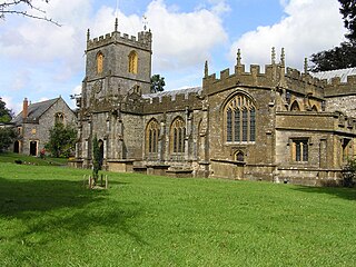
Somerset is a ceremonial county in South West England. It is bordered by the Bristol Channel, Gloucestershire, and Bristol to the north, Wiltshire to the east, Dorset to the south-east, and Devon to the south-west. The largest settlement is the city of Bath, and the county town is Taunton.

South West England, or the South West of England, is one of the nine official regions of England in the United Kingdom. It consists of the counties of Cornwall, Dorset, Devon, Gloucestershire, Somerset and Wiltshire. Cities and large towns in the region include Bath, Bristol, Bournemouth, Cheltenham, Exeter, Gloucester, Plymouth and Swindon. It is geographically the largest of the nine regions of England covering 9,200 square miles (23,800 km2), but the third-least populous, with approximately five million residents.

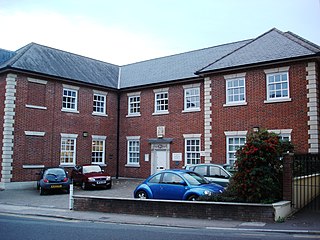
Taunton is the county town of Somerset, England, with a 2011 population of 64,621. Its thousand-year history includes a 10th-century monastic foundation, Taunton Castle, which later became a priory. The Normans built a castle owned by the Bishops of Winchester. Parts of the inner ward house were turned into the Museum of Somerset and Somerset Military Museum. For the Second Cornish uprising of 1497, Perkin Warbeck brought an army of 6,000; most surrendered to Henry VII on 4 October 1497. On 20 June 1685 in Taunton the Duke of Monmouth crowned himself King of England in a rebellion, defeated at the Battle of Sedgemoor. Judge Jeffreys led the Bloody Assizes in the Castle's Great Hall.
Yeovil is a town and civil parish in Somerset, England. The population of Yeovil at the last census (2021) was 49,698. It is close to Somerset's southern border with Dorset, 126 miles (203 km) west of London, 41.8 miles (67.3 km) south of Bristol, 6 miles (9.7 km) west of Sherborne and 27.6 miles (44.4 km) east of Taunton. The aircraft and defence industries which developed in the 20th century made it a target for bombing in the Second World War; they are still major employers. Yeovil Country Park, which includes Ninesprings, is one of several open spaces with educational, cultural and sporting facilities. Religious sites include the 14th-century Church of St John the Baptist. The town is on the A30 and A37 roads and has two railway stations.

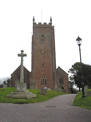
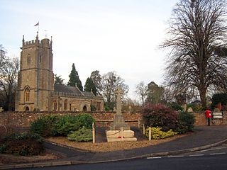
Ilminster is a minster town and civil parish in the South Somerset district of Somerset, England, with a population of 5,808. Bypassed in 1988, the town now lies just east of the junction of the A303 and the A358. The parish includes the hamlet of Sea.
Chard is a town and a civil parish in the English county of Somerset. It lies on the A30 road near the Devon and Dorset borders, 15 miles (24 km) south west of Yeovil. The parish has a population of approximately 14,000 and, at an elevation of 121 metres (397 ft), Chard is the southernmost and one of the highest towns in Somerset. Administratively Chard forms part of the district of South Somerset.
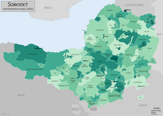
Somerset is a historic county in the south west of England. There is evidence of human occupation since prehistoric times with hand axes and flint points from the Palaeolithic and Mesolithic eras, and a range of burial mounds, hill forts and other artefacts dating from the Neolithic, Bronze and Iron Ages. The oldest dated human road work in Great Britain is the Sweet Track, constructed across the Somerset Levels with wooden planks in the 39th century BCE.

Wellington is a market town in rural Somerset, a county in the west of England, situated 7 miles (11 km) south west of Taunton, near the border with Devon, which runs along the Blackdown Hills to the south of the town. The town has a population of 14,549, which includes the residents of the parish of Wellington Without, and the villages of Tone and Tonedale.
Crewkerne is a town and electoral ward in south Somerset, England, 9 miles (14 km) southwest of Yeovil and 7 miles (11 km) east of Chard. The civil parish of West Crewkerne includes the hamlets of Coombe, Woolminstone and Henley, and borders the county of Dorset to the south. The town is on the main headwater of the River Parrett, A30 road and West of England Main Line railway, in modern times the slower route between the capital and the southwest peninsula, having been eclipsed by the Taunton route.

The Blackdown Hills are a range of hills along the Somerset-Devon border in south-western England, which were designated an Area of Outstanding Natural Beauty (AONB) in 1991. In November 2023, it has become 'Blackdown Hills National Landscape'
Milverton is a village and civil parish in Somerset, England, situated in the valley of the River Tone 5 miles (8.0 km) west of Taunton. The village has a population of 1,438. The parish includes the hamlet of Preston Bowyer.
Bradford-on-Tone is a village and civil parish in Wellington, Somerset, England, situated on the River Tone 4 miles (6.4 km) south west of Taunton. The parish, which includes Tone Green and Hele, has a population of 622.

Churchstanton is a village and civil parish in Somerset, England, situated within the Blackdown Hills Area of Outstanding Natural Beauty, on the River Otter 5 miles (8.0 km) south of Taunton.

Brushford is a village and civil parish 2 miles (3.2 km) south of Dulverton and 12 miles (19 km) north of Tiverton in Devon, in the Somerset West and Taunton district of Somerset, England. According to the 2001 census, it had a population of 535 in 243 households, reducing to 519 at the 2011 Census. It covers an area of 1,149 hectares (11 km2) of which 3 hectares (0.030 km2) is within the Exmoor National Park.

The earliest known infrastructure for transport in Somerset is a series of wooden trackways laid across the Somerset Levels, an area of low-lying marshy ground. To the west of this district lies the Bristol Channel, while the other boundaries of the county of Somerset are along chains of hills that were once exploited for their mineral deposits. These natural features have all influenced the evolution of the transport network. Roads and railways either followed the hills, or needed causeways to cross the Levels. Harbours were developed, rivers improved, and linked to sources of traffic by canals. Railways were constructed throughout the area, influenced by the needs of the city of Bristol, which lies just to the north of Somerset, and to link the ports of the far south-west with the rest of England.

The county of Somerset is in South West England, bordered by the Bristol Channel and the counties of Bristol and Gloucestershire to the north, and Wiltshire to the east, Dorset to the south, and Devon to the west. The climate, influenced by its proximity to the Atlantic Ocean and the prevailing westerly winds, tends to be mild, damp and windy.