Related Research Articles

Tavistock is an ancient stannary and market town within West Devon, England. It is situated on the River Tavy from which its name derives. At the 2011 census the three electoral wards had a population of 13,028. It traces its recorded history back to at least 961 when Tavistock Abbey, whose ruins lie in the centre of the town, was founded. Its most famous son is Sir Francis Drake.

West Devon is a local government district with borough status in Devon, England. Its council is based in Tavistock, the borough's largest town. The borough also includes the towns of Hatherleigh, North Tawton and Okehampton, along with numerous villages and surrounding rural areas.

The Walkham is a river whose source is on Dartmoor, Devon, England. It rises in the wide gap between Roos Tor and Great Mis Tor and flows almost due south for approximately 3 miles (4.8 km) leaving the tors and thus National Park behind then south-west for 1 mile (1.6 km) past Woodtown. The river then reaches a village, Horrabridge, with a small compact network of streets mainly on the south or left bank. It receives most of its tributaries which are unnamed headwaters along its south-flowing inception, draining the near side of two series of six tors (peaks) to the west ending in Pew Tor at 320 metres and likewise to the east ending in Leeden Tor at 389 metres. In absolute distance, 2 miles (3.2 km) west of the village and the same south of the small well-preserved town of Tavistock by a footbridge on the West Devon Way the Walkham joins the Tavy which discharges into the Tamar Estuary north of the Plymouth conurbation after a fast descent around wide hillsides, a few miles south.

The Plym Valley Railway is a 1 mile 14 chains (1.9 km) heritage railway based on part of the now-closed South Devon and Tavistock Railway, a branch line of the Great Western Railway in Devon, England. The line originally opened in 1859 and closed in 1962. Heritage first ran in 2001.

Mary Tavy is a village with a population of around 600, located four miles north of Tavistock in Devon in south-west England; it is named after the River Tavy. There is an electoral ward with the same name. Its population at the 2011 census was 1,559. Mary Tavy used to be home to the world's largest copper mine Wheal Friendship, as well as a number of lead and tin mines. It lies within Dartmoor National Park. The village lies a mile or two north of Peter Tavy; both were shown as separate settlements in the Domesday Book entry of 1086.

Torridge and West Devon is a constituency represented in the House of Commons of the UK Parliament since 2005 by Geoffrey Cox, a Conservative.
Tavistock Association Football Club is a football club based in Tavistock, Devon, England. They play in the Southern League Division One South.
Tavistock was the name of a parliamentary constituency in Devon between 1330 and 1974. Until 1885 it was a parliamentary borough, consisting solely of the town of Tavistock; it returned two Members of Parliament to the House of Commons of the Parliament of the United Kingdom until 1868, when its representation was reduced to one member. From 1885, the name was transferred to a single-member county constituency covering a much larger area.

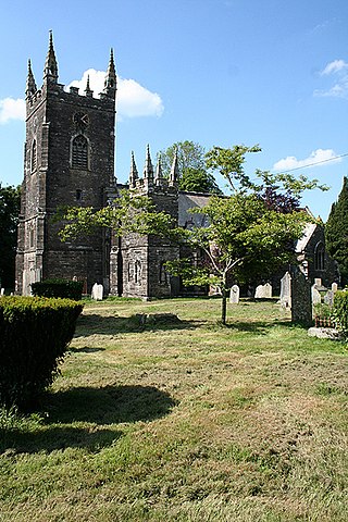
Tavistock Abbey, also known as the Abbey of Saint Mary and Saint Rumon, is a ruined Benedictine abbey in Tavistock, Devon. Nothing remains of the abbey except the refectory, two gateways and a porch. The abbey church, dedicated to Our Lady and St Rumon, was destroyed by Danish raiders in 997 and rebuilt under Lyfing, the second abbot. The church was further rebuilt in 1285 and the greater part of the abbey between 1457 and 1458.

Tamar Valley Area of Outstanding Natural Beauty or Tamar Valley AONB is a legally designated Area of Outstanding Natural Beauty in Devon and Cornwall in England.
South Devon, formerly known as the Southern Division of Devon, was a parliamentary constituency in the county of Devon in England. From 1832 to 1885 it returned two Knights of the Shire to the House of Commons of the Parliament of the United Kingdom, elected by the bloc vote system.

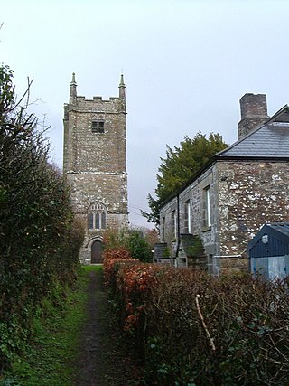
Whitchurch is a suburban village and civil parish to the south-east of the town of Tavistock, Devon, England. It lies in the West Devon local authority area, and within Tavistock Deanery for ecclesiastical purposes. The village itself is no longer in the civil parish, having been absorbed into Tavistock in 1930, leaving the parish of Whitchurch just covering the rural areas south-east of the town. Historically, Whitchurch formed part of the Roborough Hundred.
Werrington is a civil parish and former manor now in Cornwall, England, United Kingdom. Prior to boundary changes it straddled the Tamar and lay within the county of Devon. The portion on the west side was transferred to Cornwall by the abolition of Broadwoodwidger Rural District by the Local Government Commission for England in 1966. It is situated 1 mile (1.6 km) to the west of the Tamar, the traditional boundary between Devon and Cornwall, and 1 mile (1.6 km) north of Launceston.

Brentor is a village in West Devon, England. Its population in 2001 was 423. The village is dominated by the hill of Brent Tor, topped by the village's church.
Coryton is a hamlet and civil parish in the West Devon district of Devon, England, to the north west of Tavistock.
Tavistock College is a coeducational secondary school and sixth form located in Tavistock, Devon, England. It had approximately 1800 pupils. The schools draws pupils from a catchment area of about 20 km (12 mi) radius.

Gulworthy is a hamlet and civil parish in Devon, England that adjoins the border with Cornwall. There are a group of buildings by the road junction Gulworthy Cross which constitute the centre of the parish. These are Gulworthy School, St Paul's Church and the Parish Hall. In 2011 the parish had a population of 518. However it is part of the electoral ward of Tamarside, the population of Tamarside at the 2011 census was 1,622.
Lifton Hundred was the name of one of thirty two ancient administrative units of Devon, England.

Sampford Spiney is a village and civil parish in the Walkham valley, about 4 miles east south east of Tavistock, in the West Devon district, in the county of Devon, England. In 2011 the parish had a population of 117. The parish touches Walkhampton, Whitchurch and Horrabridge.
References
- 1 2 "THE HUNDREDS OF DEVON". GENUKI. Retrieved 8 April 2018.
| | This Devon location article is a stub. You can help Wikipedia by expanding it. |