
The Taupo Volcanic Zone (TVZ) is a volcanic area in the North Island of New Zealand that has been active for the past two million years and is still highly active. Mount Ruapehu marks its south-western end and the zone runs north-eastward through the Taupo and Rotorua areas and offshore into the Bay of Plenty. It is part of the larger Central Volcanic Region that extends further westward through the western Bay of Plenty to the eastern side of the Coromandel Peninsula and has been active for four million years. The Taupo Volcanic Zone is widening east–west at the rate of about 8 mm per year. It is named after Lake Taupo, the flooded caldera of the largest volcano in the zone.
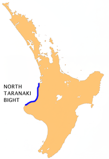
The North Taranaki Bight is a large bay that extends north and east from the north coast of Taranaki in New Zealand's North Island. The name is echoed by the South Taranaki Bight to the south of Cape Egmont.

Orakei is a suburb of Auckland city, in the North Island of New Zealand. It is located on a peninsula five kilometres to the east of the city centre, on the shore of the Waitemata Harbour, which lies to the north, and Hobson Bay and Orakei Basin, two arms of the Waitemata, which lie to the west and south. To the east is the suburb of Mission Bay. The mouth of the Waitemata is to the immediate north of Orakei, lying between Bastion Point, in Orakei, and North Head, in Devonport on the North Shore.

The source of the Waitara River lies in the very steep hill country to the east of Mount Taranaki/Egmont, near Tahora. After proceeding in a southwesterly direction toward Central Taranaki, the river abruptly turns to flow in a northwesterly direction to the Tasman Sea: meeting it at the coastal town of Waitara.
Waipuku is a settlement in inland Taranaki, in the western North Island of New Zealand. It is located between Stratford and Inglewood on State Highway 3.
The Hinemaiaia Stream is a river of the central North Island of New Zealand. It flows northwest from Kaimanawa Forest Park, flowing into the eastern shore of Lake Taupo at Hatepe, half way between Taupo and Turangi. It is a popular Fly fishing stream with good numbers of Rainbow trout spawning in the winter months of June through to September.
The Kaikou River is a river of the Northland Region of New Zealand's North Island. It flows initially north, then east, and finally south, from its source approximately halfway between Dargaville and Kaikohe, before joining with the Moengawahine Stream to become the Hikurangi River.
The Kaukapakapa River is a river of New Zealand's North Island. It flows west, reaching the southernmost point of the Kaipara Harbour close to the town of Helensville. The small township of Kaukapakapa lies on the banks of the river, some 5 kilometres (3 mi) from its mouth.
The Mimi River is a river of the Taranaki Region of New Zealand's North Island. It flows generally southwest from its sources in rough hill country 25 kilometres northeast of Urenui to reach the sea five kilometres northeast of the town. State Highway 3 follows the valley of the Mimi River for part of its length.
The Mohakatino River is a northern river in the Taranki region of New Zealand's North Island. It flows generally west from its origins west of Ohura, roughly paralleling the course of its northerly neighbour, the larger Mokau River. The Mohakatino reaches the Tasman Sea 3 kilometres (2 mi) south of Mokau.
The Ngunguru River is a river of the Northland Region of New Zealand's North Island. It initially flows southwest before turning east to flow into a long, wide estuary which empties into Ngunguru Bay to the northwest of Whangarei. The town of Ngunguru sits on the estuary's north bank at its opening to the bay.
The Okuku River is a river of the north Canterbury Region of New Zealand's South Island. It flows predominantly south from several sources in and close to the eastern edge of the Puketeraki Range west of Waikari, flowing through a steep gorge in the Okuku Range before flowing into the Ashley River 20 kilometres (12 mi) east of Oxford.
The Oparau River is a river of the Waikato Region of New Zealand's North Island. It flows southwest from its sources in the Pirongia Forest Park and flows into the Kawhia Harbour 5 kilometres (3 mi) east of Kawhia.
The Taringamotu River is a river of the Manawatu-Wanganui Region of New Zealand's North Island. It rises at the southern end of the Hauhungaroa Range, flowing generally west to meet the Ongarue River, part of the Whanganui River system, close to the town of Taumarunui.
The Tongaporutu River is a river of the Taranaki Region of New Zealand's North Island. It initially flows north from its origins near Tahora, turning west to reach the Tasman Sea coast close to the settlement of Tongaporutu, 15 kilometres south of Mokau.
The Urenui River is a river of the Taranaki Region of New Zealand's North Island. It flows northeast before turning northwest to reach the coast at Urenui.
The Waitoetoe River is a small river of the Taranaki Region of New Zealand's North Island. It flows close to the town of Urenui.
The Whakaki River is located in the Northland Region of New Zealand's North Island. Despite its name, it is better described as a silty arm of the Kaipara Harbour. It flows northwest to reach the Arapaoa River.
Waikato's Manganui River is located close to the west coast of New Zealand's North Island. It flows south, parallel to the coast of the North Taranaki Bight, before flowing into the Awakino River 5 kilometres (3 mi) from the latter's mouth.
Motutieke Island is the largest of the many low-lying marshy islands in the delta of the Waikato River, New Zealand's longest river. Stretching for some 7 kilometres (4 mi), and close to 1,000 metres (3,300 ft) wide at its widest, the island is in reality two islands separated by a shallow channel. The main body of the Waikato River flows to the southeast of the island, with narrow channels separating it to the north from the mainland of New Zealand's North Island. The smaller Puehunui Island lies close to the northwest.


