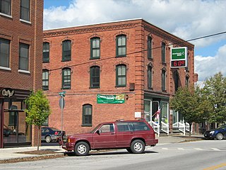
Enosburg Falls is a village in the town of Enosburgh in Franklin County, Vermont, in the United States. The population was 1,329 at the 2010 census, down from 1,473 at the 2000 census.

White River Junction is an unincorporated village and census-designated place (CDP) in the town of Hartford in Windsor County, Vermont, United States. The population was 2,286 at the 2010 census, making it the largest community within the town of Hartford.

Windsor is a town in Windsor County, Vermont, United States. As the "Birthplace of Vermont", the town is where the Constitution of Vermont was adopted in 1777, thus marking the founding of the Vermont Republic—a sovereign state until 1791 when Vermont joined the United States. Over much of its history, Windsor was home to a variety of manufacturing enterprises. The population was 3,553 at the 2010 census.

Middlebury is the shire town of Addison County, Vermont, United States. The population was 8,496 at the 2010 census. Middlebury is home to Middlebury College and the Henry Sheldon Museum of Vermont History.

The New England Culinary Institute (NECI) is a private for-profit culinary college in Montpelier, Vermont. It was founded on June 15, 1980, by Fran Voigt and John Dranow. The first NECI class, conducted by Chef Michel LeBorgne, had seven students. The enrollment was 500 in 2015. A second campus was operated in Essex, Vermont, from August 1989 through August 2009.

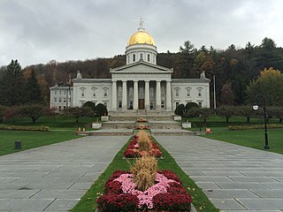
The Vermont House of Representatives is the lower house of the Vermont General Assembly, the state legislature of the U.S. state of Vermont. The House comprises 150 members, with each member representing around 4,100 citizens. Representatives are elected to a two-year term without term limits.

Gutterson Fieldhouse is a 4,035-seat hockey arena in Burlington, Vermont. It is home to the Vermont Catamounts men's and women's ice hockey teams. It is the largest indoor arena in the state of Vermont. It is adjacent to Patrick Gymnasium at the school's athletic complex. It is named for Albert Gutterson, class of 1912, the school's first Olympian. He set an Olympic record with a 7.60 meter long jump, beating, among others, the great Jim Thorpe.

David Zuckerman is an American businessman and politician of the Vermont Progressive Party serving as the 81st and current Lieutenant Governor of Vermont, elected in 2016. He previously served in the Vermont House of Representatives for six terms (1997–2011), and the Vermont Senate for two (2013–2017).
Union High School District No. 32, known as U-32 High School, is in East Montpelier, Vermont, United States. It is the regional high school for the central Vermont towns of Berlin, Calais, Middlesex, East Montpelier, and Worcester, and students from Orange, Washington, and Roxbury can choose attend U-32 after middle school. It encompasses grades seven through twelve in a combined middle and senior high school.

Vermont Route 14 is a north–south state highway in northeastern Vermont, United States. It is 110.2 miles (177.3 km) long and extends from U.S. Route 4 and U.S. Route 5 in White River Junction to Vermont Route 100 in Newport. Between White River Junction and the city of Barre, the route parallels Interstate 89. Vermont Route 14 was originally designated in 1922 as part of the New England road marking system. Its north end was truncated in 1926 as a result of the designation of U.S. Route 2 but was extended north along an old alignment of Vermont Route 12 in the 1960s.
U.S. Route 2 (US 2) is a part of the U.S. Highway System that is split into two segments. Its eastern segment runs from Rouses Point, New York, to Houlton, Maine. In Vermont, US 2 extends 151.604 miles (243.983 km) from the New York state line in Alburgh to the New Hampshire state line in Guildhall. West of Vermont, US 2 continues into New York for another 0.87 miles (1.40 km) to an intersection with US 11 in Rouses Point. US 2 passes through the cities of Burlington and Montpelier as it traverses the state. The Burlington to Montpelier route was first laid out as a toll road in the early 19th century. It was later incorporated into the transcontinental auto trail known as the Theodore Roosevelt International Highway in 1919 before being designated as part of US 2 in 1926.

The first Green Mountain Film Festival took place in Montpelier, Vermont in 1997. In March 1999, a second festival was held and it has been an annual March event ever since. In 2010 the festival was extended to include a series of satellite screenings in St. Johnsbury, Vermont. In 2018 the festival will also host screenings in Essex Junction, VT at the Essex Cinema.

Montpelier High School (MHS) is a public secondary school, comprising grades 9-12, located in Montpelier, Vermont. MHS serves the Montpelier School District. Montpelier is located near the center of Vermont in Washington County.
Saint Monica's Church is a Roman Catholic parochial in the city of Barre, Vermont. It is in the Diocese of Burlington. The congregation dates from the original settlement of Barre in the 19th century, and its present building dates from the late 1880s.

Saint Augustine Church is a Roman Catholic church dedicated to Saint Augustine and located on Barre Street in Montpelier, Vermont.
The Wells River is a tributary of the Connecticut River, approximately 15 miles (24 km) long, in the U.S. state of Vermont.

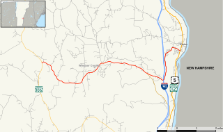
Vermont Route 44 (VT 44) is a state highway in the U.S. state of Vermont. The highway runs 10.190 miles (16.399 km) from VT 106 in Reading east to U.S. Route 5 (US 5) and VT 12 in Windsor. VT 44 passes through West Windsor in southern Windsor County, serving the area north of Mount Ascutney. The highway has an auxiliary route, VT 44A, which provides access to Mount Ascutney State Park and connects VT 44 with Interstate 91 (I-91) in Weathersfield. VT 44 was established in 1958 along the highway between Reading and Windsor. The three towns had previously maintained the highway with support from the state for construction and maintenance, including reconstruction along several segments in the 1940s. The state paved VT 44 in the early 1970s and early 1980s. VT 44A was established in 1987 when part of VT 44 in Windsor was returned to town maintenance.

St. Thomas Church is a Roman Catholic church in the Town of Underhill, Vermont in the United States, located in the unincorporated village of Underhill Center.


