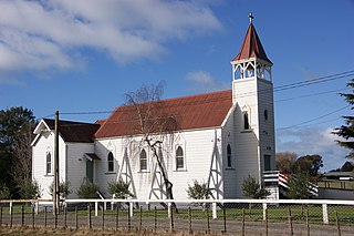
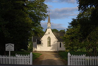
Te Awa, Hawke's Bay

Last updated

Te Awa is a suburb of the city of Napier, in the Hawke's Bay region of New Zealand's eastern North Island.

Napier, New Zealand Urban area in Hawkes Bay, New Zealand

Napier is a New Zealand city with a seaport, located in Hawke's Bay on the eastern coast of the North Island. The population of Napier is about 63,900 as of the June 2018. About 18 kilometres (11 mi) south of Napier is the inland city of Hastings. These two neighbouring cities are often called "The Bay Cities" or "The Twin Cities" of New Zealand. The total population of the Napier-Hastings Urban Area is 134,500 people, which makes it the sixth-largest urban area in New Zealand, closely followed by Dunedin (122,000), and trailing Tauranga (141,600).

North Island The northern of the two main islands of New Zealand

The North Island, also officially named Te Ika-a-Māui, is one of the two main islands of New Zealand, separated from the larger but much less populous South Island by Cook Strait. The island's area is 113,729 square kilometres (43,911 sq mi), making it the world's 14th-largest island. It has a population of 3,749,200.

It consists of a mix of 1920s small railway workers' houses which survived the 1931 Hawke's Bay earthquake, Art Deco homes built during the 1960s and 1970s, and twenty-first century subdivisions. [1]

1931 Hawkes Bay earthquake earthquake

The 1931 Hawke's Bay earthquake, also known as the Napier earthquake, occurred in New Zealand at 10:47 am on 3 February, killing 256, injuring thousands and devastating the Hawke's Bay region. It remains New Zealand's deadliest natural disaster. Centred 15 km north of Napier, it lasted for two and a half minutes and measured magnitude 7.8 Ms (magnitude 7.9 Mw). There were 525 aftershocks recorded in the following two weeks, with 597 being recorded by the end of February. The main shock could be felt in much of New Zealand, with reliable reports coming in from as far south as Timaru, on the east coast of the South Island.
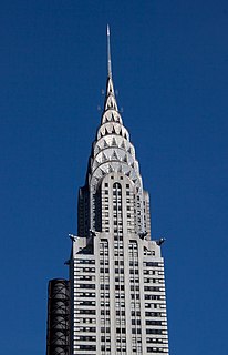
Art Deco Influential visual arts design style which first appeared in France during the 1920s

Art Deco, sometimes referred to as Deco, is a style of visual arts, architecture and design that first appeared in France just before World War I. Art Deco influenced the design of buildings, furniture, jewelry, fashion, cars, movie theatres, trains, ocean liners, and everyday objects such as radios and vacuum cleaners. It took its name, short for Arts Décoratifs, from the Exposition internationale des arts décoratifs et industriels modernes held in Paris in 1925. It combined modern styles with fine craftsmanship and rich materials. During its heyday, Art Deco represented luxury, glamour, exuberance, and faith in social and technological progress.

Education

Te Awa has two schools:

Napier Boys High School

Napier Boys' High School is a secondary boys' school in, Napier, New Zealand. It currently has a school roll of approximately 1,200 pupils. The school provides education from year 9 to Year 13.

Residents also use two other schools:

Napier Girls High School

Napier Girls' High School is a state secondary school on Clyde Road, Napier, New Zealand. It has a current school roll of over 1000.

Related Research Articles

Wairoa Place in Hawkes Bay, New Zealand

Wairoa is a town and territorial authority district in New Zealand's North Island. The town is the northernmost in the Hawke's Bay region, and is located on the northern shore of Hawke Bay at the mouth of the Wairoa River and to the west of Mahia Peninsula. It is 118 kilometres northeast of Napier, and 92 kilometres southwest of Gisborne. Percentage-wise, it is often known for being New Zealand's most Maori town, with over 62.29% of the population identifying themselves as Maori. At the same time, it is also the largest town within the district of Wairoa.

Clive, New Zealand Place in New Zealand

Clive is a small town, ten kilometres from the city centres of both Napier and Hastings in the Hawke's Bay region of New Zealand's North Island. It is close to the mouth of the Ngaruroro River.

Flaxmere human settlement in New Zealand

Flaxmere is a township in the Hastings District and outlying suburb of Hastings City, in the Hawke's Bay Region of New Zealand's North Island. It consists of a series of cul-de-sacs, radiating from a main street.

Napier Hill

Napier Hill is a limestone outcrop and suburb rising above the lowland districts of the city of Napier on New Zealand's North Island.

Pukehou Place in New Zealand

Pukehou is a farming locality in southern Hawke's Bay, in the eastern North Island of New Zealand.

Otane Place in New Zealand

Otane is a township in the Central Hawke's Bay District and the Hawke's Bay region, on the east coast of New Zealand's North Island. The small village, has a school, general store, cafe and pub, and is located just off State Highway 2. The community had a population of 537 as of 2013.

Onekawa is a suburb of the city of Napier, in the Hawke's Bay Region of the eastern North Island of New Zealand.

Raureka is a suburb of Hastings City, in the Hawke's Bay Region of New Zealand's North Island.

Maraenui is a suburb of the city of Napier, in the Hawke's Bay region of New Zealand's eastern North Island.

Te Hapara is a suburb of the New Zealand city of Gisborne. It is located in the northwest of the city. It contains one primary school, Te Hapara School, which is located in Mill Road.

Eskdale is a rural settlement the Hastings District and Hawke's Bay Region of New Zealand's North Island. It is located north of Napier on State Highway 5, near the mouth of the Esk River.

Puketapu is a rural community in the Hastings District and Hawke's Bay Region of New Zealand's North Island.

Tamatea is a suburb of the city of Napier, in the Hawke's Bay region of New Zealand's eastern North Island.

Central Napier is the central area and business district of Napier, in the Hawke's Bay region of New Zealand's eastern North Island.

Meeanee is a suburb of the city of Napier, in the Hawke's Bay region of New Zealand's eastern North Island.

Poraiti is a semi-rural suburb of the city of Napier, in the Hawke's Bay region of New Zealand's eastern North Island.

Parkvale is a suburb of Hastings City, in the Hawke's Bay Region of New Zealand's North Island.

Akina is a suburb of Hastings City, in the Hawke's Bay Region of New Zealand's North Island.

Camberley is a suburb of Hastings City, in the Hawke's Bay Region of New Zealand's North Island.

Flaxmere is a suburb of Hastings City, in the Hawke's Bay Region of New Zealand's North Island.

References

  1. "Once seen as a small suburb, Te Awa has started to take off". New Zealand Media and Entertainment. Hawke's Bay Today. 4 March 2019.
  2. "Te Awa School Official School Website". nbhs.school.nz.
  3. "Te Awa School Ministry of Education School Profile". educationcounts.govt.nz. Ministry of Education.
  4. 1 2 "Directory of Schools - as at 3 April 2019". New Zealand Ministry of Education. Retrieved 9 May 2018.
  5. "Te Awa School Education Review Office Report". ero.govt.nz. Education Review Office.
  6. "Napier Boys' High School Official School Website". nbhs.school.nz.
  7. "Ministry of Education School Profile". educationcounts.govt.nz. Ministry of Education.
  8. "Napier Boys' High School Education Review Office Report". ero.govt.nz. Education Review Office.
  9. "Napier Intermediate Ministry of Education School Profile". educationcounts.govt.nz. Ministry of Education.
  10. "Napier Intermediate Education Review Office Report". ero.govt.nz. Education Review Office.
  11. "Napier Girls' High School Official School Website". nghs.school.nz.
  12. "Napier Girls' High School Ministry of Education School Profile". educationcounts.govt.nz. Ministry of Education.
  13. "Napier Girls' High School Education Review Office Report". ero.govt.nz. Education Review Office.

Coordinates: 39°31′02″S176°54′05″E / 39.517220°S 176.901394°E / -39.517220; 176.901394

Geographic coordinate system Coordinate system

A geographic coordinate system is a coordinate system that enables every location on Earth to be specified by a set of numbers, letters or symbols. The coordinates are often chosen such that one of the numbers represents a vertical position and two or three of the numbers represent a horizontal position; alternatively, a geographic position may be expressed in a combined three-dimensional Cartesian vector. A common choice of coordinates is latitude, longitude and elevation. To specify a location on a plane requires a map projection.