Related Research Articles
Simplicius of Cilicia was a disciple of Ammonius Hermiae and Damascius, and was one of the last of the Neoplatonists. He was among the pagan philosophers persecuted by Justinian in the early 6th century, and was forced for a time to seek refuge in the Persian court, before being allowed back into the empire. He wrote extensively on the works of Aristotle. Although his writings are all commentaries on Aristotle and other authors, rather than original compositions, his intelligent and prodigious learning makes him the last great philosopher of pagan antiquity. His works have preserved much information about earlier philosophers which would have otherwise been lost.
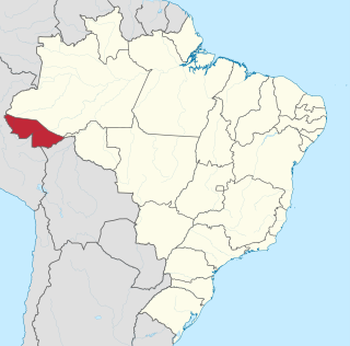
Acre is a state located in the west of the North Region of Brazil and the Amazonia Legal. Located in the westernmost part of the country, at a two-hour time difference from Brasília, Acre is bordered clockwise by the Brazilian states of Amazonas and Rondônia to the north and east, the Bolivian department of Pando to the southeast, and the Peruvian regions of Madre de Dios, Ucayali and Loreto to the south and west. The state, which has 0.42% of the Brazilian population, generates 0.2% of the Brazilian GDP.
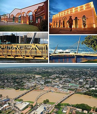
Rio Branco is a Brazilian municipality, capital of the state of Acre. Located in the valley of the Acre River in northern Brazil, it is the most populous municipality in the state, with 413,418 inhabitants, according to the 2018 census, almost half the state population. Rio Branco was one of the first settlements to develop in the region, being the westernmost major settlement in the country and the 4th-oldest state capital city in Northern Brazil, after Belém, Manaus and Macapá.

Arawan is a family of languages spoken in western Brazil and Peru (Ucayali).
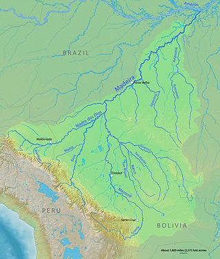
The Roosevelt River is a Brazilian river, a tributary of the Aripuanã River about 760 km (470 mi) in length.

The Acre River is a 680 kilometres (420 mi) long river in central South America.

Panoan is a family of languages spoken in Peru, western Brazil, and Bolivia. It is possibly a branch of a larger Pano–Tacanan family.

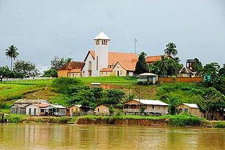
Cruzeiro do Sul is a municipality located on the Juruá river in the west of the Brazilian state of Acre. It is the second-largest city in Acre.

Marechal Thaumaturgo is a municipality located in the west of the Brazilian state of Acre. Its population is 19,299 and its area is 7,744 km².
Porto Walter is a municipality located in the west of the Brazilian state of Acre. Its population is 12,241 and its area is 6,136 km².

The Millers River is a 52.1-mile-long (83.8 km) river in northern Massachusetts, originating in Ashburnham and joining the Connecticut River just downstream from Millers Falls, Massachusetts. Sections of the river are used for whitewater kayaking, and a section upriver is popular with flatwater racers, and the river is known locally as a good place for pike fishing.

The Salmon River is formed at the confluence of the Blackledge and Jeremy rivers about one mile west of North Westchester, Connecticut. It drains 96,000 acres and courses for 10.4 miles (16.7 km) to Salmon Cove near Moodus where it flows into the Connecticut River. The Salmon River is probably the largest stream and watershed whose sources and mouth are entirely within the limits of Connecticut.
Ciudad Nueva District is one of ten districts of the province Tacna in Peru.
Catuti is a municipality in the north of the Brazilian state of Minas Gerais. As of 2022 the population was 5,250 in a total area of 286 km2 (110 sq mi). The elevation is 518 metres (1,699 ft) It became a municipality in 1997. The postal code (CEP) is 39526-000.
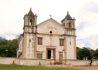
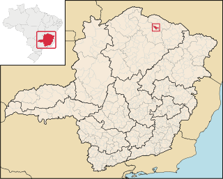
Matias Cardoso is a municipality in the north of the state of Minas Gerais in Brazil.
Breu River is a river of Acre state in western Brazil.
Igarapé Paraná is a river of Acre state in western Brazil.
Juruá-Mirim River is a river of Acre state in western Brazil.
The Mill River is a 1.25-mile (2.01 km) long tributary of the Connecticut River in Springfield, Massachusetts. It flows from Watershops Pond to its confluence with the Connecticut River. It is referred to as "The Miracle Mile" in a 2009 master's thesis that outlines possibilities for reclaiming the river's mouth as a recreational area. As of 2011, the final 350 feet (110 m) of the river, including its mouth, is confined in a pipe underneath Interstate 91, railroad tracks and a car dealership. Many Springfield residents have bemoaned the loss of the Mill River as a recreational area, and hope to gain greater access to both it and Connecticut Rivers in upcoming years. As it has for over a century, today the Mill River serves as a barrier between Springfield neighborhoods. Surrounding it are some of the most densely urbanized locations in Springfield.

Pilch Fields is an 11.1-hectare (27-acre) biological Site of Special Scientific Interest (SSSI) west of Great Horwood in Buckinghamshire. It is managed by the Berkshire, Buckinghamshire and Oxfordshire Wildlife Trust.
References
Coordinates: 8°59′01″S72°42′56″W / 8.9837°S 72.7156°W