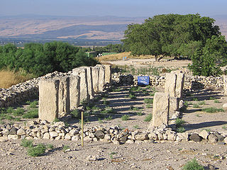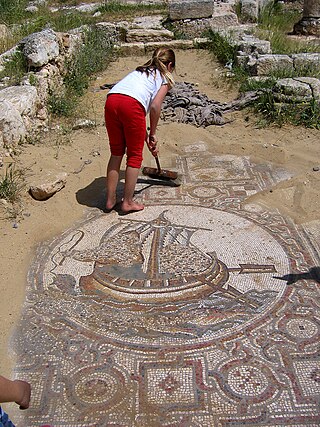
Antipatris was a city built during the first century BC by Herod the Great, who named it in honour of his father, Antipater. The site, now a national park in central Israel, was inhabited from the Chalcolithic Period to the late Roman Period. The remains of Antipatris are known today as Tel Afek, although formerly as Kŭlat Râs el 'Ain. It has been identified as either the tower of Aphek mentioned by Josephus, or the biblical Aphek, best known from the story of the Battle of Aphek. During the Crusader Period the site was known as Surdi fontes, "Silent springs". The Ottoman fortress known as Binar Bashi or Ras al-Ayn was built there in the 16th century.

Ekron, in the Hellenistic period known as Accaron was a Philistine city, one of the five cities of the Philistine Pentapolis, located in present-day Israel.

Apollonia, known in the Early Islamic period as Arsuf and in the Crusader Kingdom of Jerusalem as Arsur, was an ancient city on the Mediterranean coast of today's Israel. In Israeli archaeology it is known as Tel Arshaf. Founded by the Phoenicians during the Persian period in the late sixth century BCE, it was inhabited continuously until the Crusader period, through the Hellenistic, Roman, and Byzantine periods, during the latter being renamed to Sozusa. It was situated on a sandy area ending towards the sea with a cliff, about 34 kilometres (21 mi) south of Caesarea.

Tel Dor or Tell el-Burj, also Khirbet el-Burj in Arabic, is an archaeological site located on the Israeli coastal plain of the Mediterranean Sea next to modern moshav Dor, about 30 kilometers (19 mi) south of Haifa, and 2.5 kilometers (1.6 mi) west of Hadera. Lying on a small headland at the north side of a protected inlet, it is identified with D-jr of Egyptian sources, Biblical Dor, and with Dor/Dora of Greek and Roman sources.

The archaeology of Israel is the study of the archaeology of the present-day Israel, stretching from prehistory through three millennia of documented history. The ancient Land of Israel was a geographical bridge between the political and cultural centers of Mesopotamia and Egypt.

Israel Finkelstein is an Israeli archaeologist, professor emeritus at Tel Aviv University and the head of the School of Archaeology and Maritime Cultures at the University of Haifa. Finkelstein is active in the archaeology of the Levant and is an applicant of archaeological data in reconstructing biblical history. Finkelstein is the current excavator of Megiddo, a key site for the study of the Bronze and Iron Ages in the Levant.

Gezer, or Tel Gezer, in Arabic: تل الجزر – Tell Jezar or Tell el-Jezari is an archaeological site in the foothills of the Judaean Mountains at the border of the Shfela region roughly midway between Jerusalem and Tel Aviv. It is now an Israeli national park. In the Hebrew Bible, Gezer is associated with Joshua and Solomon.

Tel Hazor, also Chatsôr, translated in LXX as Hasōr, named in Arabic Tell Waqqas / Tell Qedah el-Gul, is an archaeological tell at the site of ancient Hazor, located in Israel, Upper Galilee, north of the Sea of Galilee, in the northern Korazim Plateau. From the Middle Bronze Age to the Iron Age, Hazor was the largest fortified city in the region and one of the most important in the Fertile Crescent. It maintained commercial ties with Babylon and Syria, and imported large quantities of tin for the bronze industry. In the Book of Joshua, Hazor is described as "the head of all those kingdoms". Though scholars largely do not consider the Book of Joshua to be historically accurate, archaeological excavations have emphasized the city's importance.

Tel Arad or Tell 'Arad is an archaeological tell, or mound, located west of the Dead Sea, about 10 kilometres west of the modern Israeli city of Arad in an area surrounded by mountain ridges which is known as the Arad Plain.

Khirbet Beit Lei or Beth Loya is an archaeological tell in the Judean lowlands of Israel. It is located about 5.5 km southeast of Tel Lachish and ten miles west-northwest of Hebron, on a hill 400 m above sea level.

Rujm el-Hiri is an ancient megalith consisting of concentric circles of stone with a tumulus at center. It is located in the Israeli-occupied portion of the Golan Heights some 16 kilometres (9.9 mi) east of the coast of the Sea of Galilee, in the middle of a large plateau covered with hundreds of dolmens.
Khirbet Kerak or Beth Yerah is a tell located on the southern shore of the Sea of Galilee in modern-day Israel. The tell spans an area of over 50 acres—one of the largest in the Levant—and contains remains dating from the Early Bronze Age and from the Persian period through to the Early Islamic period.

Tel Anafa is an archaeological site and nature reserve in the Upper Galilee, Israel.

Tel Michal is an archaeological site on Israel's central Mediterranean coast, near the modern city of Herzliya, about 6.5 kilometres (4.0 mi) north of the Yarkon River estuary and 4 kilometres (2.5 mi) south of Arsuf-Appolonia. Excavations have yielded remains from the Middle Bronze Age to the Early Arab period.

Tell Hadar, is an archaeological site on the northeastern shore of the Sea of Galilee. It contains a settlement and a port. A wall, 70 metres (230 ft) across, is either of the Late Bronze Age I or Iron Age I. In between periods of no human presence, it had grown, under the control of an Aramean kingdom, possibly Geshur; a planned city, granaries, and possibly other storage facilities, were constructed. In the 9th century BC the wall was discarded. An excavation revealed two buildings sharing one wall.

Tel Yokneam, also spelled Yoqne'am or Jokneam, is an archaeological site located in the northern part of the modern city of Yokneam Illit, Israel. It is known in Arabic as Tell Qamun, believed to be a corruption of the Hebrew name. The site is an elevated mound, or tell, spanning around 40 dunams and rising steeply to a height of 60 meters (200 ft). With a few brief interruptions, Yokneam was occupied for 4,000 years, from the Middle Bronze Age to the Ottoman period.

Tel Qashish, also spelled Tel Kashish or Tell el-Qassis in Arabic, is a tell in the northwestern Jezreel Valley, on the north bank of the Kishon River. The ancient settlement at Tel Qashish is believed to be a satellite of the nearby city of Yokneam, located about 2 kilometres (1.2 mi) south.
Tel Qiri is a tel and an ancient village site located inside the modern kibbutz of HaZore'a in northern Israel. It lies on the eastern slopes of the Menashe Heights and the western edge of the Jezreel Valley. As of the beginning of the excavations in 1975, almost half of the site was still visible, but today the entire site is covered by the houses of HaZore'a. The site spans an area of one hectare and is believed to have been a dependency of the nearby Tel Yokneam. The site hosted some human activity during the Neolithic and Chalcolithic periods, as well as parts of the Bronze Age. An uninterrupted sequence of settlement lasted from the Iron Age to the Roman-Byzantine period. Unlike all urban centers in northern Israel, the village in Tel Qiri, which flourished during the Iron Age, escaped all military events and no traces of destruction can be found there. This minor, damaged and seemingly insignificant site yielded an amazingly rich and diverse quantity of remains of different periods.
Tel Mevorakh is a small mound situated on the southern bank of Nahal Taninim in Israel. The tel does not exceed 1 dunam but rises to a height of 15 metres (50 ft) above its surrounding plain. The site contains some fifteen layers of human settlement, which accumulate to a height of 8 meters, meaning the natural hill does not exceed a height of 7 meters. It is located on the border between the wide Sharon Plain and the coast of Mount Carmel.

'En Esur, also En Esur or Ein Asawir, is an ancient site located on the northern Sharon Plain, at the entrance of the Wadi Ara pass leading from the Coastal Plain further inland. The site includes an archaeological mound (tell), called Tel Esur or Tell el-Asawir, another unnamed mound, and two springs, one of which gives the site its name.


