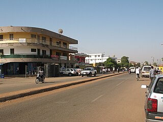
Accra is the capital and largest city of Ghana, located on the southern coast at the Gulf of Guinea, which is part of the Atlantic Ocean. As of 2021 census, the Accra Metropolitan District, 20.4 km2 (7.9 sq mi), had a population of 284,124 inhabitants, and the larger Greater Accra Region, 3,245 km2 (1,253 sq mi), had a population of 5,455,692 inhabitants. In common usage, the name "Accra" often refers to the territory of the Accra Metropolitan District as it existed before 2008, when it covered 199.4 km2 (77.0 sq mi). This territory has since been split into 13 local government districts: 12 independent municipal districts and the reduced Accra Metropolitan District (20.4 km2), which is the only district within the capital to be granted city status. This territory of 199.4 km2 contained 1,782,150 inhabitants at the 2021 census, and serves as the capital of Ghana, while the district under the jurisdiction of the Accra Metropolitan Assembly proper (20.4 km2) is distinguished from the rest of the capital as the "City of Accra".

Winneba is a town and the capital of Effutu Municipal District in Central Region of South Ghana. Winneba has a population of 60,331. Winneba, traditionally known as Simpa, is a historic fishing port in south Ghana, lying on the south coast, 140 kilometres (90 mi) east of Cape Coast. The current member of parliament is Alexander Kwamina Afenyo-Markin.

Wa is a town and the capital of the Wa Municipal District and the Upper West Region of Ghana. It has a population of 200,672 people according to the 2021 census.

Tema is a city on the Bight of Benin and Atlantic coast of Ghana. It is located 25 kilometres (16 mi) east of the capital city; Accra, in the region of Greater Accra, and is the capital of the Tema Metropolitan District. As of 2013, Tema is the eleventh most populous settlement in Ghana, with a population of approximately 161,612 people – a marked decrease from its 2005 figure of 209,000. The Greenwich Meridian passes directly through the city. Tema is locally nicknamed the "Harbour City" because of its status as Ghana's largest seaport. It consists of 25 different communities which are numbered accordingly with each of them having easy access to the basic amenities.

The Greater Accra Region has the smallest area of Ghana's 16 administrative regions, occupying a total land surface of 3,245 square kilometres. This is 1.4 per cent of the total land area of Ghana. It is the most populated region, with a population of 5,455,692 in 2021, accounting for 17.7 per cent of Ghana's total population.

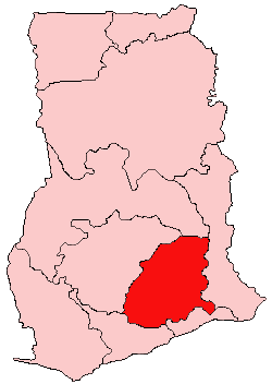
Kwahu or Kwawu is an area and group of people that live in Ghana and are part of the Twi-speaking Akan group. The region has been dubbed Asaase Aban, or the Natural Fortress, given its position as the highest habitable elevation in the country. Kwahu lies in the Eastern Region of Ghana, on the west shore of Lake Volta. The Kwahus share the Eastern Region with the Akyem and Akuapem, as well as the Adangbe-Krobos. Among Kwahu lands, a significant migrant population works as traders, farm-hands, fisherfolk, and caretakers in the fertile waterfront 'melting pot' of Afram plains. These migrants are mostly from the Northern and Volta Regions, as well as, some indigenous Guans from the bordering Oti and Brong-Ahafo regions live in the Afram Plains area. Kwahus are traditionally known to be wealthy traders, owning a significant number of businesses and industries in Ghana.

Teshie is a coastal town in the Ledzokuku Municipal District, a district in the Greater Accra Region of southeastern Ghana. Teshie is the ninth most populous settlement in Ghana, with a population of 171,875 people.

Dangme East District is a former district that was located in Greater Accra Region, Ghana. Originally created as an ordinary district assembly in 1988, which was created from the former Dangme District Council. However on 28 June 2012, it was split off into two new districts: Ada East District and Ada West District. The district assembly was located in the eastern part of Greater Accra Region and had Ada Foah as its capital town.

South Dayi District is one of the eighteen districts in Volta Region, Ghana. Originally it was formerly part of the then-larger Kpando District on 10 March 1989, until the southern part of the district was split off by a decree of president John Agyekum Kufuor on 19 August 2004 to create South Dayi District; thus the remaining part has been retained as Kpando District. The district assembly is located in the western part of Volta Region and has Kpeve as its capital town.
Articles related to Ghana include:

Homowo is a festival celebrated by the Ga people of Ghana in the Greater Accra Region. The festival starts at the end of April into May with the planting of crops before the rainy season starts. The Ga people celebrate Homowo in the remembrance of famine that once happened in their history in precolonial Ghana. The Ga Homowo or Harvest Custom is an annual tradition among the Accra people, with its origin tied to the Native Calendar and the Damte Dsanwe people of the Asere Quarter. Asere is a sub-division of the Ga Division in the Accra District of the Gold Coast Colony.

Anomabu, also spelled Anomabo and formerly as Annamaboe, is a town on the coast of the Mfantsiman Municipal District of the Central Region of South Ghana. Anomabu has a settlement population of 14,389 people.
Sakumono is a small town before Nungua from Ashaiman. It is in the Tema Metropolitan district, a district in the Greater Accra Region of Ghana. It was originally a small fishing village on Sakumono Lagoon, but by 2008 was being swallowed up as the twin cities of Nungua and Tema were merging. Its elevation is 71m. Sakumono, also known as Community 13, is one of the interesting towns in the area, with the main township being close to the beach and the lagoon. It also has several sectors of Estate buildings and jurisdiction.
Pokuase, also spelled Pokoasi, is a suburb of Accra, the capital city of Ghana and spans the area from Pokuase, leading off the Accra-Kumasi motorway on the right coming from Accra central; and leading off the motorway at Pokuase Junction and rising to ‘Okai Kwei Hill’, on the left coming from town. It is a mixture of lively retail shopping areas, with local stores, bars or 'drinking spots', bus/taxi stations, and a market. It also has many hotels, guest houses and rental apartments- such as the eco-chic Legassi Gardens Apartments-, and 'high-end' developing residential estates, such as Ofankor Hills Estates and Franko Estates, amongst many others; as well as the long-established executive gated community of ACP Estates.; and HFS Estates which borders the erstwhile Gua Koo Sacred Grove in Pokuase.
Ashaiman is a large town and the capital of the Ashaiman Municipal District in the Greater Accra Region of Ghana. According to the 2021 census, the town, along with the district, has a population of 208,060 people. Ethnic groups who resided in Ashaiman are the Ga-Adangbe, Ga, Guan, Hausa, Fante people, Dagomba, Ewe, Ashanti, and Akuapem. The current Mantse of the town is Nii Annang Adzor.

Denning Edem Hotor is a Ghanaian recording artist and entertainer who performs under the name Edem. In 2015, he was awarded Best International Act-Africa at the Black Canadian Awards in Canada.
Adukrom is a town in the Okere District Assembly in the Eastern Region of Ghana. It shares borders with Awukugua Akuapem where Okomfo anokye was born The town is known for the Nifahene Stool of Akuapem and the capital of Okere District and situated on the Togo Atakora hills on the main Ho-Koforidua main trunk road in the northern part of Akuapem.
Dodowa is a town located in the Greater Accra Region of Ghana, it is the district capital of Dangme West district, now Shai Osudoku District.
Abiriw is a town in the Okere District Assembly in the Eastern Region of Ghana.It shares border with Akropong and Dawu.
The Kpledjoo Festival is an annual harvest festival celebrated by the chiefs and peoples of Tema in the Greater Accra Region of Ghana. It is usually celebrated in late March or first week in April.


