Tepatepec

Last updated
Tepatepec
Municipal seat
Tepatepec.jpg
Municipal Palace
Glifo de Tepatepec (Francisco I. Madero).png
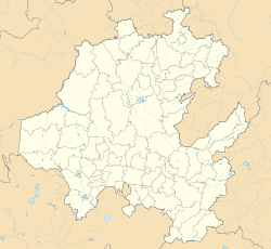
Mexico Hidalgo location map.svg
Red pog.svg
Tepatepec
Mexico States blank map.svg
Red pog.svg
Tepatepec
Coordinates: 20°15′20″N99°00′10″W / 20.25556°N 99.00278°W / 20.25556; -99.00278
CountryMexico
State Hidalgo
Municipality Francisco I. Madero
Elevation
1,977 m (6,486 ft)
Time zone CST
Postal code
42660
LADA 738
Website www.tepatepec.mx

Tepatepec is a community in the Mexican state of Hidalgo. It is the municipal seat of Francisco I. Madero.

Contents

In 1911 it was connected to other communities in the area by bridle paths. [1] In a 1953 publication it was reported to have 4,000 inhabitants and a school. [2] A skeleton found under a home in the area is venerated as a saint. [3] There is a library.

Tepatepec is the hometown of politician Xóchitl Gálvez Ruiz. [4]
Demographics

Vertical bar chart of Tepatepec between 1930 and 2020
Tepatepec
Parish of Saint Agustin Church Parroquia de San Agustin. Tepatepec, Hidalgo..JPG
Parish of Saint Agustín Church
School building Tepatepec, Hgo., Mexico - panoramio.jpg
School building
Monument Tepatepec. 08.jpg
Monument

See also

Related Research Articles

<span class="mw-page-title-main">Treaty of Guadalupe Hidalgo</span> 1848 agreement ending the Mexican–American War

The Treaty of Guadalupe Hidalgo officially ended the Mexican–American War (1846–1848). It was signed on 2 February 1848 in the town of Guadalupe Hidalgo.

<span class="mw-page-title-main">Miguel Hidalgo y Costilla</span> Mexican Catholic preacher(1753–1811)

Don Miguel Gregorio Antonio Ignacio Hidalgo y Costilla Gallaga Mandarte y Villaseñor, commonly known as Miguel Hidalgo y Costilla or Miguel Hidalgo, was a Catholic priest, leader of the Mexican War of Independence and recognized as the Father of the Nation.

<span class="mw-page-title-main">Michoacán</span> State of Mexico

Michoacán, formally Michoacán de Ocampo, officially the Estado Libre y Soberano de Michoacán de Ocampo'Free and Sovereign State of Michoacán de Ocampo', is one of the 31 states which, together with Mexico City, comprise the Federal Entities of Mexico. The state is divided into 113 municipalities and its capital city is Morelia. The city was named after José María Morelos, a native of the city and one of the main heroes of the Mexican War of Independence.

<span class="mw-page-title-main">State of Mexico</span> State of central Mexico

The State of Mexico, officially just Mexico, is one of the 32 federal entities of Mexico. Commonly known as Edomex to distinguish it from the name of the whole country, it is the most populous, as well as the second most densely populated, state in the country.

<span class="mw-page-title-main">Hidalgo (state)</span> State of Mexico

Hidalgo, officially the Free and Sovereign State of Hidalgo, is one of the 31 states which, along with Mexico City, constitute the 32 federal entities of Mexico. It is divided into 84 municipalities and its capital city is Pachuca de Soto. It is located in east-central Mexico and is bordered by San Luis Potosí and Veracruz on the north, Puebla on the east, Tlaxcala and State of Mexico on the south and Querétaro on the west.

<span class="mw-page-title-main">Miguel Hidalgo, Mexico City</span> Borough in Mexico City, Mexico

Miguel Hidalgo is a borough (alcaldía) in western Mexico City, it encompasses the historic areas of Tacuba, Chapultepec and Tacubaya along with a number of notable neighborhoods such as Polanco and Lomas de Chapultepec. With landmarks such as Chapultepec Park and the Museo Nacional de Antropología, it is the second most visited borough in Mexico City after Cuauhtémoc where the historic center of Mexico City is located. Tacubaya and Tacuba both have long histories as independent settlements and were designated as “Barrios Mágicos” by the city for tourism purposes.

<span class="mw-page-title-main">Guanajuato</span> State of Mexico

Guanajuato, officially the Free and Sovereign State of Guanajuato, is one of the 32 states that make up the Federal Entities of Mexico. It is divided into 46 municipalities and its capital city is Guanajuato.

<span class="mw-page-title-main">Pachuca</span> Capital and largest city of Hidalgo, Mexico

Pachuca, formally known as Pachuca de Soto, is the capital and largest city of the east-central Mexican state of Hidalgo, located in the south-central part of the state. Pachuca de Soto is also the name of the municipality for which the city serves as municipal seat. Pachuca is located about 90 kilometres (56 mi) north of Mexico City via Mexican Federal Highway 85.

Nopaltepec is municipality in State of Mexico, Mexico. It's municipal seat and second largest town is the town of Nopaltepec. It is approximately 250 km (160 mi) from Toluca, the state capital. The name derives from Náhuatl meaning "on nopal hill". It was originally called "Santa María de la Asunción Nopaltepec" but, after 1960, only Nopaltepec has been used.

La Real Sociedad Canina de España is the Spanish kennel club. It was founded in Madrid as the Sociedad Central de Fomento de las Razas Caninas en España on 27 June 1911, and became a legal entity on 12 July 1911; on 1 December 1911 it received the royal patronage of Alfonso XIII, and the word 'Real' was added before the name.

<span class="mw-page-title-main">Ciudad Hidalgo, Michoacán</span> City in Michoacán, Mexico

Ciudad Hidalgo, or simply Hidalgo, is a city and municipal seat of the Municipality of Hidalgo in the far northeast of the state of Michoacán, Mexico. It is a city located in a rural, mountainous area. While most of the city consists of modern buildings, its principal monument is the 16th-century church and former monastery of San José. Formerly, its name was Taximaroa, and it was the part of the Purépecha Empire closest to the Aztec Empire. This prompted two unsuccessful Aztec invasions as well as the first Spanish incursion into Purépecha lands in 1522. For both the city and rural communities around it, forestry and furniture making are important parts of the economy, but deforestation is forcing the area to look into alternatives such as tourism to take advantage of its natural resources and cultural sites.

<span class="mw-page-title-main">Lomas de Chapultepec</span> Neighborhood of Mexico City in Miguel Hidalgo

Lomas de Chapultepec is a colonia, or officially recognized neighborhood, located in the Miguel Hidalgo borough of Mexico City. It dates back to the 1920s, when it was founded with the name Chapultepec Heights. Its main entrance is through Paseo de la Reforma.

Chicano nationalism is the pro-indigenist ethnic nationalist ideology of Chicanos.

<span class="mw-page-title-main">Lycée Franco-Mexicain</span> Private French school with two campuses in Mexico City and one in Morelos

The Liceo Franco Mexicano A.C. or the Lycée Franco-Mexicain is a private French school with three campuses. It is one of the largest French lycées in the world with over 3,000 students in its two Mexico City campuses: Polanco in Miguel Hidalgo in northern Mexico City, and Coyoacán in southern Mexico City.

<span class="mw-page-title-main">Polanco, Mexico City</span> Neighborhood in Mexico City

Polanco is a neighborhood in the Miguel Hidalgo borough of Mexico City. Polanco is an affluent colonia, noted for its luxury shopping along Presidente Masaryk Avenue, the most expensive street in Mexico, as well as for the numerous prominent cultural institutions located within the neighborhood.

<span class="mw-page-title-main">Huejutla de Reyes</span> Municipality and town in Hidalgo, Mexico

Huejutla de Reyes is a city and one of the 84 municipalities of Hidalgo, in central-eastern Mexico. The name comes from the Nahuatl huexotl ("willow") and tlan ("place"), while "de Reyes" commemorates local cobbler Antonio Reyes Cabrera who died defending Huejutla from French invaders in 1866.

<span class="mw-page-title-main">Chihuahua (state)</span> State of Mexico

Chihuahua, officially the Estado Libre y Soberano de Chihuahua, is one of the 31 states which, along with Mexico City, comprise the 32 federal entities of Mexico. It is located in the northwestern part of Mexico and is bordered by the states of Sonora to the west, Sinaloa to the southwest, Durango to the south, and Coahuila to the east. To the north and northeast, it shares an extensive border with the U.S. adjacent to the U.S. states of New Mexico and Texas. The state was named after its capital city, Chihuahua City; the largest city is Ciudad Juárez. In 1864 the city of Chihuahua was declared capital of Mexico by Benito Juarez during the Reform War and French intervention. The city of Parral was the largest producer of silver in the world in 1640. During the Mexican War of Independence, Miguel Hidalgo was executed on July 30, 1811, in Chihuahua city.

<span class="mw-page-title-main">Xóchitl Gálvez</span> Mexican politician (born 1963)

Bertha Xóchitl Gálvez Ruiz is a Mexican politician and businesswoman. From 2015 until 2018, she was mayor of Mexico City's Miguel Hidalgo borough. From 2018 to 2023, she was a plurinominal senator in the Mexican Congress's LXIV and LXV Legislatures. As a senator, she caucused with the center-right National Action Party, but she frequently supported progressive politics on social issues such as abortion, drug policy, and social spending. She graduated from the UNAM School of Engineering with a degree in computer engineering. She received the nomination as the Fuerza y Corazón por México coalition's nominee for the 2024 Mexican presidential election.

References

  1. González, F.; S, Leopoldo Salazar (July 8, 1911). "The Mining Industry of Mexico". Imp. y Fototipia de la Secretaría de Fomento via Google Books.
  2. Unesco (July 8, 1953). "Problems in Education" via Google Books.
  3. Pansters, Wil G. (September 1, 2019). La Santa Muerte in Mexico: History, Devotion, and Society. University of New Mexico Press. ISBN   9780826360823 via Google Books.
  4. Díaz, Pedro López (July 8, 2006). La clase política mexicana: diccionario. UNAM. ISBN   9789686719918 via Google Books.