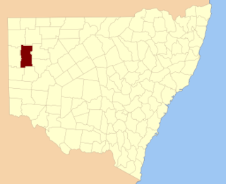
Terrigal Parish is a civil Parish of Gregory County in New South Wales. [1]
The parish is on Marthaguy Creek on the eastern boundary of the Macquarie Marshes Nature Reserve. [2]

Terrigal Parish is a civil Parish of Gregory County in New South Wales. [1]
The parish is on Marthaguy Creek on the eastern boundary of the Macquarie Marshes Nature Reserve. [2]

Cumberland County is a county in the State of New South Wales, Australia. Most of the Sydney metropolitan area is located within the County of Cumberland.
Bannaby

Darbalara is a rural community on the east bank of the junction of the Murrumbidgee River and Tumut River in the Riverina. It is situated by road, about 25 kilometres north east of Gundagai and 25 kilometres south of Coolac.

Gloucester County was one of the original Nineteen Counties in New South Wales, and is now one of the 141 cadastral divisions of New South Wales. It includes the area around Port Stephens. It is bounded on the north and west by the Manning River, and on the south-west by the Williams River.

Yancowinna County is one of the 141 cadastral divisions of New South Wales.

Blaxland County is one of the 141 cadastral divisions of New South Wales. It is bounded to the south by the Lachlan River and a small part of Waverley Creek. It includes Mount Hope and the Nombinnie Nature Reserve.

Cowper County, New South Wales is one of the 141 cadastral divisions of New South Wales.

Gregory County is one of the 141 cadastral divisions of New South Wales. It is bordered by Bogan River in the west, and includes the area to the northeast of Nyngan. It includes the Macquarie Marshes Nature Reserve, and the town of Quambone.

Irrara County is one of the 141 cadastral divisions of New South Wales. It is located south of the border with Queensland, east of the Paroo River, and west of the Warrego River.

Mootwingee County, New South Wales is one of the 141 cadastral divisions of New South Wales.

Tongowoko County is one of the 141 cadastral divisions of New South Wales. It is located in the remote north-west of the state, south of the Queensland border.

The Parish of Tarago is a parish of Argyle County. It does not actually contain the town of Tarago, which is located further to the southeast in the Parish of Mulwaree. The Parish was established by the Department of Lands in New South Wales.

The Parish of Currawang is a parish of Argyle County located to the north of Lake George. The parish was formerly known as the parish of Currowang, the former name discontinued on 14 November 1980 and the present name assigned.
Mumblebone, New South Wales is a rural locality of Warren Shire and a civil parish of Gregory County, New South Wales, a Cadastral divisions of New South Wales.
Billabulla, New South Wales is a rural locality of Warren Shire and a civil parish of Gregory County, New South Wales, a Cadastral divisions of New South Wales.

Gardiner Parish is a civil parish of Gregory County in New South Wales.
Duffity Parish is a civil parish of Gregory County, New South Wales in Warren Shire located at 31°11'04.0"S 147°39'51.0"E. in New South Wales.
Yarrawell Parish is a civil parish of Gregory County, New South Wales in Warren Shire located at 31°11'04.0"S 147°39'51.0"E. in New South Wales.

Tameribundy Parish is a civil Parish of Gregory County in New South Wales.
Gilgoen Parish is a civil parish of Gregory County, New South Wales.