Tessera (Venus)

Last updated

Tessera terrain in the Maxwell Montes seen in white on the right of the image. Eastern edge of Lakshmi Planum seen in gray on the left. Maxwell Montes of planet Venus.jpg
Tessera terrain in the Maxwell Montes seen in white on the right of the image. Eastern edge of Lakshmi Planum seen in gray on the left.

A tessera (plural tesserae) is a region of heavily deformed terrain on Venus, characterized by two or more intersecting tectonic elements, high topography, and subsequent high radar backscatter. [1] Tesserae often represent the oldest material at any given location and are among the most tectonically deformed terrains on Venus's surface. [2] [3] Diverse types of tessera terrain exist. It is not currently clear if this is due to a variety in the interactions of Venus's mantle with regional crustal or lithospheric stresses, or if these diverse terrains represent different locations in the timeline of crustal plateau formation and fall. [4] Multiple models of tessera formation exist and further extensive studies of Venus's surface are necessary to fully understand this complex terrain.

Contents

Exploration

Pioneer Venus Orbiter detected regions of anomalous radar properties and high backscatter. Using SAR imaging, the Venera 15 and Venera 16 orbiters revealed these regions to be chaotically tiled terrain, which Soviet scientists named "паркет" (parquet, pronounced par-key'yet), later known as "tesserae." [5] [6] The most recent data concerning tessera terrain comes from the Magellan Mission, in which the majority of Venus's surface was mapped in high resolution (~100 m/pixel). [7] Future missions to Venus would allow for further understanding of tessera terrain.

Locations

Tesserae are recognized as covering 7.3% of Venus's surface, approximately 3.32×10⁷ square kilometres (1.28×10⁷ sq mi), and occur mostly within a few extensive provinces. [8] They are heavily concentrated between 0°E and 150°E. These longitudes represent a large area between a crustal extension center in the Aphrodite Terra and a crustal convergence center in Ishtar Terra. [1] Tesserae are exposed almost entirely within Venus's crustal plateaus. Tessera inliers, regions of tessera not found within current crustal plateaus are thought to represent regions of collapsed crustal plateaus. [7] [9] [10] Large regions of tessera terrain are labelled based on their latitude. Regions in the equatorial and southern latitudes are labelled as "regio" while regions in the northern latitudes are labelled as "tesserae." [11]

A comprehensive list of regiones and tesserae can be found under List of geological features on Venus. Some well explored regions of tessera include:

Interpretive outline of tessera terrain (white outline) imposed on "GIS Map of Venus" (GIS Map of Venus source: USGS Astrogeology Science Center) Tessera Terrain on Venus gif.gif
Interpretive outline of tessera terrain (white outline) imposed on "GIS Map of Venus" (GIS Map of Venus source: USGS Astrogeology Science Center)

Formation

Model of crustal plateau and tessera terrain formation via mantle downwelling after Gilmore (1998). Downwelling.gif
Model of crustal plateau and tessera terrain formation via mantle downwelling after Gilmore (1998).

Tesserae represent an ancient time of globally thin lithosphere on Venus. [4] Tessera Terrain does not participate in the global resurfacing events of Venus. [9] It was thought by many researches that the tesserae might form a global "onion skin" of sorts, and extended beneath Venus's regional plains. [12] [13] However, the currently accepted models support regional formation. [7] [14] Multiple models have been put forward to explain the formation of tessera terrain. Models of formation by mantle downwelling and pulsating continents are the most currently accepted models. A model of formation due to a lava pond via bolide impact was put forth, although it has not currently gained much traction in the scientific community due to skepticism of the ability of a bolide impact to generate sufficient melt. A model of formation due to mantle plumes (upwelling) was persistent for many years, however, it has since been abandoned due to its contradictory prediction of sequences of extension versus the observed cross cutting relationships.

Downwelling

Model of crustal plateau and tessera terrain formation after Hansen (2006). Lava Pond via Giant Impact.gif
Model of crustal plateau and tessera terrain formation after Hansen (2006).

In the downwelling model, mantle downwelling, possibly due to mantle convection, causes compression and thickening of the crust, creating the compressional elements of tessera terrain. Isostatic rebound occurs due to the crustal thickening. After downwelling ends, a delamination event within the mantle produces extensional elements of tessera. [15] This model does not currently explain tessera's location within crustal plateaus, and instead predicts a domical shape. [9]

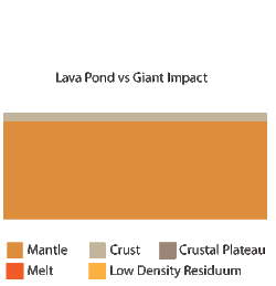
Lava pond via giant impact

In the lava pond via giant impact model, melt due to a bolide impact on a thin lithosphere rises to the surface to form a lava pond. Convection throughout the lava pond resulted in surface deformation that created tessera terrain. Isostatic rebound of the solidified pond creates a crustal plateau structure. [16] This model does not currently explain how convection could transmit enough force to deform several kilometers of brittle material.

Pulsating continents

Pulsating continents model Pulsating continents model.gif
Pulsating continents model

In the pulsating continents model, differentiated, low density crust survives early global subduction events forming continental regions. These regions undergo compression due to heating from the surrounding mantle, forming the compressional features of tessera, such as fold and thrust belts, and basin dome terrain. After sufficient crustal thickening has occurred, new lithosphere is generated causing gravitational collapse, producing the extensional features of tessera, such as extensive grabens. During this collapse, decompression causes partial melting, producing the intratessera volcanism seen within the larger regions of tessera terrain. This model requires that the material comprising tessera terrain is continental in nature. Future missions to Venus to sample surface compositions are necessary to support this model. [9] This model does not currently explain how a global subduction event could cause the delamination of the entire mantle lithosphere, leaving only low density crust behind.

Variety of tessera terrain

Individual patterns of tessera terrain record the variations in interactions of the mantle with local regional stresses. [1] [7] This variation manifests itself in a wide array of diverse terrain types. Multiple types of sampled tessera terrain are below, however, they are not meant as a classification scheme, and instead emphasize the variety of terrain types. [17]

Fold Terrain is easily recognizable by its well defined linear fabrics. This type of terrain is composed of long ridges and valleys, greater than 100 km long, that are cross cut by minor extensional fractures that run perpendicular to the fold axes of the ridges. This likely formed due to unidirectional contraction. [17]

Lava Flow Terrain is named such due to its resemblance to Pahoehoe flows found on Earth, with long curving ridges. It is thought that this terrain may be formed due to displacement and deformation due to movement of the material beneath these crustal pieces.

Ribbon Terrain is characterized by ribbons and folds that are typically orthogonal to one another. Ribbons are long and narrow extensional troughs that are separated by narrow ridges. Ribbon terrain can be found both in large crustal plateaus and within tessera inliers. [7] [14]

S-C Terrain is named such due to its geometric similarity to S-C tectonic fabrics on Earth. It consists of two main structures: synchronous folds and small, 5 to 20 km long graben that cross cut the folds perpendicularly. Unlike many other types of tessera terrain, S-C terrain indicates a simple, rather than complex deformation history in which deformation due to widespread motion on Venus is widely distributed. This type of terrain also indicates that strike-slip movement on Venus's surface is possible. [17]

Basin and Dome Terrain, also known as honeycomb terrain, consists of curved ridges and troughs that form a pattern analogous to an egg carton. [17] These structures represent multiple phases of deformation, and are considered the most complex appearing style of tessera. [1] Basin and dome terrain is typically found within the center of crustal plateaus. [17]

Star Terrain is composed of multiple graben and fractures that trend in many directions, but radiate in a star-like pattern. This pattern is thought to be due to doming underneath previously deformed and fractured areas, in which the local uplift causes the radiating pattern. [17]

Related Research Articles

<span class="mw-page-title-main">Rio Grande rift</span>

The Rio Grande rift is a north-trending continental rift zone. It separates the Colorado Plateau in the west from the interior of the North American craton on the east. The rift extends from central Colorado in the north to the state of Chihuahua, Mexico, in the south. The rift zone consists of four basins that have an average width of 50 kilometres (31 mi). The rift can be observed on location at Rio Grande National Forest, White Sands National Park, Santa Fe National Forest, and Cibola National Forest, among other locations.

<span class="mw-page-title-main">Downwelling</span> Process of accumulation and sinking of higher density material beneath lower density material

Downwelling is the process of accumulation and sinking of higher density material beneath lower density material, such as cold or saline water beneath warmer or fresher water or cold air beneath warm air. It is the sinking limb of a convection cell. Upwelling is the opposite process, and together, these two forces are responsible in the oceans for the thermohaline circulation. The sinking of the cold lithosphere at subduction zones is another example of downwelling in plate tectonics.

<span class="mw-page-title-main">Lithosphere</span> Outermost shell of a terrestrial-type planet or natural satellite

A lithosphere is the rigid, outermost rocky shell of a terrestrial planet or natural satellite. On Earth, it is composed of the crust and the lithospheric mantle, the topmost portion of the upper mantle that behaves elastically on time scales of up to thousands of years or more. The crust and upper mantle are distinguished on the basis of chemistry and mineralogy.

<span class="mw-page-title-main">Subduction</span> A geological process at convergent tectonic plate boundaries where one plate moves under the other

Subduction is a geological process in which the oceanic lithosphere and some continental lithosphere is recycled into the Earth's mantle at convergent boundaries. Where the oceanic lithosphere of a tectonic plate converges with the less dense lithosphere of a second plate, the heavier plate dives beneath the second plate and sinks into the mantle. A region where this process occurs is known as a subduction zone, and its surface expression is known as an arc-trench complex. The process of subduction has created most of the Earth's continental crust. Rates of subduction are typically measured in centimeters per year, with rates of convergence as high as 11 cm/year.

Isostasy or isostatic equilibrium is the state of gravitational equilibrium between Earth's crust and mantle such that the crust "floats" at an elevation that depends on its thickness and density. This concept is invoked to explain how different topographic heights can exist at Earth's surface. Although originally defined in terms of continental crust and mantle, it has subsequently been interpreted in terms of lithosphere and asthenosphere, particularly with respect to oceanic island volcanoes, such as the Hawaiian Islands.

<span class="mw-page-title-main">Craton</span> Old and stable part of the continental lithosphere

A craton is an old and stable part of the continental lithosphere, which consists of Earth's two topmost layers, the crust and the uppermost mantle. Having often survived cycles of merging and rifting of continents, cratons are generally found in the interiors of tectonic plates; the exceptions occur where geologically recent rifting events have separated cratons and created passive margins along their edges. Cratons are characteristically composed of ancient crystalline basement rock, which may be covered by younger sedimentary rock. They have a thick crust and deep lithospheric roots that extend as much as several hundred kilometres into Earth's mantle.

<span class="mw-page-title-main">Forearc</span> The region between an oceanic trench and the associated volcanic arc

Forearc is a plate tectonic term referring to a region in a subduction zone between an oceanic trench and the associated volcanic arc. Forearc regions are present along convergent margins and eponymously form 'in front of' the volcanic arcs that are characteristic of convergent plate margins. A back-arc region is the companion region behind the volcanic arc.

<span class="mw-page-title-main">Geology of Venus</span> Geological structure and composition of the second planet from the Sun

The geology of Venus is the scientific study of the surface, crust, and interior of the planet Venus. Of all the other planets in the Solar System, it is the one nearest to Earth and most like it in terms of mass, but has no magnetic field or recognizable plate tectonic system. Much of the ground surface is exposed volcanic bedrock, some with thin and patchy layers of soil covering, in marked contrast with Earth, the Moon, and Mars. Some impact craters are present, but Venus is similar to Earth in that there are fewer craters than on the other rocky planets that are largely covered by them. This is due in part to the thickness of the Venusian atmosphere disrupting small impactors before they strike the ground, but the paucity of large craters may be due to volcanic re-surfacing, possibly of a catastrophic nature. Volcanism appears to be the dominant agent of geological change on Venus. Some of the volcanic landforms appear to be unique to the planet. There are shield and composite volcanoes similar to those found on Earth. Given that Venus has approximately the same size, density, and composition as Earth, it is plausible that volcanism may be continuing on the planet today, as demonstrated by recent studies.

<span class="mw-page-title-main">Cleopatra (crater)</span> Crater on Venus

Cleopatra, initially called Cleopatra Patera, is an impact crater on Venus, in Maxwell Montes.

<span class="mw-page-title-main">Ovda Regio</span>

Ovda Regio is a Venusian crustal plateau located near the equator in the western highland region of Aphrodite Terra that stretches from 10°N to 15°S and 50°E to 110°E. Known as the largest crustal plateau in Venus, the regio covers an area of approximately 15,000,000 square kilometres (5,800,000 sq mi) and is bounded by regional plains to the north, Salus Tessera to the west, Thetis Regio to the east, and Kuanja as well as Ix Chel chasmata to the south. The crustal plateau serves as a place to hold the localized tessera terrains in the planet, which makes up roughly 8% of Venus' surface area. The kinematic evolution of crustal plateaus on Venus has been a debated topic in the planetary science community. Understanding its complex evolution is expected to contribute to a better knowledge of the geodynamic history of Venus. It is named after a Marijian forest spirit that can appear as both male and female.

Volcanic passive margins (VPM) and non-volcanic passive margins are the two forms of transitional crust that lie beneath passive continental margins that occur on Earth as the result of the formation of ocean basins via continental rifting. Initiation of igneous processes associated with volcanic passive margins occurs before and/or during the rifting process depending on the cause of rifting. There are two accepted models for VPM formation: hotspots/mantle plumes and slab pull. Both result in large, quick lava flows over a relatively short period of geologic time. VPM's progress further as cooling and subsidence begins as the margins give way to formation of normal oceanic crust from the widening rifts.

<span class="mw-page-title-main">Intraplate deformation</span>

Intraplate deformation is the folding, breaking, or flow of the Earth's crust within plates instead of at their margins. This process usually occurs in areas with especially weak crust and upper mantle, such as the Tibetan Plateau. Intraplate deformation brings another aspect to plate tectonic theory.

Mountains are widely distributed across the surface of Io, the innermost large moon of Jupiter. There are about 115 named mountains; the average length is 157 km (98 mi) and the average height is 6,300 m (20,700 ft). The longest is 570 km (350 mi), and the highest is Boösaule Montes, at 17,500 metres (57,400 ft), taller than any mountain on Earth. Ionian mountains often appear as large, isolated structures; no global tectonic pattern is evident, unlike on Earth, where plate tectonics is dominant.

<span class="mw-page-title-main">Guinevere Planitia</span> Planitia on Venus

Guinevere Planitia is an expansive lowland region of Venus that lies east of Beta Regio and west of Eistla Regio. These low-lying plains, particularly in the western portion, are characterized by apparent volcanic source vents and broad regions of bright, dark, and mottled deposits. They are the only break in an equatorially connected zone of highlands and tectonic zones. The types, numbers, and patterns of mapped tectonic features and small volcanic landforms in the region provide important detail in the interpretation and evolution of venusian landscape.

<span class="mw-page-title-main">Geodynamics of Venus</span>

NASA's Magellan spacecraft mission discovered that Venus has a geologically young surface with a relatively uniform age of 500±200 Ma. The age of Venus was revealed by the observation of over 900 impact craters on the surface of the planet. These impact craters are nearly uniformly distributed over the surface of Venus and less than 10% have been modified by plains of volcanism or deformation. These observations indicate that a catastrophic resurfacing event took place on Venus around 500 Ma, and was followed by a dramatic decline in resurfacing rate. The radar images from the Magellan missions revealed that the terrestrial style of plate tectonics is not active on Venus and the surface appears to be immobile at the present time. Despite these surface observations, there are numerous surface features that indicate an actively convecting interior. The Soviet Venera landings revealed that the surface of Venus is essentially basaltic in composition based on geochemical measurements and morphology of volcanic flows. The surface of Venus is dominated by patterns of basaltic volcanism, and by compressional and extensional tectonic deformation, such as the highly deformed tesserae terrain and the pancake like volcano-tectonic features known as coronae. The planet's surface can be broadly characterized by its low lying plains, which cover about 80% of the surface, 'continental' plateaus and volcanic swells. There is also an abundance of small and large shield volcanoes distributed over the planet's surface. Based on its surface features, it appears that Venus is tectonically and convectively alive but has a lithosphere that is static.

<span class="mw-page-title-main">Irnini Mons</span> Mountain on Venus

Irnini Mons is a volcanic structure on the planet Venus, and is named after the Assyro-Babylonian goddess of cedar-tree mountains. It has a diameter of 475 km (295 mi), a height of 1.75 km (1.09 mi), and is located in Venus' northern hemisphere. More specifically, it is located in the central Eistla Regio region at in the V-20 quadrangle. Sappho Patera, a 225 km (140 mi) diameter wide, caldera-like, depression tops the summit of Irnini Mons. The primary structural features surrounding Irnini Mons are graben, seen as linear depressed sections of rock, radiating from the central magma chamber. Also, concentric, circular ridges and graben outline the Sappho Patera depression at the summit. The volcano is crossed by various rift zones, including the north-south trending Badb Linea rift, the Guor Linea rift extending to the northwest, and the Virtus Linea rift continuing to the southeast.

<span class="mw-page-title-main">Lada Terra</span> Terra on Venus

Lada Terra is a major landmass near the south pole of Venus which is centered at 60°S and 20°E and has a diameter of 8,615 kilometres (5,353 mi). It is defined by the International Astronomical Union as one of the three "major landmasses," or terrae, of Venus. The term "landmass" is not analogous to the landmass on Earth, as there are no apparent oceans on Venus. The term here applies to a substantial portion of land that lies above the average planetary radius, and corresponds to highlands.

<span class="mw-page-title-main">Ganis Chasma</span> Chasma on Venus

Ganis Chasma is a group of rift zones on the surface of the planet Venus. Bright spots detected by the Venus Monitoring Camera on the European Space Agency's Venus Express in the area suggest that there may be active volcanism on Venus.

<span class="mw-page-title-main">Surface features of Venus</span>

The surface of Venus is dominated by geologic features that include volcanoes, large impact craters, and aeolian erosion and sedimentation landforms. Venus has a topography reflecting its single, strong crustal plate, with a unimodal elevation distribution that preserves geologic structures for long periods of time. Studies of the Venusian surface are based on imaging, radar, and altimetry data collected from several exploratory space probes, particularly Magellan, since 1961. Despite its similarities to Earth in size, mass, density, and possibly composition, Venus has a unique geology that is unlike Earth's. Although much older than Earth's, the surface of Venus is relatively young compared to other terrestrial planets, possibly due to a global-scale resurfacing event that buried much of the previous rock record. Venus is believed to have approximately the same bulk elemental composition as Earth, due to the physical similarities, but the exact composition is unknown. The surface conditions on Venus are more extreme than on Earth, with temperatures ranging from 453 to 473 °C and pressures of 95 bar. Venus lacks water, which makes crustal rock stronger and helps preserve surface features. The features observed provide evidence for the geological processes at work. Twenty feature types have been categorized thus far. These classes include local features, such as craters, coronae, and undae, as well as regional-scale features, such as planitiae, plana, and tesserae.

<span class="mw-page-title-main">Mapping of Venus</span> Process and results of human description of features of Venus

The mapping of Venus refers to the process and results of human description of the geological features of the planet Venus. It involves surface radar images of Venus, construction of geological maps, and the identification of stratigraphic units, volumes of rock with a similar age.

References

  1. 1 2 3 4 Bindschadler, Duane; Head, James (1991). "Tessera Terrain, Venus: Characterization and Models for Origin and Evolution". Journal of Geophysical Research. 96 (B4): 5889–5907. Bibcode:1991JGR....96.5889B. doi:10.1029/90jb02742.
  2. Ivers, Carol; McGill, George. "Kinematics of a Tessera Block in the Vellamo Planitia Quadrangle". Lunar and Planetary Science. 29.
  3. Hansen, Vicki; Willis, James (1998). "Ribbon Terrain Formation, Southwestern Fortuna Tessera, Venus: Implications for Lithosphere Evolution". Icarus. 132 (2): 321–343. Bibcode:1998Icar..132..321H. doi:10.1006/icar.1998.5897. S2CID   18119376.
  4. 1 2 Hansen, Vicki; Phillips, Roger; Willis, James; Ghent, Rebecca (2000). "Structures in tessera terrain, Venus: Issues and answers". Journal of Geophysical Research. 105 (E2): 4135–4152. Bibcode:2000JGR...105.4135H. doi: 10.1029/1999je001137 .
  5. Barsukov, V.L., et al, "The geology of Venus according to the results of an analysis of radar images obtained by Venera-15 and Venera-16 Preliminary data", Geokhimiya, Dec. 1984
  6. Head, James (1990). "Venus Trough and Ridge Tessera: Anolog to Earth Oceanic Crust Formed at Spreading Centers?". Journal of Geophysical Research. 95 (B5): 7119–7132. Bibcode:1990JGR....95.7119H. doi:10.1029/jb095ib05p07119.
  7. 1 2 3 4 5 Hansen, Vicki; Banks, Brian; Ghent, Rebecca (1999). "Tessera terrain and crustal plateaus, Venus". Geology. 27 (12): 1071–1074. Bibcode:1999Geo....27.1071H. doi:10.1130/0091-7613(1999)027<1071:ttacpv>2.3.co;2.
  8. Ivanov, Mikhail; Head, James (2011). "Global Geologic Map of Venus". Planetary and Space Science. 59 (13): 1559–1600. Bibcode:2011P&SS...59.1559I. doi:10.1016/j.pss.2011.07.008.
  9. 1 2 3 4 Romeo, I.; Turcotte, D.I. (2008). "Pulsating continents on Venus: An explanation for crustal plateaus and tessera terrains" (PDF). Earth and Planetary Science Letters. 276 (1–2): 85–97. Bibcode:2008E&PSL.276...85R. doi:10.1016/j.epsl.2008.09.009.
  10. Campbell, Bruce; Campbell, Donald; Morgan, Gareth; Carter, Lynn; Nolan, Micael (2015). "Evidence for crater ejecta on Venus tessera terrain from Earth-based radar images" (PDF). Icarus. 250: 123–130. Bibcode:2015Icar..250..123C. doi:10.1016/j.icarus.2014.11.025.
  11. Bougher, Steven; Hunten, Donald; Phillips, Roger (1997). Venus II : Geology, Geophysics, Atmosphere, and Solar Wind Environment. University of Arizona Press. ISBN   978-0816518302.
  12. Solomon, S.C. (1993). "The geophysics of Venus". Physics Today. 46 (7): 38–55. Bibcode:1993PhT....46g..48S. doi:10.1063/1.881359.
  13. Turcotte, D.L. (1993). "An episodic hypothesis for Venusian tectonics". Journal of Geophysical Research. 98 (E9): 17061–17068. Bibcode:1993JGR....9817061T. doi:10.1029/93je01775.
  14. 1 2 Hansen, V.L.; Lopez, I. (2009). "Implications of Venus Evolution Based on Ribbon Tessera Relation Within Five Large Regional Areas". Lunar and Planetary Science Conference.
  15. Gilmore, Martha; Collins, Geoffrey; Ivanov, Mikhail (1998). "Style and sequence of extensional structures in tessera terrain, Venus". Journal of Geophysical Research. 103 (E7): 16813. Bibcode:1998JGR...10316813G. doi: 10.1029/98JE01322 .
  16. Hansen, Vicki (2006). "Geologic constraints on crustal plateau surface histories, Venus: The lava pond and bolide impact hypotheses". Journal of Geophysical Research. 111 (E11010): E11010. Bibcode:2006JGRE..11111010H. doi: 10.1029/2006JE002714 .
  17. 1 2 3 4 5 6 Hansen, Vicki; Willis, James (1996). "Structural Analysis of a Sampling of Tesserae: Implications for Venus Geodynamics". Icarus. 123 (2): 296–312. Bibcode:1996Icar..123..296H. doi:10.1006/icar.1996.0159.