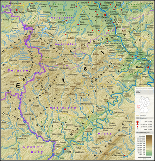
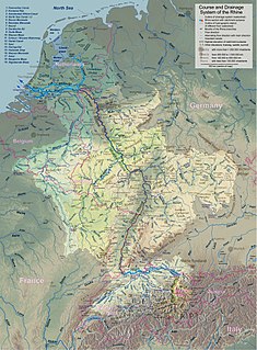
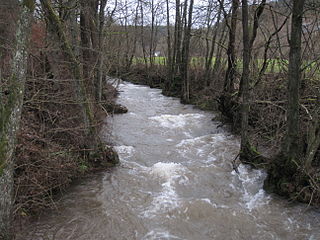
The Swist is a stream, 43.6 kilometres (27.1 mi) long, in the German Rhineland. It rises on the northern edge of the Eifel at 330 metres above sea level and empties rom the right and southeast into the Rhine tributary, the Erft, between Weilerswist and Bliesheim. Occasionally the Swist is also called the Swistbach, and locals often just call it der Bach.

The Ahr Hills are a range of low mountains and hills up to 623.8 m above sea level (NHN) and 25 kilometres (16 mi) long in the Eifel region of Germany, which lie roughly southwest of Bonn on the border between the German states of North Rhine-Westphalia and Rhineland-Palatinate.

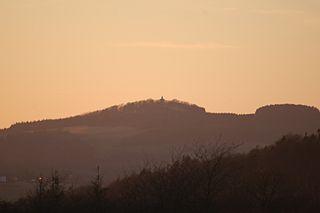
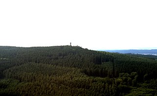
The Aremberg is, at 623 m above sea level (NN), the highest mountain in the Ahr Hills or Ahr Eifel (Ahreifel). It lies in the district of Ahrweiler, Rhineland-Palatinate (Germany).

The Ahr Valley Railway, Remagen–Ahrbrück, is currently a 29 km-long, partly single-track and non-electrified branch line, which runs through the Ahr valley from Remagen via Ahrweiler and Dernau to Ahrbrück in the German state of Rhineland-Palatinate. It is served by Regionalbahn services on line RB 30.
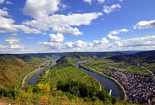
The Moselle Hills form a ridge, up to 434.1 m above sea level (NHN), on the left bank of the River Moselle between Reil and Schweich in the Rhineland-Palatinate counties of Bernkastel-Wittlich and Trier-Saarburg. There are vineyards on the southern slopes of the wooded hills. They lie on the southern edge of the Eifel region.

The Ahr valley is named after the Ahr, a left tributary of the Rhine in Germany. It begins at the Ahr spring (Ahrquelle) in Blankenheim in the county of Euskirchen and runs generally eastwards. At its southernmost point it enters the county of Ahrweiler, and hence the state of Rhineland-Palatinate. Running through the collective municipality of Adenau the valley bends northeast at its confluence with the Adenauer Bach and reaches the collective municipality of Altenahr, from where it resumes its characteristic west to east course, albeit interrupted by meanders. Here begins the section that is known as the Ahr valley (Ahrtal) in a touristic sense. Here it is characterized by vineyards on the south-facing slopes and a picturesque rocky landscape, carved out by the river creating a 300 metre deep gorge in the Ahr Hills. In the next stage the Ahr reaches the area of the county town of Bad Neuenahr-Ahrweiler, before finally discharging into the Rhine south of Remagen in the borough of Sinzig.
The Michelsberg, at 586.1 m above sea level (NHN), is the highest point in the borough of Bad Münstereifel in the county of Euskirchen in the German state of North Rhine-Westphalia. The hill, which rises near the village of Mahlberg belongs to that part of the Eifel mountains known as the Ahr Hills (Ahreifel), and is the second highest point in the range.
The Moselle Eifel forms the southeastern strip of the East Eifel to the left of the Moselle from the city of Trier downstream as far as Moselkern; in the southeast it does not reach as far as the Moselle Valley. It lies exclusively within the German state of Rhineland-Palatinate and is a truncated highland, roughly half of which is forested.

The Heidenköpfe (plural) are a group of three summits near Dahlem in Germany that are about 595 m above sea level (NHN). They lie within the mountain region of North Eifel in the counties of Euskirchen and Vulkaneifel in the states of North Rhine-Westphalia (NW) and Rhineland-Palatinate (RP).

The Hochstein is a volcanic cone, 563 m above sea level (NHN), in the Eifel near Obermendig in the German state of Rhineland-Palatinate and county ofMayen-Koblenz.
The Toter Mann near Friedewald in the Hessian county of Hersfeld-Rotenburg is, at 480.3 m above sea level (NHN), the highest natural hill in the Seulingswald range. This small upland is the southernmost spur of the Fulda-Werra Uplands.
Münstereifel Forest is densely wooded region in the northern part of the Eifel mountains in North Rhine-Westphalia, Germany. In the south it borders on the state of Rhineland-Palatinate. It has an area of 237 km² and lies at a height of between 200 and 500 m above sea level (NHN).

The Rockeskyller Kopf near Rockeskyll in the county of Vulkaneifel in the German state of Rhineland-Palatinate is a hill, 554.6 m above sea level (NHN), in the Eifel mountains. It is an extinct volcano complex from the Quaternary period, around 360,000 years old and is designated as a natural monument (ND-7233-420).

The Häuschen is a hill, 506.5 m above sea level (NHN), in the Eifel mountains. It rises near Ahrweiler in the county of Ahrweiler in the German state of Rhineland-Palatinate.
The Sonnenberg, near Heimbach in the county of Düren in the state of North Rhine-Westphalia, is a hill, 393.3 m above sea level (NHN), in the Rur Eifel, a northern part of the Eifel mountains in Germany.
The Platißbach is a roughly seven-kilometre-long (4.3 mi), southern and orographically right-hand tributary of the River Olef in the municipality of Hellenthal in Germany.
The Köppel, at 540.2 m above sea level (NHN), is the second highest point in the Montabaur Heights, an elongated hill ridge in the Lower Westerwald in Germany. It is second only to the nearby Alarmstange and lies on the boundary between Montabaur and Dernbach in the county of Westerwaldkreis in the state of Rhineland-Palatinate. At the summit is the Köppel viewing tower.
The Ettringer Bellerberg, also called the Ettringer Bellberg, is a hill, 427.5 m above sea level (NHN), forming the western flank of the Bellerberg Volcano, a volcano system that was active about 200,000 years ago.