
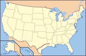
Presidio County is a county located in the U.S. state of Texas. As of the 2020 census, its population was 6,131. Its county seat is Marfa. The county was created in 1850 and later organized in 1875. Presidio County is in the Trans-Pecos region of West Texas and is named for the border settlement of Presidio del Norte. It is on the Rio Grande, which forms the Mexican border.

San Angelo is a city in and the county seat of Tom Green County, Texas, United States. Its location is in the Concho Valley, a region of West Texas between the Permian Basin to the northwest, Chihuahuan Desert to the southwest, Osage Plains to the northeast, and Central Texas to the southeast. According to the 2020 United States Census, San Angelo had a total population of 99,893. It is the principal city and center of the San Angelo metropolitan area, which had a population of 121,516.

The Chisholm Trail was a trail used in the post-Civil War era to drive cattle overland from ranches in Texas to Kansas railheads. The trail was established by Black Beaver, a Lenape guide and rancher, and his friend Jesse Chisholm, a Cherokee merchant. They collected and drove numerous cattle along the trail to Kansas, where they could be shipped east to achieve higher prices. The southern terminus was Red River Station, a trading post near the Red River along the northern border of Texas. The northern terminus was a trading post near Kansas City, Kansas. Chisholm owned both of these posts. In the years of the cattle drives, cowboys drove large herds from ranches across Texas to the Red River Station and then north to Kansas City.

Los Adaes was the capital of Tejas (Texas) on the northeastern frontier of New Spain from 1721 to 1773. It included a Franciscan mission, San Miguel de Cuellar de los Adaes, and a presidio, Nuestra Señora del Pilar de Los Adaes. The name Adaes derives from the indigenous Adai people, members of the Caddoan confederacy of Indians who were the people the missionaries aimed to convert to Christianity. The presidio and mission were established to counter French influence in Louisiana territory and defend New Spain from possible invasion or encroachment by the French. In 1763 Louisiana came under the control of Spain and the Los Adaes outpost was no longer necessary for defense. In 1773 the Spanish closed the mission and presidio and forced the population to move to San Antonio.

State Highway 17 runs from Marfa to Pecos in west Texas. The road is maintained by the Texas Department of Transportation (TxDOT).

The Texas Historical Commission is an agency dedicated to historic preservation within the U.S. state of Texas. It administers the National Register of Historic Places for sites in Texas.
The Texas Brazos Trail is a non-profit organization which promotes heritage tourism, economic development, and historic preservation. It is one of ten regions which make up the Texas Heritage Trails Program of the Texas Historical Commission.

The Camino Real de Tierra Adentro, also known as the Silver Route, was a Spanish 2,560-kilometre-long (1,590 mi) road between Mexico City and San Juan Pueblo, New Mexico, that was used from 1598 to 1882. It was the northernmost of the four major "royal roads" that linked Mexico City to its major tributaries during and after the Spanish colonial era.

The geography of Texas is diverse and large. Occupying about 7% of the total water and land area of the U.S., it is the second largest state after Alaska, and is the southernmost part of the Great Plains, which end in the south against the folded Sierra Madre Oriental of Mexico. Texas is in the South Central United States of America, and is considered to form part of the U.S. South and also part of the U.S. Southwest.
The Forts of Texas include a number of historical and operational military installations. For over 200 years, various groups fought over access to or control over the region that is now Texas. Possession of the region was claimed and disputed by the European powers of Spain and France, and the continental countries of Mexico, the United States, the Republic of Texas, and the Confederate States of America. Ownership of specific lands was claimed and disputed by different ethnic groups, including numerous Native American tribes, Mexican residents, Anglo- and African-American settlers, and European immigrants. Access to and control of resources were claimed and disputed by various economic groups, including indigenous hunter/gatherers, farmers, herders, ranchers, colonists, settlers, buffalo hunters, traders, bandits, smugglers, pirates, and revolutionaries. Over the centuries, claims and disputes were enforced by Native American warriors, Spanish conquistadors, French cavaliers, Texas Rangers, local militias, and uniformed regular army regiments of Spain, Mexico, Texas, the United States, and the Confederacy.

The Fort McKavett State Historic Site is a former United States Army installation located in Menard County, Texas. The fort was first established in 1852 as part of a line of forts in Texas intended to protect migrants traveling to California. The fort was deemed unnecessary and abandoned in 1859 and was occupied by settlers. From 1861 to 1863, during the American Civil War, the fort became an outpost of Confederate forces on the Texas frontier until they left for other theaters of the war. When the US Army returned to Texas in the later 1860s, the fort was reoccupied and rebuilt, and became a base for the "Buffalo Soldier", or all-African American, 24th Infantry and 9th Cavalry Regiments.
The El Camino Real de los Tejas National Historic Trail is a national historic trail covering the U.S. section of El Camino Real de Los Tejas, a thoroughfare from the 18th-century Spanish colonial era in Spanish Texas, instrumental in the settlement, development, and history of Texas. The National Park Service designated El Camino Real de los Tejas National Historic Trail as a unit in the National Trails System in 2004.

Fort Phantom Hill, also called the Camp on the Clear Fork, is a former United States Army installation located in Jones County, Texas. The fort was established in 1851 as part of a line of forts in Texas to protect migrants passing through the state on their way to California. The US Army abandoned the fort in 1854 and it was shortly thereafter mostly destroyed by fire. In 1858, it became a station of the Butterfield-Overland Mail route until it moved out of Texas with the beginning of the American Civil War in 1861. During the war, the fort was occupied by Confederate frontier troops until the Confederacy's defeat and surrender. Following the US Army's return to Texas after the Civil War, Fort Phantom Hill was used as a subpost of the larger, newer Fort Griffin until 1875.
Presidio Park is a city historic park in San Diego, California. It is the site where the San Diego Presidio and the San Diego Mission, the first European settlements in what is now the Western United States, were founded in 1769.
The Texas Forest Trail is a non-profit organization which promotes heritage tourism, economic development, and historic preservation. The organization is one of ten driving trail regions which make up the award-winning Heritage Trails Program of the Texas Historical Commission.
The Texas Hill Country Trail is a non-profit organization which promotes heritage tourism, economic development, and historic preservation. It is one of ten regions which make up the Texas Heritage Trails Program of the Texas Historical Commission.
The Texas Independence Trail is a non-profit organization which promotes heritage tourism, economic development, and historic preservation. It is one of ten regions which make up the Texas Heritage Trails Program of the Texas Historical Commission.
The Texas Lakes Trail is a non-profit organization which promotes heritage tourism, economic development, and historic preservation. It is one of ten regions which make up the Texas Heritage Trails Program of the Texas Historical Commission.

The Texas Plains Trail is a nonprofit organization which promotes heritage tourism, economic development, and historic preservation in a 52 county region in the Texas Panhandle and Texas South Plains. The headquarters of the organization is in Lubbock, Texas. Founded as part of John Connally's 1968 initiative to boost tourism in the state during HemisFair '68, the Texas Plains Trail is one of 10 travel trails that cover the entire state. Originally designed as a driving tour that encompassed more than 580 miles via designated roads adorned with iconic blue highway signs, the trail was reestablished as a nonprofit organization in 2003 as part of the broader Texas Heritage Trails Program and their efforts to stimulate economic growth by boosting tourism and historic preservation throughout Texas.
