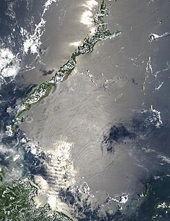
Myanmar is the northwestern-most country of mainland Southeast Asia. It lies along the Indian and Eurasian Plates, to the southeast of the Himalayas. To its west is the Bay of Bengal and to its south is the Andaman Sea. It is strategically located near major Indian Ocean shipping lanes.The neighboring countries are China, India, Bangladesh, Thailand and Laos.

Yemen is located in Southwest Asia, at the southern tip of the Arabian Peninsula, between Oman and Saudi Arabia. It is situated at the entrance to the Bab-el-Mandeb Strait, which links the Red Sea to the Indian Ocean and is one of the most active and strategic shipping lanes in the world. Yemen has an area of 527,970 square kilometres (203,850 sq mi), including the islands of Perim at the southern end of the Red Sea and Socotra at the entrance to the Gulf of Aden. Yemen's land boundaries total 1,746 kilometres (1,085 mi). Yemen borders Saudi Arabia to the north and Oman to the northeast.

The Sulu Sea is a body of water in the southwestern area of the Philippines, separated from the South China Sea in the northwest by Palawan and from the Celebes Sea in the southeast by the Sulu Archipelago. Borneo is found to the southwest and Visayas to the northeast.
This is a list of extreme points of Earth, the geographical locations that are farther north or south than, higher or lower in elevation than, or farthest inland or out to sea from, any other locations on the landmasses, continents or countries.

The Cayos Arcas is a chain of three tiny sand cays and an accompanying reef system in the Gulf of Mexico, 128 kilometres from the mainland. It is located approximately 130 kilometres from the mainland, west of Campeche. Their aggregate land area is 22.8 hectares. They belong to the municipality of Champotón in the state of Campeche.

Cheduba Island is an island in the Bay of Bengal close to Ramree Island and belongs to Myanmar, formerly Burma. It has a maximum length of 33 km (21 mi), with an area of approximately 523 km2 (202 sq mi)

Pulau Ketam is an island located off the coast of Port Klang, Selangor, Malaysia. The island is in the intertidal zone and the chief vegetation is mangrove.

Ramree Island is an island off the coast of Rakhine State, Burma. The area of the island is about 1,350 square kilometres (520 sq mi) and the main populated center is Ramree.

Bentinck Kyun is an island in the Mergui Archipelago, Burma (Myanmar). It lies 14 km west of Letsok-aw Kyun in the Andaman Sea. Bentinck has a very irregular indented shape. The island is thickly wooded and its area is 78 km².

Namonuito Atoll, also called Namonweito, Weito, or Magur Islands, is the largest atoll of the Federated States of Micronesia and of the Caroline Islands with a total area of 2,267 square kilometres, unless one considers the still larger Chuuk (Truk) Lagoon as a type of atoll in an early stage of development. In Micronesia, only Kwajalein Atoll of the Marshall Islands is still larger.

Manaung is a township of Kyaukpyu District in the Rakhine State of Western Myanmar. The principal town is Manaung. Manaung Township, situated on Manaung Island consists of three islands: Manaung Island, Ye Kyun Island and Taik Kyun Island. Manaung is not only a township of Kyaukpyu District but also the second biggest island of Rakhine State in Myanmar.

Ussuri Bay is a major bay within Peter the Great Gulf of the Sea of Japan.

Venø is a small Danish island located in Limfjorden in the north of Jutland, 3 kilometres north of Struer. It is 7.5 kilometres long and has a maximum width of 1.5 kilometres. With an area of 6.5 square kilometres, it has a population of 204 as of 1 January 2015. Since 1958, there has been a ferry service from Venø Odde, the island's most southerly point, over the narrow sound to Kleppen. Venø's highest point, Forstov Bakke, is 27 metres above sea level and has cliffs to the west. The island is a popular holiday destination with good beaches and camping facilities. The only village is Venø By in the centre of the island and has Denmark's smallest church as well as a small fishing harbour which is suitable for pleasure boats.

Zadetkyi Island or Zadetkyi Kyun, also known as Saint Matthew's Island, is an island at the southern end of the Mergui Archipelago, Burma. Its northern side forms the southern shore of Hastings Harbor, where there is a base of the Myanmar Navy.

Wa Kyun is an island in the Andaman Sea, right off the coast of Mon State, in the southern area of Burma. This 2 kilometres (1.2 mi) long island is located in the midst of a shoal or shallow area. It is covered with dense forest and rises to a height of 135 metres (443 ft).

Kyungyi Island is an island in the Andaman Sea, right off the coast of Mon State, in the southern area of Burma.

Kokunye Kyun is an island in the Andaman Sea, right off the coast of Mon State, in the southern area of Burma. It is located in an area of shoals. This island is 1.4 kilometres (0.87 mi) long and its maximum width is 0.4 kilometres (0.25 mi). It is covered with dense forest and rises to a height of 140 metres (460 ft).

Unguan is a small island off the coast of Rakhine State, Myanmar.

Myingyi Kyun, also known as High Island, is a small island off the coast of Ayeyarwady Region, Burma.


