
Cirencester is a market town and civil parish in the Cotswold District of Gloucestershire, England. Cirencester lies on the River Churn, a tributary of the River Thames. It is the eighth largest settlement in Gloucestershire and the largest town within the Cotswolds. It is the home of the Royal Agricultural University, the oldest agricultural college in the English-speaking world, founded in 1840. The town had a population of 20,229 in 2021. The town is 18 miles (29 km) northwest of Swindon, 18 miles (29 km) southeast of Gloucester, 37 miles (60 km) west of Oxford and 39 miles (63 km) northeast of Bristol.

The M4, originally the London-South Wales Motorway, is a motorway in the United Kingdom running from west London to southwest Wales. The English section to the Severn Bridge was constructed between 1961 and 1971; the Welsh element was largely complete by 1980, though a non-motorway section around Briton Ferry bridge remained until 1993. On the opening of the Second Severn Crossing in 1996, the M4 was rerouted over it.

Elephant and Castle is an area of South London, England, in the London Borough of Southwark. The name also informally refers to much of Walworth and Newington, due to the proximity of the London Underground station of the same name. The name is derived from a local coaching inn.
Tinsley Viaduct is a two-tier road bridge in Sheffield, England; it was the first of its kind in the United Kingdom. It carries the M1 and the A631 for a distance of 3,389 feet (1,033 m) over the Don Valley, from Tinsley to Wincobank, also crossing the Sheffield Canal, the Midland Main Line and the former South Yorkshire Railway line from Tinsley Junction to Rotherham Central. The Supertram route to Meadowhall runs below part of the viaduct on the trackbed of the South Yorkshire Railway line to Barnsley.

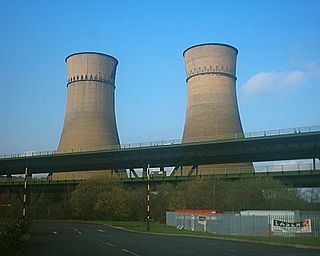
The M5 is a motorway in England linking the Midlands with the South West. It runs from junction 8 of the M6 at West Bromwich near Birmingham to Exeter in Devon. Heading south-west, the M5 runs east of West Bromwich and west of Birmingham through Sandwell Valley. It continues past Bromsgrove, Droitwich Spa, Worcester, Tewkesbury, Cheltenham, Gloucester, Bristol, Portishead, Clevedon, Weston-super-Mare, Bridgwater, Taunton, Tiverton, Cullompton terminating at junction 31 for Exeter.

The M20 is a motorway in Kent, England. It follows on from the A20 at Swanley, meeting the M25, and continuing on to Folkestone, providing a link to the Channel Tunnel and the ports at Dover. It is 50.6 miles (81.4 km) long. Although not signposted in England, this road is part of the European route E15. It is also used as a holding area for goods traffic when traffic across the English Channel is disrupted, such as Operation Stack and Operation Brock.

The A48 is a trunk road in Great Britain running from the A40 at Highnam, 3 miles (4.8 km) west of Gloucester, England, to the A40 at Carmarthen, Wales. Before the Severn Bridge opened on 8 September 1966, it was a major route between England and South Wales. For most of its route, it runs almost parallel to the M4 motorway. During times of high winds at the Severn Bridge, the A48 is used as part of the diversion route and is still marked as a Holiday Route.

The M32 is a 4.4-mile-long (7.1 km) motorway in South Gloucestershire and Bristol, England. It provides a link from the M4, a major motorway linking London and South Wales, to Bristol city centre and is maintained by National Highways, the national roads body.

The M49 is a motorway in England that links the M4 (J22) with the M5 (J18A). The southern end is on the outskirts of Avonmouth and the northern end is immediately to the east of the Prince of Wales Bridge which was constructed at the same time 1996. It is 5 miles (8 km) long and unique in that it is only accessible from other motorways.

Shirley is an area of south London, England, within the London Borough of Croydon. It lies north of Spring Park and Addington, east of Addiscombe, south of Monks Orchard and west of West Wickham, and 10 miles south-southeast of Charing Cross. Prior to the creation of Greater London in 1965, Shirley was in the administrative county of Surrey.

The A419 road is a primary route between Chiseldon near Swindon at junction 15 of the M4 with the A346 road, and Whitminster in Gloucestershire, England near the M5 motorway. The A419 is managed and maintained by a private company, Road Management Group, on behalf of the UK Department for Transport.

The A417 is a main road in England, running from Streatley, Berkshire to Hope under Dinmore, Herefordshire. It is best known for its section between Cirencester and Gloucester where it has primary status and forms part of the link between the major settlements of Swindon and Gloucester.

Grove Hill is an area of the Middlesbrough's Longlands and Beechwood ward in the Borough of Middlesbrough, North Yorkshire, England. It is a historic part of the North Riding of Yorkshire. The area's main shopping area is off Marton Road at the junction with Marton Burn Road and Belle Vue.

Longport is an area of Stoke-on-Trent, England. It is the location for Longbridge Hayes industrial estate.

Kingscote is a village and civil parish in the Cotswold district of Gloucestershire, England, set on the uplands near the south western edge of the Cotswold hills. It is situated about two miles (3 km) east of Uley, five miles (8 km) east of Dursley and four miles (6 km) west of Tetbury. The landscape is designated an Area of Outstanding Natural Beauty. The hamlet of Newington Bagpath lies to the west of the village; the parish lands extend near to the small village of Owlpen.

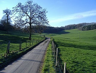
Cowley is a village and civil parish in the Cotswold District of Gloucestershire, England. It lies between the A417 and A435 roads between Cheltenham and Cirencester in the Churn Valley, and has a population of 333. The name originates from 'cow' and 'leigh', literally meaning cow pasture.

Birdlip is a village and civil parish, in the Cotswold district, in the county of Gloucestershire, England. It is in the Cotswolds Area of Outstanding Natural Beauty 6 miles (9.7 km) south of Cheltenham and 8 miles (13 km) south east of Gloucester.
Kingscote Park is a Grade II listed house and country estate in Kingscote, near Tetbury, Gloucestershire, England. The original Kingscote Park was demolished in 1951. Both houses formed part of the manor of Kingscote which was held by the Kingscote family from the 12th century and is mentioned in the Domesday Book as 'Chingescote'.
An air balloon usually refers to a hot air balloon.

A650 road is a main route through the West Yorkshire conurbation in England. The road goes from Keighley to Wakefield on a rough north west/south east axis for 25 miles (40 km). The route is mostly single carriageway with some dualled sections in the Aire Valley, Bradford and the approach to Wakefield from the M1.

