Related Research Articles

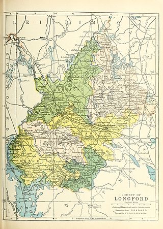
County Longford is a county in Ireland. It is in the province of Leinster. It is named after the town of Longford. Longford County Council is the local authority for the county. The population of the county was 46,634 at the 2022 census. The county is based on the historic Gaelic territory of Annaly (Anghaile), formerly known as Teffia (Teathbha).
County Westmeath is a county in Ireland. It is in the province of Leinster and is part of the Eastern and Midland Region. It formed part of the historic Kingdom of Meath, which was named Mide because the kingdom was located in the geographical centre of Ireland. Westmeath County Council is the administrative body for the county, and the county town is Mullingar. At the 2022 census, the population of the county was 95,840.

Turlough Hill, also known as Tomaneena, is a 681-metre-high (2,234 ft) mountain in County Wicklow in Ireland and site of Ireland's only pumped-storage hydroelectricity plant. The power station is owned and operated by the ESB and can generate up to 292 megawatts (392,000 hp) of electricity at times of peak demand.
Abbeylara is a village in the easternmost portion of County Longford, Ireland, located about three kilometers east of Granard on the R396 regional road. Its name is derived from a monastery, the great Abbey of Lerha, founded in 1205 by Hiberno-Norman magnate, Risteárd de Tiúit, for Cistercian monks. The monastery was dissolved in 1539, although its ruins are still apparent on approach to the village. An ancient earthwork, the Duncla or Black Pig's Dyke, which runs south-eastwards from Lough Gowna to Lough Kinale, goes through the larger parish of Abbeylara, and passes about one kilometre north of the village.
The River Erne in the northwest of the island of Ireland, is the second-longest river in Ulster, flowing through Northern Ireland and the Republic of Ireland, and forming part of their border.
Mullinalaghta, also officially referred to as Mullanalaghta, is a half-parish in the north-eastern part of County Longford, Ireland, located about eight kilometres north of Granard.

Lough Gowna is a fresh water lake which is the uppermost lake on the River Erne. It is located on the border between County Longford and County Cavan, with the largest part of the lake being in County Longford.

Rathmullan is a seaside village and townland on the Fanad Peninsula in County Donegal, Ireland. It is situated on the western shore of Lough Swilly, 11 kilometres (7 mi) north-east of Ramelton and 12 km (7 mi) east of Milford. Rathmullan was the point of departure during the Flight of the Earls in 1607, a major turning point in Irish history.
Events from the year 1540 in Ireland.

Lough Beg is a small freshwater lake north of Lough Neagh in Northern Ireland. The lake is located on the border between County Londonderry and County Antrim. The Lower Bann flows into it from Lough Neagh at the southern end and continues on its route to the sea from the northern end. Church Island which is on the lake was the site of a pre-Viking monastery and during the summer it is normally reachable by foot. Due to the area's many rare plants and it being a stopping point for migrating birds the area was protected as the Lough Beg National Nature Reserve. It is one of the main Irish breeding areas for the scarce Garganey.

Cavan Gaels is a Gaelic Athletic Association club from Cavan Town, County Cavan in Ireland. They are affiliated to Cavan GAA. The club was founded in 1957 following the merging of two clubs in Cavan Town, Cavan Harps and Cavan Slashers. They are the second most successful team in Cavan GAA history, with 14 Senior Championship titles, the most recent being in 2017. Cavan Gaels appeared in 16 of the 20 Cavan Senior Football Championship finals between 1998 and 2017 - winning 10.

Gowna are a Gaelic football club based in the village of Loch Gowna, County Cavan, Ireland.

Glencar Lough, locally known as Glencar Lake, is a freshwater lake in the northwest of Ireland. It covers an area of 1.15 square kilometres and lies mostly in County Leitrim with a smaller part in County Sligo. Glencar Waterfall is located near the lake's north shore on the Leitrim side.
Granard is a barony in County Longford, Ireland.

Lough Beagh, also known as Lough Veagh, is a freshwater lake in the northwest of Ireland. It is located in north County Donegal and is part of Glenveagh National Park.
The Tyrone Group is a lithostratigraphical term coined to refer to a particular succession of rock strata which occur in Northern Ireland within the Visean Stage of the Carboniferous Period. It comprises a series of limestones, shales and sandstones which accumulated to a thickness of 2400m in the northwest Carboniferous basin of Ireland. The type areas for the group are the Clogher Valley of County Tyrone and the Fermanagh Highlands of nearby County Fermanagh. The rocks of the group sit unconformably on older rocks of the Shanmullagh Formation of the Fintona Group which are the local representatives of the Lower Old Red Sandstone. The top of the Dartry Limestone, the uppermost part of the group, is a disconformity, above which are the layered sandstones and shales of the Meenymore Formation of the Leitrim Group. The succession continues south and west across the border into the Republic of Ireland, though different names are typically applied.

Ben Lugmore at 803 metres (2,635 ft) is the 29th-highest peak in Ireland on the Arderin scale, and the 37th-highest peak on the Vandeleur-Lynam scale. It is in a horseshoe-shaped massif that includes the slightly higher peak of Mweelrea at 814 metres (2,671 ft), the highest mountain in the Irish province of Connacht. The massif is between Killary Harbour and Doo Lough, in County Mayo.
Aughnacliffe, officially Aghnacliff , is a village in County Longford, Ireland. It is located close to Lough Gowna and the border with County Cavan.
Conor Brady in an Irish Gaelic footballer who plays for the Gowna club and the Cavan county team.
References
- ↑ Columb, F. (2002). The Lough Gowna Valley. Gasan Academic Publishing Company. ISBN 978-0-9543707-0-1.
| | This article about a non-fiction book on Irish history is a stub. You can help Wikipedia by expanding it. |