Acton is a town and area in west London, England, within the London Borough of Ealing. It is 6.1 miles (10 km) west of Charing Cross.

Willenhall is a historic market town and civil parish in the Metropolitan Borough of Walsall, and partly in Wolverhampton, in the West Midlands, England, with a population taken at the 2011 census of 28,480. It is situated between Wolverhampton and Walsall, historically in the county of Staffordshire. It lies upon the River Tame, and is part of the Black Country.

The White Hart was the personal badge of Richard II, who probably derived it from the arms of his mother, Joan "The Fair Maid of Kent", heiress of Edmund of Woodstock. It may also have been a pun on his name, as in "Rich-hart". In the Wilton Diptych, which is the earliest authentic contemporary portrait of an English king, Richard II wears a gold and enamelled white hart jewel, and even the angels surrounding the Virgin Mary all wear white hart badges. In English Folklore, the white hart is associated with Herne the Hunter.

Minchinhampton is a Cotswolds market town and a civil parish in the Stroud District of Gloucestershire, South West England. The town is located on a hilltop, 4 miles (6.4 km) south-east of Stroud. The common offers wide views over the Severn Estuary into Wales and further into the Cotswolds. It is an ancient town which was recorded in the Domesday Book.

Chedington is a small village and civil parish in west Dorset, England, situated near the A356 road 4 miles (6.4 km) southeast of Crewkerne in Somerset. Dorset County Council estimate that in 2013 the population of the civil parish was 130. It is administered as part of Parrett and Axe Parish Council.

Coombe is a historic neighbourhood in the Royal Borough of Kingston upon Thames in south west London, England. It sits on high ground, east of Norbiton. Most of the area was part of the former Municipal Borough of Malden and Coombe before local government re-organisation in 1965. It now shares borders with the boroughs of Merton and Sutton with, to the north, the small, inter-related neighbourhoods of Kingston Hill and Kingston Vale, beyond which is Richmond Park in Richmond; and Roehampton/Putney Vale in Wandsworth. To the east are public playing fields and Wimbledon Common.
Sinah is the area at the southwestern end of Hayling Island. It incorporates the Ferrypoint, Sinah Beach, The Kench, Sinah Warren, and Sinah Common. It is bounded to the east by West Town. Langstone Harbour and its entrance form the north and west borders, and to the south is Hayling Bay.
Old Windsor is a village and civil parish, in the Royal Borough of Windsor and Maidenhead, in Berkshire, England. It is bounded by the River Thames to the east and the Windsor Great Park to the west.

Nettlebed is a village and civil parish in Oxfordshire in the Chiltern Hills about 4+1⁄2 miles (7 km) northwest of Henley-on-Thames and 6 miles (10 km) southeast of Wallingford. The parish includes the hamlet of Crocker End, about 1⁄2 mile (800 m) east of the village. The 2011 Census recorded a parish population of 727.

Walton-on-the-Hill is a village in the Reigate and Banstead district, in the county of Surrey, England. It is midway between the market towns of Reigate and Epsom. The village is a dispersed cluster on the North Downs centred less than one mile inside of the M25 motorway. The village hosts the Walton Heath Golf Club, whose former members include King Edward VIII, Winston Churchill and David Lloyd George.

Heaton Park is a public park in Manchester, England, covering an area of over 600 acres (242.8 ha). The park includes the grounds of a Grade I listed, neoclassical 18th century country house, Heaton Hall. The hall, remodelled by James Wyatt in 1772, is now only open to the public on an occasional basis as a museum and events venue. It is the biggest park in Greater Manchester, and also the largest municipal park in Europe.

Aylburton is a village and civil parish in the Forest of Dean district of Gloucestershire, England, on the A48 road about two miles south-west of Lydney. According to the 2001 census it had a population of 689, increasing to 711 at the 2011 census.
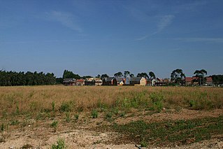
Red Lodge is a village and civil parish situated in rural Suffolk, England, between Mildenhall and Newmarket, and very close to the A11 and A14 roads.

Seale is a village in Surrey, England. Seale covers most of the civil parish of Seale and Sands and the steep slope and foot of the south side of the Hog's Back as well as a large hill which exceeds it – as such is part of the Surrey Hills Area of Outstanding Natural Beauty.

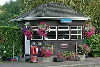
Box is a small village in Gloucestershire, England. It is in the civil parish of Minchinhampton, and is located 3 miles (4.8 km) south of Stroud and 10 miles (16 km) west of Cirencester. Minchinhampton is about 1 mile (1.6 km) away and Nailsworth is about 1.5 miles (2.4 km) away. Box has a population of about 400. Box lies at the edge of Minchinhampton Common, designated as a SSSI. The common is used for the grazing of cattle, and the absence of a cattle grid at the entrance to the village means cows are able to wander through its streets. The village holds annual produce show, pantomime and open garden events.

East Worldham is a village and former civil parish, now in the parish of Worldham, in the East Hampshire district of Hampshire, England. It is 1.9 miles (3.1 km) east of Alton; and 1.9 miles (3.1 km) south-west of Wyck. Hartley Mauditt and West Worldham are nearby, which, along with East Worldham, form the parish of Worldham. The village is just east of the A31 road and contains St Mary's Church and the Three Horse Shoes pub, amongst other buildings. Worldham Golf Course located just to west and Dean Farm Golf Course just to the east. For centuries the village and surrounding parish were owned by Winchester College. In 1931 the parish had a population of 208.

Hamptworth is a hamlet in Wiltshire, England, in the extreme southeast of the county. It is in the civil parish of Landford, and lies within the boundaries of the New Forest National Park.

Minchinhampton Common is a 182.7-hectare (451-acre) biological and geological Site of Special Scientific Interest in Minchinhampton, Gloucestershire, England, notified in 1972.

Sudbrook Park in Petersham was developed by John Campbell, 2nd Duke of Argyll in the early 18th century. Sudbrook House, designed for Argyll by James Gibbs and now Grade I listed by Historic England, is considered a fine example of Palladian architecture. The house and its surrounding park have been the home of the Richmond Golf Club since 1891.
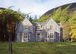
In Great Britain and Ireland a sporting lodge – also known as a hunting lodge, hunting box, fishing hut, shooting box, or shooting lodge – is a building designed to provide lodging for those practising the sports of hunting, shooting, fishing, stalking, falconry, coursing and other similar rural sporting pursuits.