Minchinhampton Common

Last updated

Minchinhampton Common
Site of Special Scientific Interest
Minchinhampton Common in blossom - geograph.org.uk - 1631550.jpg
Minchinhampton Common flowering
Gloucestershire UK location map.svg
Red pog.svg
Location within Gloucestershire
Location Gloucestershire
Grid reference SO855010
Coordinates 51°42′29″N2°12′38″W / 51.707997°N 2.210522°W / 51.707997; -2.210522
InterestBiological/Geological
Area182.7 hectare
Notification 1972
Natural England website

Minchinhampton Common (grid reference SO855010 ) is a 182.7-hectare (451-acre) biological and geological Site of Special Scientific Interest in Gloucestershire, notified in 1972. [1] [2]

Contents

The site is owned and managed by the National Trust. The common is one of the largest grassland commons in the Cotswold area. It is south of Rodborough Common SSSI. Both commons are on Jurassic limestone and are a central plateau with steep sides. They drop down to the Nailsworth Valley on the west side and the Frome Valley on the north side. The site designation includes the outlying areas of Iron Mills and Littleworth Commons. [1] Neu-Lindsey Nature Reserve adjoins the western edge of Minchinhampton Common. [3]

Minchinhampton Common is of both geological and biological importance. There are disused quarries near the centre which provide fossil evidence for research purposes. It is unimproved, herb-rich grassland. [1] There are five units of assessment [4]

The limestone Longstone of Minchinhampton is supposedly the burial site of a Danish leader, [5] [6] and the area on the east side of the common known as Woefuldane Bottom has been suggested as a possible site of the Battle of Edington. [7]

Geology

The quarries are one of the most important Bathonian (Middle Jurassic) research sites in the United Kingdom. The fossil Limestones provide examples of various marine species including bivalve and gastropod fauna including limpets and thick-shelled sea snails, coral, crustaceans, and reptiles. The site provides opportunities for significant further research on the local rock strata of the Minchinhampton and Burleigh limestones, and the relationship to the Bathonian successions to the east and south. [1]

Biology

Flora

The central plateau supports a short grassland sward (due to stock grazing) with longer vegetation on the steeper slopes. The grassland includes upright brome, tor-grass, sheep's fescue, quaking grass, and crested dog's-tail. Flowering herbs include common rock-rose, harebell, chalk milkwort, and field scabious. The area has a significant population of orchids, including the bee orchid, fragrant orchid, and frog orchid. [1]

There are more neutral grasslands and herb species in areas of landslip on the margins of the site. There are wet areas which support marshy vegetation. There are also areas of scrub which is dominated by hawthorn, bramble, and dog rose. There is juniper on the site and a limited amount of broad-leaved woodland on the margins. [1]

Fauna

The site is known for its variety of invertebrates and butterflies recorded are chalkhill blue, small blue, marsh fritillary and Duke of Burgundy fritillary. Moth records include cistus forester and juniper carpet. [1]

The rare greater horseshoe bat is recorded as hibernating in the disused stone mines on the Nailsworth side. [1]

Usage

There is a golf club and course. [8] The grass is used to graze cattle in the warmer months, this is administered by the "hayward". [9] Because of the cattle roaming free, there is a speed limit of 40 mph in the area. Part of the common was used to house a US military field hospital [10] during WW2.

Related Research Articles

<span class="mw-page-title-main">Lower Woods</span>

Lower Woods is a 280.1-hectare (692-acre) biological and geological Site of Special Scientific Interest near the village of Wickwar, South Gloucestershire, notified in 1966 and renotified in 1985. The site area has increased at last revision in 1974 to a 284.1-hectare (702-acre) site. The site is a nature reserve managed by the Gloucestershire Wildlife Trust.

<span class="mw-page-title-main">Midger</span>

Midger is a 65.7-hectare (162-acre) biological Site of Special Scientific Interest straddling the border of Gloucestershire and South Gloucestershire, notified in 1966 and renotified in 1984. Since the last revision in 1974, the size has been reduced to a 56-hectare (140-acre) site. It lies east of Hillesley, Gloucestershire and north of Hawkesbury Upton, South Gloucestershire. It is at the head of the Kilcott Valley.

<span class="mw-page-title-main">Strawberry Banks</span> Biological Site of Special Scientific Interest in Gloucestershire, England

Strawberry Banks is a 5.06-hectare (12.5-acre) biological Site of Special Scientific Interest in Gloucestershire, notified in 1993.

<span class="mw-page-title-main">Selsley</span> Human settlement in England

Selsley is a village within the civil parish of King's Stanley and district of Stroud, in Gloucestershire, England. It is composed of around 175 houses, scattered around the western and eastern edge of a Cotswold spur, located approximately 2 miles (3.2 km) south of Stroud.

<span class="mw-page-title-main">Barnsley Warren</span> Biological Site of Special Scientific Interest in Gloucestershire, England

Barnsley Warren is a 61.3-hectare (151-acre) biological Site of Special Scientific Interest in Gloucestershire, notified in 1954 and renotified in 1984. The site is also included in A Nature Conservation Review. It lies in a steep-sided dry valley, east of the A429, northeast of Cirencester in the Cotswolds. The site is listed in the 'Cotswold District' Local Plan 2001-2011 as a Key Wildlife Site (KWS).

<span class="mw-page-title-main">Brassey SSSI</span> Biological Site of Special Scientific Interest in Gloucestershire, England

Brassey is a 2.1-hectare (5.2-acre) biological Site of Special Scientific Interest in Gloucestershire, notified in 1954 and renotified in 1983. It is situated on the north side of the Windrush Valley, midway between Naunton and Upper Slaughter. The reserve comprises sloping, unimproved limestone pasture. There is a fast-flowing stream. This site is one of the few freshwater marshes in Gloucestershire. The stream joins the River Windrush.

<span class="mw-page-title-main">Daneway Banks SSSI</span> Biological Site of Special Scientific Interest in Gloucestershire, England

Daneway Banks is a 17-hectare (42-acre) biological Site of Special Scientific Interest in Gloucestershire, notified in 1954 and renotified in 1983. It lies half a mile west of Sapperton and is part of a group of wildlife sites in the Frome Valley that includes Siccaridge Wood and Sapperton Canal reserves. The site is in the Cotswold Area of Outstanding Natural Beauty.

<span class="mw-page-title-main">Box Farm Meadows SSSI</span> Biological Site of Special Scientific Interest in Gloucestershire, England

Box Farm Meadows (Stuart Fawkes reserve) (grid reference ST865997) is a 8.3-hectare (21-acre) biological Site of Special Scientific Interest in Gloucestershire, notified in 1985. This was formerly known as Balls Green Pastures. The reserve is situated at the southern edge of Box village and one mile east of Nailsworth.

<span class="mw-page-title-main">Wotton Hill</span> Hill in Gloucestershire, England

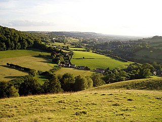
Wotton Hill is a hill on the edge of the Cotswold Hills in Gloucestershire, England, 0.5 miles (0.80 km) north of Wotton-under-Edge. The Cotswold Way passes over the hill.

<span class="mw-page-title-main">Swift's Hill SSSI</span> Geological site in England

Swift's Hill is a 9.15-hectare (22.6-acre) biological and geological Site of Special Scientific Interest in Gloucestershire, notified in 1966 and renotified in 1984.

<span class="mw-page-title-main">Bull Cross, The Frith and Juniper Hill</span> Site of Special Scientific Interest in Gloucestershire, England

Bull Cross, The Frith and Juniper Hill is a 42.33-hectare (104.6-acre) biological and geological Site of Special Scientific Interest in Gloucestershire, notified in 1954. The site is listed in the ‘Stroud District’ Local Plan, adopted November 2005, Appendix 6 as an SSSI and Regionally Important Geological Site (RIGS).

<span class="mw-page-title-main">Cleeve Common</span>

Cleeve Common is a 455-hectare (1,120-acre) biological and geological Site of Special Scientific Interest in Gloucestershire, England, notified in 1974. It is looked after by a small charity called Cleeve Common Trust, formally Cleeve Common Board of Conservators.

<span class="mw-page-title-main">Cotswold Commons and Beechwoods</span> Biological Site of Special Scientific Interest in Gloucestershire, England

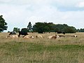
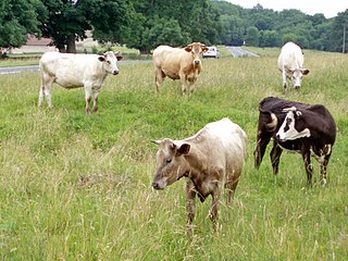
Cotswold Commons and Beechwoods is a 665.5-hectare (1,644-acre) biological Site of Special Scientific Interest in Gloucestershire, notified in 1954.

<span class="mw-page-title-main">Edge Common</span>

Edge Common is a 20.47-hectare (50.6-acre) biological Site of Special Scientific Interest in Gloucestershire, notified in 1974.

<span class="mw-page-title-main">Juniper Hill, Edgeworth</span> Biological Site of Special Scientific Interest in Gloucestershire, England

Juniper Hill, Edgeworth is an 11.25-hectare (27.8-acre) biological Site of Special Scientific Interest in Gloucestershire, notified in 1974. The site is listed in the 'Cotswold District' Local Plan 2001-2011 as a Key Wildlife Site (KWS).

<span class="mw-page-title-main">Leckhampton Hill and Charlton Kings Common</span>

Leckhampton Hill and Charlton Kings Common is a 63.8-hectare (158-acre) biological and geological Site of Special Scientific Interest in Gloucestershire, notified in 1954. There are five units of assessment.

<span class="mw-page-title-main">Range Farm Fields</span> Biological Site of Special Scientific Interest in Gloucestershire, England

Range Farm Fields is a 12.8-hectare (32-acre) biological Site of Special Scientific Interest in Gloucestershire, near to Gloucester City, notified in 1996.

<span class="mw-page-title-main">Rodborough Common, Gloucestershire</span> Biological and geological Site of Special Scientific Interest in Gloucestershire, United Kingdom

Rodborough Common is a 116.0-hectare (287-acre) biological and geological Site of Special Scientific Interest in Gloucestershire, notified in 1954. The site is listed in the ‘Stroud District’ Local Plan, adopted November 2005, Appendix 6 as an SSSI and a Regionally Important Geological Site (RIGS). The Common is also a Special Area of Conservation (SAC) under the EU Habitats Directive

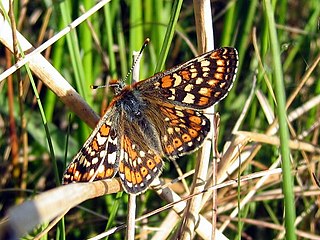
Rough Bank, Miserden is a 9.2-hectare (23-acre) biological Site of Special Scientific Interest in Gloucestershire, notified in 1986. It was purchased by the wildlife charity Butterfly Conservation in 2012.

<span class="mw-page-title-main">Wildmoorway Meadows</span>

Wildmoorway Meadows is a 12.6-hectare (31-acre) biological Site of Special Scientific Interest in Gloucestershire, to the east of Fairford, notified in 1989. The site is listed in the 'Cotswold District' Local Plan 2001-2011 as a Key Wildlife Site (KWS).

References

  1. 1 2 3 4 5 6 7 8 Natural England SSSI information on the citation
  2. Stroud District Local Plan, adopted November 2005, Appendix 6 ‘Sites of Nature Conservation Interest’ Archived 2012-06-06 at the Wayback Machine
  3. Kelham, A, Sanderson, J, Doe, J, Edgeley-Smith, M, et al., 1979, 1990, 2002 editions, 'Nature Reserves of the Gloucestershire Trust for Nature Conservation/Gloucestershire Wildlife Trust'
  4. Natural England SSSI information on the Minchinhampton units
  5. Partridge, J. B. (1912). "Cotswold Place-Lore and Customs". Folklore. 23 (3): 339–341. JSTOR   1255154.
  6. Darvill, Timothy (2013). Prehistoric Gloucestershire: Forests and Vales and High Blue. Amberley Publishing Limited. ISBN   9781445619941.
  7. J.M.Moffat. Battle of Ethandun pp. 106 – 110 in Brayley. The graphic and Historical Illustrator. via Google Books Retrieved 4 March 2012
  8. Minchinhampton Golf Club
  9. National Trust PDF page 16 (hayward)
  10. Army Camps & Barracks in Gloucestershire

SSSI Source