Hobbs Quarry SSSI, Longhope

Last updated

Hobbs Quarry, Longhope
Site of Special Scientific Interest
A patch of wood anemones - geograph.org.uk - 730742.jpg
Wood anemones (Anemone nemorosa) in a Forest of Dean wood
Gloucestershire UK location map.svg
Red pog.svg
Location within Gloucestershire
Location Gloucestershire
Grid reference SO695195
Coordinates 51°52′25″N2°26′37″W / 51.873683°N 2.443701°W / 51.873683; -2.443701
InterestBiological/Geological
Area1 hectare
Notification 1966
Natural England website

Hobbs Quarry, Longhope (grid reference SO695195 ) is a 1-hectare (2.5-acre) geological and biological Site of Special Scientific Interest in Gloucestershire, England, notified in 1966. [1] [2] It is situated midway between Longhope and Dursley Cross in the Forest of Dean. Adjacent woods are Kiln Wood and Coleman's Wood. The site was managed by the Gloucestershire Wildlife Trust. [3] Ownership changed to an independent Charitable Trust - Hobbs Nature Reserve Trust - on 1 August 2023. The Management Plan is similar to the one GWT had agreed with Natural England, combining conservation and research work on the geological exposures and preservation of the valuable natural environment. An explanatory website is under development to aid any groups planning educational visits. Local specialists are available to assist with these if required.

Contents

The site is listed in the 'Forest of Dean Local Plan Review' as a Key Wildlife Site (KWS). [4]

The quarry is known for its geological exposures, and was originally about a mile long extending into Kiln Wood, which is to the north of this reserve. The southernmost part of the quarry was used as a public landfill site and destroyed and the northernmost part became under threat from fly-tipping. The Nature Conservancy Council designated the site an SSSI and undertook rehabilitation work. The Gloucestershire Wildlife Trust purchased the site in 1981. The Forest of Dean District Council provided grant aid. [3]

History

The quarry was worked from the seventeenth century to the end of the nineteenth century at least. It is depicted on the OS map of 1889. It produced burning-lime and there is an old kiln standing at the southern end of the reserve. Classic exposures of Silurian Wenlock limestone were left once quarrying ceased. The series of algal and coral reefs have major visual impact and are called 'ballstones' because they have a circular cross-section. Drapes of bedded limestone overlay the reefs and were formed about 400 million years ago when the region was under warm seas. The rocks contain a diversity of fossils, referred to in scientific publications from the mid-nineteenth century. The fossils include corals, brachipods, trilobites and crinoids. This is an important educational location for geology students. [3] [5]

Lime was used for improve Dean soils which are acid, and for making mortar. When limestone was burned using a kiln, dangerous quicklime is produced. This slaked with water makes hydrated lime which can be transported safely. [5]

Trees and plants

When the site was no longer a working quarry its floor and walls were soon colonised by a mass of the more common species such as ash, bramble and wild clematis (known as old man's beard). The damp walls support moss and hart's-tongue fern. [5]

The presence of small-leaved lime indicates that the quarry was once part of the adjoining Coleman's Wood which is ancient woodland. Traditionally the limes were coppiced. There is pedunculate oak, silver birch and field maple, and shrubs such as hazel, goat willow, dogwood and hawthorn. [3]

The upper edges of the reserve were not quarried and the area supports ancient woodland flowers such as wood anemone, wood sorrel, primrose, sweet woodruff, greater butterfly-orchid, herb paris and bluebell. [5]

Birds, mammals and invertebrates

Reported bird sightings include blackcap, treecreeper, nuthatch, and long-tailed tit. Buzzards and ravens are seen and heard. The common dormouse may be found. The sheltered site is ideal for butterflies. [5]

Conservation

The area supporting the most impressive exposures and the floor are maintained free of scrub. The banks are managed to provide good views from pathways and to encourage the spring flowers. [3]

Publications

Related Research Articles

The Gloucestershire Wildlife Trust is the Gloucestershire local partner in a conservation network of 46 Wildlife Trusts. The Wildlife Trusts are local charities with the specific aim of protecting the United Kingdom's natural heritage. The Gloucestershire Wildlife Trust is managed by a board of trustees elected from its membership who provide overall direction for the development of the trust and there are advisory committees. The work of the trust is carried out through staff and volunteers.

<span class="mw-page-title-main">Lower Woods</span>

Lower Woods is a 280.1-hectare (692-acre) biological and geological Site of Special Scientific Interest near the village of Wickwar, South Gloucestershire, notified in 1966 and renotified in 1985. The site area has increased at last revision in 1974 to a 284.1-hectare (702-acre) site. The site is a nature reserve managed by the Gloucestershire Wildlife Trust.

<span class="mw-page-title-main">Midger</span>

Midger is a 65.7-hectare (162-acre) biological Site of Special Scientific Interest straddling the border of Gloucestershire and South Gloucestershire, notified in 1966 and renotified in 1984. Since the last revision in 1974, the size has been reduced to a 56-hectare (140-acre) site. It lies east of Hillesley, Gloucestershire and north of Hawkesbury Upton, South Gloucestershire. It is at the head of the Kilcott Valley.

<span class="mw-page-title-main">Strawberry Banks</span> Biological Site of Special Scientific Interest in Gloucestershire, England

Strawberry Banks is a 5.06-hectare (12.5-acre) biological Site of Special Scientific Interest in Gloucestershire, notified in 1993.

<span class="mw-page-title-main">Stenders Quarry</span> Biological and geological Site of Special Scientific Interest in Gloucestershire, England

Stenders Quarry is a 2.8-hectare (6.9-acre) biological and geological Site of Special Scientific Interest in the Forest of Dean, Gloucestershire, England, notified in 1966 and renotified in 1990. The site is designated as an SSSI for its important geological features, although there is also a diversity of plants and animals recorded.

<span class="mw-page-title-main">Wotton Hill</span> Hill in Gloucestershire, England

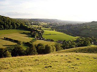
Wotton Hill is a hill on the edge of the Cotswold Hills in Gloucestershire, England, 0.5 miles (0.80 km) north of Wotton-under-Edge. The Cotswold Way passes over the hill.

Lower Wye Gorge is a 65-hectare (160-acre) biological and geological Site of Special Scientific Interest in Gloucestershire, notified in 1954 and renotified 1987. The site includes two Gloucestershire Wildlife Trust nature reserves being Ban-y-gor Wood and Lancaut. The Natural England citation states a revision for Lancaut inclusion.

<span class="mw-page-title-main">Dymock Woods SSSI</span> Biological Site of Special Scientific Interest in Gloucestershire, England

Dymock Woods is a 53-hectare (130-acre) biological Site of Special Scientific Interest in Gloucestershire, notified in 1990. The site is listed in the 'Forest of Dean Local Plan Review' as a Key Wildlife Site (KWS).

Clarke's Pool Meadow is a 1.8-hectare (4.4-acre) biological Site of Special Scientific Interest in Gloucestershire, notified in 1997. It lies on the flat top of 'Old Hill' about half a mile south of Blakeney. The site consists of two fields which were purchased by the Gloucestershire Wildlife Trust in 1997. The site was designated an SSSI in the same year and it is one of the finest surviving traditional hay meadows in Gloucestershire.

<span class="mw-page-title-main">Collinpark Wood SSSI</span> Biological Site of Special Scientific Interest in Gloucestershire, England

Collinpark Wood is a 66.69-hectare (164.8-acre) biological Site of Special Scientific Interest in Gloucestershire, notified in 1966, revised in 1974 and renotified in 1983. There was a boundary change in 1983. There are seven units of assessment. Unit 1 is a 15-hectare (37-acre) area owned and managed by the Gloucestershire Wildlife Trust. The trust purchased this part of the wood in 1979 with grant aid from WWF. The site is listed in the 'Forest of Dean Local Plan Review' as a Key Wildlife Site (KWS).

<span class="mw-page-title-main">Swift's Hill SSSI</span> Geological site in England

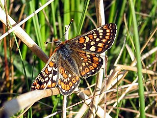
Swift's Hill is a 9.15-hectare (22.6-acre) biological and geological Site of Special Scientific Interest in Gloucestershire, notified in 1966 and renotified in 1984.

<span class="mw-page-title-main">Bull Cross, The Frith and Juniper Hill</span> Site of Special Scientific Interest in Gloucestershire, England

Bull Cross, The Frith and Juniper Hill is a 42.33-hectare (104.6-acre) biological and geological Site of Special Scientific Interest in Gloucestershire, notified in 1954. The site is listed in the ‘Stroud District’ Local Plan, adopted November 2005, Appendix 6 as an SSSI and Regionally Important Geological Site (RIGS).

<span class="mw-page-title-main">Edgehills Quarry</span> Site of Special Scientific Interest in Gloucestershire

Edgehills Quarry is a 0.4-hectare (0.99-acre) geological Site of Special Scientific Interest in Gloucestershire, notified in 1974.

<span class="mw-page-title-main">Shorn Cliff and Caswell Woods</span> Biological Site of Special Scientific Interest in Gloucestershire, England

Shorn Cliff And Caswell Woods is a 69.2-hectare (171-acre) biological Site of Special Scientific Interest in Gloucestershire, notified in 1986. The site is listed in the 'Forest of Dean Local Plan Review' as a Key Wildlife Site (KWS).

<span class="mw-page-title-main">Lippets Grove</span>

Lippets Grove is a 5-hectare (12-acre) nature reserve in Gloucestershire. The site was leased from the Forestry Commission in 1987 and is managed by the Gloucestershire Wildlife Trust. The site is listed in the 'Forest of Dean Local Plan Review' as a Key Wildlife Site (KWS).

<span class="mw-page-title-main">East Wood, Tidenham</span> Nature reserve in Gloucestershire, England

East Wood and is a 0.82-hectare (2.0-acre) nature reserve in Gloucestershire, England. The west site is 0.45-hectare (1.1-acre). The east site is 0.37-hectare (0.91-acre). It is part of a larger area of woodland called East Wood, which is adjacent to Oakhill Wood and Woolaston Wood (east). The site was leased from the Forestry Commission in 1986 and is managed by the Gloucestershire Wildlife Trust. The site is listed in the 'Forest of Dean Local Plan Review' as a Key Wildlife Site (KWS).

Ridley Bottom is a 1.1-hectare (2.7-acre) nature reserve in Gloucestershire. The site is listed in the 'Forest of Dean Local Plan Review' as a Key Wildlife Site (KWS).

<span class="mw-page-title-main">Wimberry Quarries</span> Nature reserve in Gloucestershire, England

Wimberry Quarries is a 2-hectare (4.9-acre) nature reserve in Gloucestershire in the Forest of Dean.

<span class="mw-page-title-main">Plump Hill Dolomite Quarry</span>

Plump Hill Dolomite Quarry is a 4.5-hectare (11-acre) nature reserve in Gloucestershire in the Forest of Dean.

References

  1. Natural England SSSI information on the citation
  2. Forest of Dean District Local Plan Review, adopted November 2005, Appendix D 'Nature Conservation Site Designations Within the Forest of Dean District', Sites of Special Scientific Interest Archived 2013-10-29 at the Wayback Machine
  3. 1 2 3 4 5 Kelham, A, Sanderson, J, Doe, J, Edgeley-Smith, M, et al, 1979, 1990, 2002 editions, 'Nature Reserves of the Gloucestershire Trust for Nature Conservation/Gloucestershire Wildlife Trust'
  4. Forest of Dean District Local Plan Review, adopted November 2005, Appendix D 'Nature Conservation Site Designations Within the Forest of Dean District', Key Wildlife Sites Archived 2013-10-29 at the Wayback Machine
  5. 1 2 3 4 5 'Hobbs Quarry Nature Reserve – Beautiful woodland walk among Silurian coral reefs', (undated), Gloucestershire Wildlife Trust

SSSI source