
Barnsley Warren is a 61.3-hectare (151-acre) biological Site of Special Scientific Interest in Gloucestershire, notified in 1954 and renotified in 1984. The site is also included in A Nature Conservation Review. It lies in a steep-sided dry valley, east of the A429, northeast of Cirencester in the Cotswolds. The site is listed in the 'Cotswold District' Local Plan 2001-2011 as a Key Wildlife Site (KWS).

Brassey is a 2.1-hectare (5.2-acre) biological Site of Special Scientific Interest in Gloucestershire, notified in 1954 and renotified in 1983. It is situated on the north side of the Windrush Valley, midway between Naunton and Upper Slaughter. The reserve comprises sloping, unimproved limestone pasture. There is a fast-flowing stream. This site is one of the few freshwater marshes in Gloucestershire. The stream joins the River Windrush.

Wotton Hill is a hill on the edge of the Cotswold Hills in Gloucestershire, England, 0.5 miles (0.80 km) north of Wotton-under-Edge. The Cotswold Way passes over the hill.
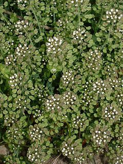
Barton Bushes is a 5.7-hectare (14-acre) biological Site of Special Scientific Interest in Gloucestershire, notified in 1996.

Bourton Down is an 11.17-hectare (27.6-acre) biological Site of Special Scientific Interest near Bourton-on-the-Hill in Gloucestershire, notified in 1974. The site is listed in the 'Cotswold District' Local Plan 2001-2011 as a Key Wildlife Site (KWS).

Boxwell SSSI is a 5.31-hectare (13.1-acre) biological Site of Special Scientific Interest in Gloucestershire, notified in 1954. The site is listed in the 'Cotswold District' Local Plan 2001-2011 as a Key Wildlife Site (KWS).
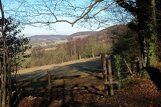
Bull Cross, The Frith and Juniper Hill is a 42.33-hectare (104.6-acre) biological and geological Site of Special Scientific Interest in Gloucestershire, notified in 1954. The site is listed in the ‘Stroud District’ Local Plan, adopted November 2005, Appendix 6 as an SSSI and Regionally Important Geological Site (RIGS).
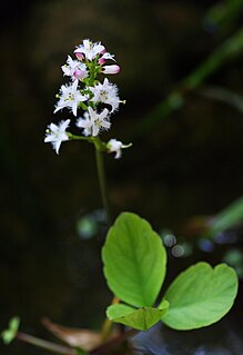
Cockleford Marsh is a 3.2-hectare (7.9-acre) biological Site of Special Scientific Interest in Gloucestershire, notified in 1991.

Cotswold Commons and Beechwoods is a 665.5-hectare (1,644-acre) biological Site of Special Scientific Interest in Gloucestershire, notified in 1954.

Crickley Hill and Barrow Wake is a 56.8-hectare (140-acre) biological and geological Site of Special Scientific Interest in Gloucestershire, notified in 1974.
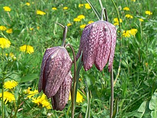
Elmlea Meadows is a 6.9-hectare (17-acre) biological Site of Special Scientific Interest in Gloucestershire, notified in 1989. The site is listed in the 'Cotswold District' Local Plan 2001-2011 as a Key Wildlife Site (KWS).
Foss Cross Quarry is a 0.67-hectare (1.7-acre) geological Site of Special Scientific Interest in Gloucestershire, notified in 1972. The site is listed in the 'Cotswold District' Local Plan 2001-2011 as a Key Wildlife Site (KWS) and a Regionally Important Geological Site (RIGS).
Hampen Railway Cutting is a 3.9-hectare (9.6-acre) geological Site of Special Scientific Interest in Gloucestershire, notified in 1974. The site is listed in the 'Cotswold District' Local Plan 2001-2011 as a Key Wildlife Site (KWS) and Regionally Important Geological Site (RIGS).

Hornsleasow Roughs is a 28.24-hectare (69.8-acre) biological Site of Special Scientific Interest in Gloucestershire, notified in 1954.

Kingscote and Horsley Woods is a 43.79-hectare (108.2-acre) biological Site of Special Scientific Interest in Gloucestershire, notified in 1966. The site is listed in the 'Cotswold District' Local Plan 2001-2011 as a Key Wildlife Site (KWS).
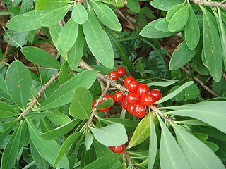
Lark Wood is a 1.11-hectare (2.7-acre) biological Site of Special Scientific Interest in Gloucestershire, notified in 1974. The site is listed in the 'Cotswold District' Local Plan 2001-2011 as a Key Wildlife Site (KWS).

Leckhampton Hill and Charlton Kings Common is a 63.8-hectare (158-acre) biological and geological Site of Special Scientific Interest in Gloucestershire, notified in 1954. There are five units of assessment.
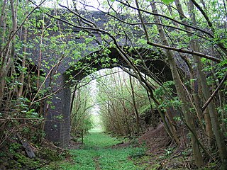
Notgrove Railway Cutting is a 1.7-hectare (4.2-acre) geological Site of Special Scientific Interest in Gloucestershire, notified in 1974. The site is listed in the 'Cotswold District' Local Plan 2001-2011 as a Key Wildlife Site (KWS) and Regionally Important Geological Site (RIGS).

Puckham Woods is a 32.38-hectare (80.0-acre) biological Site of Special Scientific Interest in Gloucestershire to the east of Cheltenham near Whittington, notified in 1954. The site is listed in the 'Cotswold District' Local Plan 2001-2011 as a Key Wildlife Site (KWS).
Stony Furlong Railway Cutting is a 2.7-hectare (6.7-acre) geological Site of Special Scientific Interest in Gloucestershire, notified in 1987. The site is listed in the 'Cotswold District' Local Plan 2001-2011 as a Key Wildlife Site (KWS) and a Regionally Important Geological Site (RIGS).


