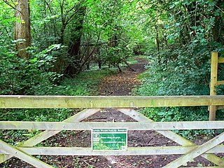
Strawberry Banks

Last updated

Strawberry Banks
Site of Special Scientific Interest
Euphydryas aurinia - geograph.org.uk - 1450925.jpg
Example - marsh fritillary (Euphydryas aurinia)
Gloucestershire UK location map.svg
Red pog.svg
Location within Gloucestershire
Location Gloucestershire
Grid reference SO910033
Coordinates 51°43′42″N2°07′54″W / 51.7283°N 2.1318°W / 51.7283; -2.1318
InterestBiological
Area5.1 hectare
Notification 1993
Natural England website

Strawberry Banks (grid reference SO910033 ) is a 5.06-hectare (12.5-acre) biological Site of Special Scientific Interest in Gloucestershire, notified in 1993. [1] [2]

Contents

This is a Gloucestershire Wildlife Trust nature reserve. The banks are thought to have once been used to grow strawberries, hence the name, and be the crash site of a Second World War German bomber. Strawberry Banks adjoins the Gloucestershire Wildlife Trust Three Groves Wood nature reserve and lies on the west-facing slopes of a small valley in the Cotswolds between the villages of France Lynch and Oakridge. [3] The site is roughly 5 km (3 miles) east of Stroud. Strawberry Banks and Three Groves Wood are part of a group of nature reserves in Stroud's Golden Valley. [4]

The site supports a large population of the marsh fritillary butterfly, and it is also one of the few sites in Britain at which the oil beetle Meloe rugosus occurs.

Species

Further information is in the nature reserves handbook. [3] This oolitic limestone grassland supports a variety of plants and animals. These include the greater butterfly-orchid, bee orchid, common spotted orchid, wild columbine, common rock-rose, milkwort, kidney vetch, wild thyme, yellow rattle and devil's bit scabious during May and June. Green-winged orchid, cowslip, early purple orchid, wood anemone, hairy violet and bluebell can be seen early in the year. In late summer pyramidal orchid, autumn gentian, clustered bellflower, Carline thistle, betony, yellow-wort, marjoram, zigzag clover, small scabious and Dyer's greenweed flower.

This site supports sainfoin, a fodder crop, which was sown many years ago on this and many other Cotswold grasslands.

There are areas of hawthorn, hazel, ash, pedunculate oak, holly and blackthorn scrub. Toothwort, nettle-leaved bellflower, woodruff and sanicle may be found in these areas. A stream, edged with trees and shrubs, runs along the bottom of the banks where meadowsweet, ramsons (wood garlic), brooklime and water figwort may be found.

The site is known for its invertebrate life, including notably marsh fritillary. Other butterflies include small blue, green hairstreak, chalkhill blue, Duke of Burgundy, marbled white, silver-washed fritillary, grizzled skipper, comma and brown argus. Roman snails, heath snail and a rare oil beetle Meloe rugosus are present.

Conservation

The banks have been gently grazed by horses and ponies since 1969, which has helped to maintain the grassland. There is regular cutting of invasive scrub and some of the large beeches at the edge of Three Groves Wood have been felled to increase the area of grassland. This is done to enhance the species rich sward.

Walks

There is a publication which details walks for recreation and observing wildlife in the Golden Valley. This includes information on Strawberry Banks and four other nearby nature reserves being Three Groves Wood, Siccaridge Wood, Daneway Banks SSSI and Sapperton Valley. The walk also includes other ancient woodland at Peyton's Grove, Oakridge village, Bakers Mill and Reservoir, Ashmeads Spring, and part of the route of the old Thames and Severn Canal. [4]

Publications

Related Research Articles

<span class="mw-page-title-main">Lower Woods</span>

Lower Woods is a 280.1-hectare (692-acre) biological and geological Site of Special Scientific Interest near the village of Wickwar, South Gloucestershire, notified in 1966 and renotified in 1985. The site area has increased at last revision in 1974 to a 284.1-hectare (702-acre) site. The site is a nature reserve managed by the Gloucestershire Wildlife Trust.

<span class="mw-page-title-main">Midger</span>

Midger is a 65.7-hectare (162-acre) biological Site of Special Scientific Interest straddling the border of Gloucestershire and South Gloucestershire, notified in 1966 and renotified in 1984. Since the last revision in 1974, the size has been reduced to a 56-hectare (140-acre) site. It lies east of Hillesley, Gloucestershire and north of Hawkesbury Upton, South Gloucestershire. It is at the head of the Kilcott Valley.

<span class="mw-page-title-main">Barnsley Warren</span> Biological Site of Special Scientific Interest in Gloucestershire, England

Barnsley Warren is a 61.3-hectare (151-acre) biological Site of Special Scientific Interest in Gloucestershire, notified in 1954 and renotified in 1984. The site is also included in A Nature Conservation Review. It lies in a steep-sided dry valley, east of the A429, northeast of Cirencester in the Cotswolds. The site is listed in the 'Cotswold District' Local Plan 2001-2011 as a Key Wildlife Site (KWS).

<span class="mw-page-title-main">Daneway Banks SSSI</span> Biological Site of Special Scientific Interest in Gloucestershire, England

Daneway Banks is a 17-hectare (42-acre) biological Site of Special Scientific Interest in Gloucestershire, notified in 1954 and renotified in 1983. It lies half a mile west of Sapperton and is part of a group of wildlife sites in the Frome Valley that includes Siccaridge Wood and Sapperton Canal reserves. The site is in the Cotswold Area of Outstanding Natural Beauty.

<span class="mw-page-title-main">Box Farm Meadows SSSI</span> Biological Site of Special Scientific Interest in Gloucestershire, England

Box Farm Meadows (Stuart Fawkes reserve) (grid reference ST865997) is a 8.3-hectare (21-acre) biological Site of Special Scientific Interest in Gloucestershire, notified in 1985. This was formerly known as Balls Green Pastures. The reserve is situated at the southern edge of Box village and one mile east of Nailsworth.

<span class="mw-page-title-main">Wotton Hill</span> Hill in Gloucestershire, England

Wotton Hill is a hill on the edge of the Cotswold Hills in Gloucestershire, England, 0.5 miles (0.80 km) north of Wotton-under-Edge. The Cotswold Way passes over the hill.

Lower Wye Gorge is a 65-hectare (160-acre) biological and geological Site of Special Scientific Interest in Gloucestershire, notified in 1954 and renotified 1987. The site includes two Gloucestershire Wildlife Trust nature reserves being Ban-y-gor Wood and Lancaut. The Natural England citation states a revision for Lancaut inclusion.

<span class="mw-page-title-main">Dymock Woods SSSI</span> Biological Site of Special Scientific Interest in Gloucestershire, England

Dymock Woods is a 53-hectare (130-acre) biological Site of Special Scientific Interest in Gloucestershire, notified in 1990. The site is listed in the 'Forest of Dean Local Plan Review' as a Key Wildlife Site (KWS).

Clarke's Pool Meadow is a 1.8-hectare (4.4-acre) biological Site of Special Scientific Interest in Gloucestershire, notified in 1997. It lies on the flat top of 'Old Hill' about half a mile south of Blakeney. The site consists of two fields which were purchased by the Gloucestershire Wildlife Trust in 1997. The site was designated an SSSI in the same year and it is one of the finest surviving traditional hay meadows in Gloucestershire.
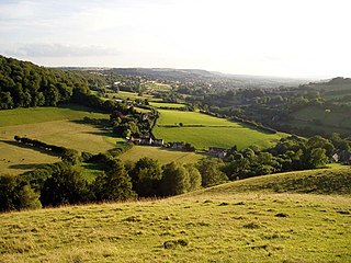
<span class="mw-page-title-main">Swift's Hill SSSI</span> Geological site in England

Swift's Hill is a 9.15-hectare (22.6-acre) biological and geological Site of Special Scientific Interest in Gloucestershire, notified in 1966 and renotified in 1984.
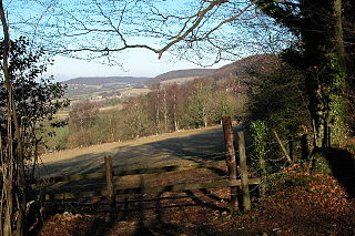
<span class="mw-page-title-main">Bull Cross, The Frith and Juniper Hill</span> Site of Special Scientific Interest in Gloucestershire, England

Bull Cross, The Frith and Juniper Hill is a 42.33-hectare (104.6-acre) biological and geological Site of Special Scientific Interest in Gloucestershire, notified in 1954. The site is listed in the ‘Stroud District’ Local Plan, adopted November 2005, Appendix 6 as an SSSI and Regionally Important Geological Site (RIGS).

<span class="mw-page-title-main">Minchinhampton Common</span> Site of Special Scientific Interest in Gloucestershire

Minchinhampton Common is a 182.7-hectare (451-acre) biological and geological Site of Special Scientific Interest in Gloucestershire, notified in 1972.

<span class="mw-page-title-main">Lippets Grove</span>

Lippets Grove is a 5-hectare (12-acre) nature reserve in Gloucestershire. The site was leased from the Forestry Commission in 1987 and is managed by the Gloucestershire Wildlife Trust. The site is listed in the 'Forest of Dean Local Plan Review' as a Key Wildlife Site (KWS).

<span class="mw-page-title-main">East Wood, Tidenham</span> Nature reserve in Gloucestershire, England

East Wood and is a 0.82-hectare (2.0-acre) nature reserve in Gloucestershire, England. The west site is 0.45-hectare (1.1-acre). The east site is 0.37-hectare (0.91-acre). It is part of a larger area of woodland called East Wood, which is adjacent to Oakhill Wood and Woolaston Wood (east). The site was leased from the Forestry Commission in 1986 and is managed by the Gloucestershire Wildlife Trust. The site is listed in the 'Forest of Dean Local Plan Review' as a Key Wildlife Site (KWS).

Ridley Bottom is a 1.1-hectare (2.7-acre) nature reserve in Gloucestershire. The site is listed in the 'Forest of Dean Local Plan Review' as a Key Wildlife Site (KWS).

<span class="mw-page-title-main">Neu-Lindsey Nature Reserve</span>

Neu-Lindsey Nature Reserve is a 0.4-hectare (0.99-acre) nature reserve in Gloucestershire. The site is listed in the ‘Stroud District’ Local Plan, adopted November 2005, Appendix 6 as a Key Wildlife Site (KWS).
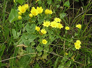
<span class="mw-page-title-main">Snows Farm Nature Reserve</span> Nature reserve in Gloucestershire, England

Snows Farm Nature Reserve is a 21.3-hectare (53-acre) nature reserve in Gloucestershire. The site is listed in the ‘Stroud District’ Local Plan, adopted November 2005, Appendix 6 as a Key Wildlife Site (KWS).

<span class="mw-page-title-main">Three Groves Wood</span> Nature reserve in Gloucestershire, England

Three Groves Wood is a 3.3-hectare (8.2-acre) nature reserve in Gloucestershire. The site is listed in the ‘Stroud District’ Local Plan, adopted November 2005, Appendix 6 as a Key Wildlife Site (KWS).
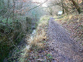
<span class="mw-page-title-main">Siccaridge Wood</span> Nature reserve in Gloucestershire, England

Siccaridge Wood is a 26.6-hectare (66-acre) nature reserve in Gloucestershire. The site is listed in the ‘Stroud District’ Local Plan, adopted November 2005, Appendix 6 as a Key Wildlife Site (KWS).

<span class="mw-page-title-main">Sapperton Valley</span>

Sapperton Valley is a 3.7-hectare (9.1-acre) nature reserve near Chalford in the Stroud district of Gloucestershire, England. The site is managed by the Gloucestershire Wildlife Trust under leasing arrangements with the Bathurst Estate, in place since 1964.

References

  1. Natural England SSSI information on the citation
  2. Stroud District Local Plan, adopted November 2005, Appendix 6 ‘Sites of Nature Conservation Interest’ Archived 2012-06-06 at the Wayback Machine
  3. 1 2 Kelham, A, Sanderson, J, Doe, J, Edgeley-Smith, M, et al, 1979, 1990, 2002 editions, 'Nature Reserves of the Gloucestershire Trust for Nature Conservation/Gloucestershire Wildlife Trust'
  4. 1 2 'The Golden Valley Walk', (undated), Gloucestershire Wildlife Trust

SSSI source