Upham Meadow and Summer Leasow

Last updated
Upham Meadow and Summer Leasow
Site of Special Scientific Interest
Twyning Meadow - geograph.org.uk - 894789.jpg
Upham Meadow (known locally as Twyning Meadow)
Gloucestershire UK location map.svg
Red pog.svg
Location within Gloucestershire
Location Gloucestershire
Grid reference SO917375
Coordinates 52°02′11″N2°07′18″W / 52.036291°N 2.121679°W / 52.036291; -2.121679 Coordinates: 52°02′11″N2°07′18″W / 52.036291°N 2.121679°W / 52.036291; -2.121679
InterestBiological
Area104.0 hectare
Notification 1991
Natural England website

Upham Meadow and Summer Leasow (grid reference SO917375 ) is a 104.0-hectare (257-acre) biological Site of Special Scientific Interest on the border between Gloucestershire and Herefordshire & Worcestershire, at Twyning and near Bredon, notified in 1991. [1] [2]

Contents

Location and habitat

The site is common land (open access). The Meadows lie next to the River Avon on the border between counties. Upham Meadow is managed for a hay crop. Summer Leasow has restricted common grazing rights and is pasture. This land, which is semi-improved neutral grassland, is flooded in the winter. Thus the site is significant for its over-wintering waders and wildfowl, and breeding waders. This is a relatively large area, with a high water table and there is minimum disturbance. There are ditches and wet areas generally. [1]

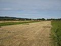
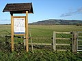
The photographs in the gallery below provide narrative on the use and rights.

Flora

The site supports grasses and herbs which are typical of wet neutral meadows. Species include narrow-leaved water-dropwort ( Oenanthe silaifolia ), which is one of the largest populations in Great Britain. There is crested dog's tail, meadow foxtail, meadow buttercup, great burnet and meadow vetchling. The national scarce mousetail is recorded for this site (one of three locations in Gloucestershire). [1]

Birds

The site supports nationally significant numbers of breeding and over-wintering birds. Breeding birds include redshank, curlew, snipe and lapwing. The wet areas and ditches support reed warbler, sedge warbler, reed bunting and mallard. [1]

Over-wintering sees the site used for feeding and roosting by large numbers of lapwing, dunlin, and golden plover. Recorded counts for golden plover indicate over two thousand. Recordings also show use by Bewick's swan in significant numbers. snipe, redshank and curlew over-winter at the site. [1]

Related Research Articles

Insh Marshes

Insh Marshes are an area of floodplain of the River Spey between Kingussie and Kincraig in Badenoch and Strathspey, Highland, Scotland. The marshes are said to be one of the most important wetlands in Europe. They lie at altitude of approximately 240 to 220 m above sea level, and form one of the largest areas of floodplain mire and fen vegetation in Scotland.

Coombe Hill Canal

Coombe Hill Canal lies in the Vale of Gloucester, south west England, north of Leigh and runs west 2.75 miles (4.43 km) from Coombe Hill Basin to the River Severn near Wainlode Hill. It opened in 1796 and closed 80 years later in 1876, after the only lock was damaged by flooding. The Gloucestershire Wildlife Trust purchased the Coombe Hill Canal nature reserve in 1985 and the area is managed by the trust. Adjacent to the Coombe Hill Canal is a large area of wet meadowland situated midway between Gloucester and Tewkesbury to the west of the A38, which was purchased by the trust in 1999. There is a north and a south meadow. This land and the Canal itself often flood in winter, which attracts hundreds of wildfowl.

Tees and Hartlepool Foreshore and Wetlands SSSI is a 255.62-hectare (631.7-acre) biological Site of Special Scientific Interest in County Durham, England notified in 1997.

West Sedgemoor


West Sedgemoor or West Sedge Moor is an area of the Somerset Levels, in Somerset, England, around 8 miles east of Taunton, which approximately coincides with the West Sedgemoor biological Site of Special Scientific Interest, a 1,016 hectare site notified as an SSSI in 1983. It is a flat, low-lying area of fields and meadows separated by water-filled rhynes and ditches. It is subject to controlled flooding in winter. It is drained by the River Parrett.

Lodmoor

Lodmoor is a Site of Special Scientific Interest (SSSI), RSPB reserve and country park in Dorset, England. The country park features a visitor centre, model railway and pitch and putt golf course. The SSSI has a wetland habitat with native birds that are rare in the UK and a range of migratory species.

The South Pennine Moors are areas of moorland in the South Pennines in northern England. The designation is applied to two different but overlapping areas, a Site of Special Scientific Interest (SSSI) covering a number of areas in West Yorkshire, North Yorkshire, Lancashire and Greater Manchester, and a much larger Special Area of Conservation (SAC) covering parts of Derbyshire, South Yorkshire and West Yorkshire, and small areas of Cheshire, Staffordshire, Greater Manchester, Lancashire and North Yorkshire.

Sevenoaks Gravel Pits

Sevenoaks Gravel Pits is a 73.7-hectare (182-acre) biological Site of Special Scientific Interest on the northern outskirts of Sevenoaks in Kent. It is managed by Kent Wildlife Trust as the Sevenoaks Wildlife Reserve and Jeffery Harrison Visitor Centre.

Ashleworth Ham Biological Site of Special Scientific Interest in Gloucestershire, England

Ashleworth Ham is a 104.73-hectare (258.8-acre) biological Site of Special Scientific Interest. It is a large area of grassland on the Severn floodplain, north of Ashleworth in Gloucestershire, England. It is registered as a Site of Special Scientific Interest and was notified in 1974 and renotified in 1985. Ashleworth Ham received this designation because it is one of three sites in the Severn Vale where migratory waterfowl winter.

Ingrebourne Marshes

Ingrebourne Marshes are a 74.8 hectare biological Site of Special Scientific Interest in Hornchurch in the London Borough of Havering. Ingrebourne Valley Local Nature Reserve includes a small part of the SSSI west of the River Ingrebourne. The site is managed by the Essex Wildlife Trust

Moorhouse and Cross Fell

Moorhouse and Cross Fell is a Site of Special Scientific Interest covering an extensive area of moorland in the Wear Valley district of west County Durham and the Eden district of Cumbria, England. It is contiguous with Upper Teesdale SSSI to the east and Appleby Fells SSSI to the south. The area covered extends roughly from an arc through the villages of Gamblesby, Leadgate and Garrigill southward as far as Milburn in the west and Cow Green Reservoir in the east. It includes the whole of Cross Fell, the summit of which, at 893 metres asl, is the highest point in the Pennines and in England outside the Lake District.

Teesdale Allotments is a Site of Special Scientific Interest in the Teesdale district of County Durham, England. It consists of two large upland areas north of the Tees valley, one to the north and east of the village of Newbiggin, the other to the north-east of Middleton-in-Teesdale.

Birding in Chennai

Housing more than 200 resident and wintering bird species, Chennai has long been a haven for bird watchers. It is the one of the few urban areas in India with diverse range of birds including greater flamingo, black baza, osprey, Indian eagle-owl, Coppersmith barbet, Spot billed pelican and pied avocet can be seen. The following are some known birding hotspots in and around Chennai.

Old River Severn, Upper Lode

Old River Severn, Upper Lode is a 3.72-hectare (9.2-acre) biological Site of Special Scientific Interest in Gloucestershire, notified in 1985. It is a cross county border site between Gloucestershire and Herefordshire and Worcestershire.

Pennsylvania Fields, Sedbury

Pennsylvania Fields, Sedbury is a 27.03-hectare (66.8-acre) biological Site of Special Scientific Interest in Gloucestershire, notified in 1985.

Severn Ham, Tewkesbury

Severn Ham, Tewkesbury is a 70.82-hectare (175.0-acre) biological Site of Special Scientific Interest in Gloucestershire near Tewkesbury, notified in 1974.

Yarley Meadows

Yarley Meadows is a 12.2-hectare (30-acre) biological Site of Special Scientific Interest in Gloucestershire, England, notified in 1987.

Walthamstow Wetlands

Walthamstow Wetlands is a 211 ha nature reserve in Walthamstow, east London, adjacent to the historic Essex-Middlesex border on the River Lea. It is focused on the Walthamstow Reservoirs, built by the East London Waterworks Company between 1853 and 1904 as part of the Lee Valley Reservoir Chain. The site is one of the largest urban wetland nature reserves in Europe and is particularly important for wildlife due to its position within the Lee Valley. It serves as a byway for migrating, wintering and breeding birds. Visitors can freely access the site's natural, industrial and social heritage in one of the capital's most densely populated urban areas.

Blue House Farm

Blue House Farm is a 242.8 hectare nature reserve and farm in North Fambridge, on the north bank of the River Crouch between Burnham-on-Crouch and South Woodham Ferrers in Essex. It is managed by the Essex Wildlife Trust. Most of the site is in of the Crouch and Roach Estuaries Site of Special Scientific Interest.

Adur Estuary

Adur Estuary is a 62.2-hectare (154-acre) biological Site of Special Scientific Interest on the western outskirts of Shoreham-by-Sea in West Sussex. Part is a Royal Society for the Protection of Birds nature reserve.

Otmoor SSSI

Otmoor SSSI is a 213-hectare (530-acre) biological Site of Special Scientific Interest north of Oxford in Oxfordshire. It is adjacent to RSPB Otmoor, and they are both part of Otmoor, an area of wetland and wet grassland which was enclosed in the early nineteenth century.

References

  1. 1 2 3 4 5 Natural England SSSI information on the citation
  2. Tewkesbury Borough Local Plan to 2011, adopted March 2006, Appendix 3 'Nature Conservation', Sites of Special Scientific Interest

SSSI source