Related Research Articles

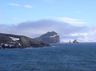
Deception Island is an island in the South Shetland Islands close to the Antarctic Peninsula with a large and usually "safe" natural harbor, which is occasionally troubled by the underlying active volcano. This island is the caldera of an active volcano, which seriously damaged local scientific stations in 1967 and 1969. The island previously held a whaling station it is now the most popular tourist destination with over 15,000 visitors per year. Two research stations are operated by Argentina and Spain during the summer season. While various countries have asserted sovereignty, it is still administered under the Antarctic Treaty System.
The Ronne Antarctic Research Expedition (RARE) was an expedition from 1947–1948 which researched the area surrounding the head of the Weddell Sea in Antarctica.

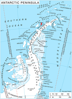
Kabile Island is an Antarctic island extending 700 m (770 yd) in south–north direction and 450 m (490 yd) wide, situated off the north coast of Greenwich Island in the South Shetland Islands, Antarctica. It has a surface area of 19 hectares.

Rupite Glacier is a 2.9 kilometres (1.8 mi) long glacier on Smith Island, South Shetland Islands draining the southeast slopes of Imeon Range east of the summit Mount Foster and southeast of Evlogi Peak. It is situated southeast of Chuprene Glacier, southwest of Pashuk Glacier and northeast of Landreth Glacier, and flows southeastward into Osmar Strait. Bulgarian early mapping in 2008. The glacier is named after the settlement Rupite and the nearby protected area in southwestern Bulgaria.

Saparevo Glacier is a 1.8 km long and 2 km wide glacier draining the northwest slopes of Imeon Range on Smith Island, South Shetland Islands, Antarctica. It is situated northeast of Kongur Glacier, and flows north-northeast of Mount Christi and southwest of Matochina Peak into Vedena Cove in Drake Passage. Bulgarian early mapping in 2009. The glacier is named after the settlement of Saparevo in Southwestern Bulgaria.

Kongur Glacier is a 2.7 kilometres (1.7 mi) long glacier draining the northwest slopes of Imeon Range on Smith Island in the South Shetland Islands, Antarctica. It is situated northeast of Dalgopol Glacier and southwest of Saparevo Glacier, and flows west of Mount Christi into Drake Passage. Bulgarian early mapping in 2009. The glacier is named after the peak and nature reserve of Kongur on Belasitsa Mountain in southwestern Bulgaria.

Dalgopol Glacier is a 3.4 kilometres (2.1 mi) long glacier draining the northwest slopes of Imeon Range on Smith Island in the South Shetland Islands, Antarctica. It is situated northeast of Vetrino Glacier and southwest of Kongur Glacier, and flows north of Mount Pisgah and northwest of Mezek Peak into Drake Passage. Bulgarian early mapping in 2009. The glacier is named after the town of Dalgopol in northeastern Bulgaria.

Vetrino Glacier is a 3.2 km long glacier on the northwest side of Imeon Range on Smith Island in the South Shetland Islands, Antarctica. It is situated northeast of Yablanitsa Glacier, southwest of Dalgopol Glacier and northwest of Ovech Glacier, drains the northwest slopes of Imeon Range north of Drinov Peak, northwest of Kostenets Saddle and west of Mount Pisgah, and flows northwestwards into Drake Passage both northeast and south of Gregory Point. The glacier is named after the town of Vetrino in northeastern Bulgaria.

Narechen Glacier is the 9 km long and 11 km wide glacier draining the western slopes of the Lassus Mountains on the northwest coast of Alexander Island in Antarctica. Flowing westwards to enter Lazarev Bay in the Wilkins Sound, Bellingshausen Sea. The glacier is situated south of the southwestern ridge of Mount Wilbye and north of Faulkner Nunatak.

Yozola Glacier is the 5 km long and 1.7 km wide glacier in the Sofia University Mountains situated in the northern portion of Alexander Island in Antarctica, and draining north-northwestwards between Mount Braun and Balan Ridge to flow into Palestrina Glacier.

Djerassi Glacier is a 2.8 km long and 1 km wide steep valley glacier situated south of Gorichane Glacier, west of the head of Malpighi Glacier, northwest of the head of Mackenzie Glacier, and north-northeast of Pirogov Glacier on Brabant Island in the Palmer Archipelago, Antarctica. It drains the west slopes of Harvey Heights and the north slopes of Mount Parry, and flows northwestwards into Lanusse Bay north of Venchan Bluff.

Pirogov Glacier is a 5 km long and 1.5 km wide glacier situated south of Djerassi Glacier, west of the head of Mackenzie Glacier and northwest of Balanstra Glacier on Brabant Island in the Palmer Archipelago, Antarctica. It drains the south-southwest slopes of Mount Parry and flows westwards to enter Dallmann Bay south of Minot Point.

Bistra Glacier is 1 nautical mile long and 0.4 nautical miles wide glacier on the northwest side of Imeon Range on Smith Island in the South Shetland Islands, Antarctica. It is situated southwest of Chuprene Glacier and northwest of Dragoman Glacier, drains the west slopes of Mount Foster and the north slopes of Slaveykov Peak, and flows northwestwards of Zavet Saddle to enter Drake Passage south of Garmen Point.

Grigorov Glacier is the 1.8 km long and 1.3 km wide glacier on the south side of Stavertsi Ridge on Albena Peninsula, Brabant Island in the Palmer Archipelago, Antarctica. It drains the east slopes of Mount Cabeza and flows southeastwards to enter Hill Bay west of Kostur Point.
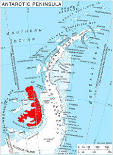
Mount Allan is the largest massif in the Traverse Mountains, isolated to the north and south by low passes, on the Rymill Coast, Palmer Land. Named in 1977 by the United Kingdom Antarctic Place-Names Committee (UK-APC) after Thomas J. Allan (1940–66), British Antarctic Survey (BAS) radio operator at Stonington Island, 1965–66, who lost his life while sledging with J.F. Noel near Tragic Corner, Fallieres Coast, in May 1966.

Landreth Glacier is the steep 2.3 km long and 600 m wide glacier on the southeast side of Imeon Range, Smith Island in the South Shetland Islands, Antarctica, which is draining southeastwards from Mount Foster between the side ridges separating it from Rupite Glacier to the north and Dragoman Glacier to the south, and flowing into Ivan Asen Cove on Bransfield Strait.

Pashuk Glacier is the steep 2.7 km long and 600 m wide glacier on the southeast side of Imeon Range, Smith Island in the South Shetland Islands, Antarctica, which is draining southeastwards from Vakarel Saddle between the side ridges descending from Antim Peak and Evlogi Peak and separating it from Krivodol Glacier to the north and Rupite Glacier to the south respectively, and flows into Osmar Strait southwest of Sredets Point.
Lewis Bay is a bay indenting the north coast of Ross Island, Antarctica, between Mount Bird and Cape Tennyson.
John Fraser Noel (1942-1966) was an engineer from Cardiff, Wales, who died in Antarctica in 1966.
Mount Noel is a mountain in the Traverse Mountains of Antarctica. It is 1,600 metres (5,200 ft) high. It is south of McHugo Peak and north of Mount Allan. It was named for John Fraser Noel (1942-1966) who died in a sledging accident near Tragic Corner while employed by the British Antarctic Survey.
References
- 1 2 "Allan, Mount". Gazetteer. Australian Antarctic Data Centre: Data management and spatial data services. Retrieved 13 September 2016.