Related Research Articles

Minster, also known as Minster-in-Thanet, is a village and civil parish in the Thanet District of Kent, England. It is the site of Minster in Thanet Priory. The village is west of Ramsgate and to the north east of Canterbury; it lies just south west of Kent International Airport and just north of the River Stour. Minster is also the "ancient capital of Thanet". At the 2011 Census the hamlet of Ebbsfleet was included.

The Isle of Sheppey is an island off the northern coast of Kent, England, neighbouring the Thames Estuary, centred 42 miles (68 km) from central London. It has an area of 36 square miles (93 km2). The island forms part of the local government district of Swale. Sheppey is derived from Old English Sceapig, meaning "Sheep Island".

Swale is a local government district with borough status in Kent, England. The council is based in Sittingbourne, the borough's largest town. The borough also contains the towns of Faversham, Queenborough and Sheerness, along with numerous villages and surrounding rural areas. It includes the Isle of Sheppey and is named after The Swale, the narrow channel which separates Sheppey from the mainland part of the borough. Some southern parts of the borough lie within the Kent Downs, a designated Area of Outstanding Natural Beauty.

Sheerness is a port town and civil parish beside the mouth of the River Medway on the north-west corner of the Isle of Sheppey in north Kent, England. With a population of 11,938, it is the second largest town on the island after the nearby town of Minster which has a population of 21,319.

Sir Robert Taylor (1714–1788) was an English architect and sculptor who worked in London and the south of England.

The Sheppey Light Railway was a railway on the Isle of Sheppey, Kent, England, which ran from Leysdown to Queenborough, where it connected with the South Eastern and Chatham Railway's Sheerness Line. It was engineered by Holman Fred Stephens and opened in August 1901 and closed on 4 December 1950. Originally there were stations at Sheerness East, East Minster on Sea, Minster on Sea, Eastchurch and Leysdown. Two halts were opened in 1905 at Brambledown and Harty Road.

James Craig was a Scottish architect who worked mostly in lowlands of the country and especially his native city of Edinburgh. He is remembered primarily for his layout of the first Edinburgh New Town.

Sittingbourne and Sheppey is a constituency in Kent represented in the House of Commons of the UK Parliament since 2010 by Gordon Henderson, a Conservative.
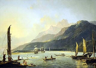
HMS Adventure was a barque that the Royal Navy purchased in 1771. She had been the merchant vessel Marquis of Rockingham, launched in 1770 at Whitby. In naval service she sailed with Resolution on James Cook's second expedition to the Pacific in 1772–1775. She was the first ship to circumnavigate the globe from west to east. After her return she served as a store ship until 1779. The navy sold her in 1783 and she resumed a civilian career, but retaining the name Adventure. She was lost in May 1811.

John Carr (1723–1807) was a prolific English architect, best known for Buxton Crescent in Derbyshire and Harewood House in West Yorkshire. Much of his work was in the Palladian style. In his day he was considered to be the leading architect in the north of England.
The decade of the 1770s in archaeology involved some significant events.

Sir Watkin Williams-Wynn, 4th Baronet was a Welsh landowner, politician and patron of the arts. The Williams-Wynn baronets had been begun in 1688 by the politician Sir William Williams, 1st Baronet, but had inherited, in the time of the 3rd baronet, Sir Watkin's father, the estates of the Wynn baronets, and changed their name to reflect this.

Garnkirk is a settlement in North Lanarkshire, located a mile (1.5 km) southwest of Muirhead. It is located 10 km northeast of Glasgow's city centre and 23 km southwest of Falkirk. Garnkirk is connected via the nearby motorways M8, M73 and M80. This provides access to Cumbernauld, Glasgow and Stirling. The nearest modern railway stations are in Gartcosh and Stepps.

The Luggie Water is one of two streams which flow out of Cumbernauld. The Scottish New Town’s name derives from the Gaelic for "the meeting of the waters", which possibly refers to the Luggie Water and the Red Burn, both of which run through Cumbernauld but which never meet.
The Switchback was a railway line in the East End of Glasgow, Scotland, constructed by the Caledonian Railway (CR). Connecting the lines at Rutherglen on the south side of the city with Robroyston on the north side, this route also served a number of industrial sidings and rail yards.

The second voyage of James Cook, from 1772 to 1775, commissioned by the British government with advice from the Royal Society, was designed to circumnavigate the globe as far south as possible to finally determine whether there was any great southern landmass, or Terra Australis. On his first voyage, Cook had demonstrated by circumnavigating New Zealand that it was not attached to a larger landmass to the south, and he charted almost the entire eastern coastline of Australia, yet Terra Australis was believed to lie further south. Alexander Dalrymple and others of the Royal Society still believed that this massive southern continent should exist. After a delay brought about by the botanist Joseph Banks' unreasonable demands, the ships Resolution and Adventure were fitted for the voyage and set sail for the Antarctic in July 1772.

William Tyler was an English sculptor, landscaper, and architect, and one of the three founding members of the Royal Academy, in 1768. He was Director of the Society of Artists.
Alexander Kincaid (1710–1777) was an 18th-century Scottish printer and publisher who served as Lord Provost of Edinburgh 1776/77.
Charles Stuart of Dunearn FRSE (1745–1826) was a Scottish minister who went on to co-found the Royal Society of Edinburgh and to be President of the Royal College of Physicians of Edinburgh.
References
- ↑ "Mapmakers - National Library of Scotland".
- ↑ Campbell, Tony (1996). "Chronicle for 1995-1996". Imago Mundi. 48: 232 – via JSTOR.
- ↑ Finch, Jonathan; Woudstra, Jan (26 October 2020). "Capability Brown, Royal Gardener". White Rose University Press. p. 51 – via universitypress.whiterose.ac.uk.
- ↑ "Kent: Greenwich (now in London Borough of Greenwich). Map of Maidenstone Hill, intended..." 24 February 1772 – via National Archive of the UK.
- ↑ "Middlesex (now in London Borough of Islington). Plan of lands formerly called Little St..." 24 February 1775 – via National Archive of the UK.
- ↑ "Kent: Minster in Sheppey. Two plans on a single sheet, showing Crown estates called..." 24 February 1776 – via National Archive of the UK.
- ↑ "Northamptonshire. Plan of Crown lands in Brigstock and Stanion leased to the Duchess of..." 24 February 1777 – via National Archive of the UK.
- ↑ "View map: Richardson, Thomas, fl. 1772-1829, Map of the town of Glasgow & country seven miles around. - Counties of Scotland, 1580-1928". maps.nls.uk.
- ↑ "New travelling map of Scotland, shewing the principal direct & cross roads ... / by Thos. Richardson, etc. - Maps of Scotland". maps.nls.uk.
| | This biographical article about a Scottish scientist is a stub. You can help Wikipedia by expanding it. |
| | This biographical article about an Earth scientist is a stub. You can help Wikipedia by expanding it. |