Chester Hjortur Thordarson — born Hjörtur Þórðarson — was an Icelandic-American inventor and manufacturer of electrical apparatus who eventually held nearly a hundred technology patents related to transformers, inductors, high voltage coils, and more.

Rock Island State Park is a state park of Wisconsin located on Rock Island off the tip of the Door Peninsula at the eastern edge of Green Bay and Lake Michigan.

This is a list of sites in Minnesota which are included in the National Register of Historic Places. There are more than 1,700 properties and historic districts listed on the NRHP; each of Minnesota's 87 counties has at least 2 listings. Twenty-two sites are also National Historic Landmarks.

Rock Island is a mostly wooded island off the tip of Wisconsin's Door Peninsula at the mouth of Green Bay, in Door County, Wisconsin. The 974.87-acre (394.5 ha) island is approximately 1.6 miles (2.6 km) long and 1.1 miles (1.8 km) wide. It rises to 65 meters above Lake Michigan, making it the highest in elevation out of all the Potawatomi Islands. It is almost entirely owned by the Wisconsin Department of Natural Resources, which maintains Rock Island State Park. It is the northernmost part of the town of Washington.

This is a list of the National Register of Historic Places listings in Door County, Wisconsin. It is intended to provide a comprehensive listing of entries in the National Register of Historic Places that are located in Door County, Wisconsin. The locations of National Register properties for which the latitude and longitude coordinates are included below may be seen in a map.

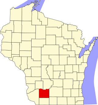
This is a list of the National Register of Historic Places listings in Grant County, Wisconsin. It is intended to provide a comprehensive listing of entries in the National Register of Historic Places that are located in Grant County, Wisconsin. The locations of National Register properties for which the latitude and longitude coordinates are included below may be seen in a map.
This is a list of the National Register of Historic Places listings in Iowa County, Wisconsin. It is intended to provide a comprehensive listing of entries in the National Register of Historic Places that are located in Iowa County, Wisconsin. The locations of National Register properties for which the latitude and longitude coordinates are included below may be seen in a map.

This is a list of the National Register of Historic Places listings in La Crosse County, Wisconsin. It is intended to provide a comprehensive listing of entries in the National Register of Historic Places that are located in La Crosse County, Wisconsin. The locations of National Register properties for which the latitude and longitude coordinates are included below may be seen in a map.

This is a list of the National Register of Historic Places listings in Ozaukee County, Wisconsin. It is intended to provide a comprehensive listing of entries in the National Register of Historic Places that are located in Ozaukee County, Wisconsin. The locations of National Register properties for which the latitude and longitude coordinates are included below may be seen in a map.

This is a list of the National Register of Historic Places listings in Walworth County, Wisconsin. It is intended to provide a comprehensive listing of entries in the National Register of Historic Places that are located in Walworth County, Wisconsin. The locations of National Register properties for which the latitude and longitude coordinates are included below may be seen in a map.

This is a list of the National Register of Historic Places listings in Saint Louis County, Minnesota. It is intended to be a complete list of the properties and districts on the National Register of Historic Places in Saint Louis County, Minnesota, United States. The locations of National Register properties and districts for which the latitude and longitude coordinates are included below, may be seen in an online map.

This is a list of properties and districts in the southern municipalities of Puerto Rico that are listed on the National Register of Historic Places. It includes places along the southern coast of the island, and on the south slope of Puerto Rico's Cordillera Central.

The Weeks Estate is a historic country estate on U.S. Route 3 in Lancaster, New Hampshire. Built in 1912 for John Wingate Weeks, atop Prospect Mountain overlooking the Connecticut River, it is one of the state's best preserved early 20th-century country estates. It was given to the state by Weeks' children, and is now Weeks State Park. It features hiking trails, expansive views of the countryside from the stone observation tower, and a small museum in the main estate house. A small portion of property at the mountain summit was listed on the National Register of Historic Places in 1985, while the park as a whole was listed in 2023.

This is a list of the National Register of Historic Places listings in Manitowoc County, Wisconsin. It is intended to provide a comprehensive listing of entries in the National Register of Historic Places that are located in Manitowoc County, Wisconsin. The locations of National Register properties for which the latitude and longitude coordinates are included below may be seen in a map.
This is a list of the properties and historic districts in Stamford, Connecticut that are listed on the National Register of Historic Places. The locations of National Register properties and districts for which the latitude and longitude coordinates are included below, may be seen in an online map.
The National Register Information System (NRIS) is a database of properties that have been listed on the United States National Register of Historic Places. The database includes more than 84,000 entries of historic sites that are currently listed on the National Register, that were previously listed and later removed, or that are pending listing. The database includes approximately 45 pieces of data for each listed property. Accuracy of the NRIS database may be imperfect. For example, a 2004 paper addressed accuracy of spatial location data for part of the NRIS content.

The Water Tower is located in Rock Island State Park on Rock Island in the town of Washington, Wisconsin.
