
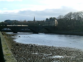
Thurso is a town and former burgh on the north coast of the Highland council area of Scotland. Situated in the historical County of Caithness, it is the northernmost town on the island of Great Britain. From a latitudinal standpoint, Thurso is located further north than the southernmost point of Norway and in addition lies more than 500 miles (800 km) north of London.

Caithness is a historic county, registration county and lieutenancy area of Scotland.

Dounreay is a small settlement and the site of two large nuclear establishments on the north coast of Caithness in the Highland area of Scotland. It is on the A836 road nine miles west of Thurso.

Dunnet Head is a headland in Highland, on the north coast of Scotland. Dunnet Head includes the most northerly point of both mainland Scotland and the island of Great Britain.
Wick is a town and royal burgh in Caithness, in the far north of Scotland. The town straddles the River Wick and extends along both sides of Wick Bay. "Wick Locality" had a population of 6,954 at the time of the 2011 census, a decrease of 3.8% from 2001.

Caithness, Sutherland and Easter Ross is a constituency of the House of Commons of the Parliament of the United Kingdom (Westminster). It is the most northerly constituency on the British mainland. It elects one Member of Parliament (MP) by the first-past-the-post system of election.

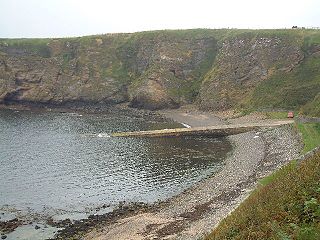
Reay is a village which has grown around Sandside Bay on the north coast of the Highland council area of Scotland. It is within the historic Parish of Reay and the historic county of Caithness.

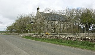
Reay Parish Church is a Church of Scotland parish church serving Reay, Caithness. It is one of the most northerly communities on the Scottish mainland, located several miles to west of Thurso. The largest local employer is the Dounreay nuclear facility.

Georgemas Junction railway station is a railway station located in the Highland council area in the far north of Scotland. It serves several rural hamlets in the historic county of Caithness, including Georgemas, Roadside and Banniskirk. It is also the nearest station to the village of Halkirk, which lies approximately 1.6 miles (2.6 km) west of the station.

Thurso railway station is a railway station located in Thurso, in the Highland council area in the far north of Scotland. It serves the town and its surrounding areas, along with ferry services linking the mainland with Stromness on the Orkney Islands.
The Sutherland and Caithness Railway was a Scottish railway company that built a line from Helmsdale, the terminus of the Duke of Sutherland's Railway to Wick and Thurso in Caithness, giving the northern towns access to Inverness. It was driven through by the efforts of the 3rd Duke of Sutherland and the engineer Joseph Mitchell in the face of apathy from interests in Wick.
The Sandside Chase was a Scottish clan battle which took place in 1437 in Caithness, about 6 miles (9.7 km) west of Thurso. The Clan Mackay launched a raid from Strathnaver towards Thurso until they encountered resistance from the locals at Dounreay. The Mackays then pulled back to Sandside, where they were joined by reinforcements and slaughtered the defenders on the coast north of Reay.
Bower is a village and civil parish in Highland, Scotland It is 10 miles from Thurso and around 11 miles from Wick. Bower is served by Wick, Thurso and Castletown for shopping, taxis and post offices.
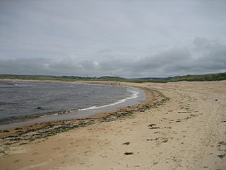
Brough /brɒx/ is a small village in Caithness on the far north coast of mainland Scotland. It is the most northerly village of mainland Great Britain. It is 10 miles east of Thurso, 20 miles north-west of Wick, 200 miles north of Edinburgh, and 500 miles north of London. It is on the southern shore of the Pentland Firth, the sea channel between Caithness and the Orkney Islands, notorious for strong tidal currents and exceptionally violent sea conditions. Brough is located on the B855 single-track road, 2.5 miles south east of Dunnet Head Lighthouse, the most northerly lighthouse and point on mainland Britain. The neighbouring village of Dunnet and the wide sandy beaches of Dunnet Bay lie 1.6 miles to the south. Brough is within the civil parish of Dunnet. John o' Groats, the north-easterly point of the mainland, lies 10 miles to the east.

Wolfburn distillery is a Highland single malt Scotch whisky distillery in Thurso, Caithness, Scotland. After ceasing production in the 1860s, a new distillery of the same name opened in 2013.

Caithness Shinty Club is a shinty team from Caithness, Scotland. They are the most northerly club in Scotland, based primarily in Thurso but pulling players from across the county.

Ousdale Broch, also known as Ousdale Burn or Allt a’ Bhurg Broch, is an Iron Age broch located between the villages of Helmsdale and Berriedale in Caithness, Scotland.

Thurso Castle is a ruined 19th-century castle, located in Thurso, Caithness, in the Scottish Highlands. Situated in Thurso East, off Castletown Road, east of the River Thurso, the site can be seen from across the river. The current castle ruins date to 1872; A large part was demolished in 1952, although there has been a fortress here since the 12th century. Part of the castle is still habitable and remains a home of the Viscounts Thurso.
Dounreay Castle is a ruined 16th-century L-plan castle, about 8 miles (13 km) west of Thurso, Highland, Scotland, within the grounds of Dounreay Nuclear Power Development Establishment. It is also known as Dounreay House. The castle and its associated structures are a Scheduled Ancient Monument.

Thurso Town Hall is a municipal structure in the High Street, Thurso, in the Highland area of Scotland. The structure, which is used as a museum, is a Category B listed building.
