Related Research Articles

Denver is a consolidated city and county, the capital, and most populous city of the U.S. state of Colorado. Its population was 715,522 at the 2020 census, a 19.22% increase since 2010. It is the 19th-most populous city in the United States and the fifth most populous state capital. It is the principal city of the Denver–Aurora–Lakewood, CO Metropolitan Statistical Area and the first city of the Front Range Urban Corridor.

Kansas City is the largest city in Missouri by population and area. As of the 2020 census, the city had a population of 508,090 in 2020, making it the 36th most-populous city in the United States. It is the central city of the Kansas City metropolitan area, which straddles the Missouri–Kansas state line and has a population of 2,392,035. Most of the city lies within Jackson County, with portions spilling into Clay, Cass, and Platte counties. Kansas City was founded in the 1830s as a port on the Missouri River at its confluence with the Kansas River coming in from the west. On June 1, 1850, the town of Kansas was incorporated; shortly after came the establishment of the Kansas Territory. Confusion between the two ensued, and the name Kansas City was assigned to distinguish them soon after.

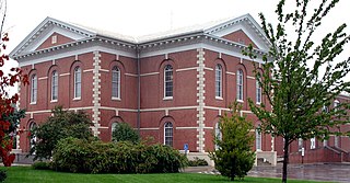
Clay County is located in the U.S. state of Missouri and is part of the Kansas City metropolitan area. As of the 2020 census, the county had a population of 253,335, making it the fifth-most populous county in Missouri. Its county seat is Liberty. The county was organized January 2, 1822, and named in honor of U.S. Representative Henry Clay from Kentucky, later a member of the United States Senate and United States Secretary of State.
Platte County is a county located in the northwestern portion of the U.S. state of Missouri and is part of the Kansas City metropolitan area. As of the 2020 census, the population was 106,718. Its county seat is Platte City. The county was organized December 31, 1838, from the Platte Purchase, named for the Platte River. The Kansas City International Airport is located in the county, approximately one mile west of Interstate 29 between mile markers 12 and 15. The land for the airport was originally in an unincorporated portion of Platte County before being annexed by Platte City, and eventually Kansas City.
Excelsior Springs is a city in Clay and Ray counties in the U.S. state of Missouri and part of the Kansas City metropolitan area. The population was 10,553 at the 2020 census. It is located approximately 30 miles (48 km) northeast of central Kansas City, Missouri.

Cameron is a city in Clinton, DeKalb and Caldwell counties in the U.S. state of Missouri. The population was 8,513 at the 2020 census.

The Kansas City metropolitan area is a bi-state metropolitan area anchored by Kansas City, Missouri. Its 14 counties straddle the border between the U.S. states of Missouri and Kansas. With 8,472 square miles (21,940 km2) and a population of more than 2.2 million people, it is the second-largest metropolitan area centered in Missouri and is the largest metropolitan area in Kansas, though Wichita is the largest metropolitan area centered in Kansas. Alongside Kansas City, Missouri, these are the suburbs with populations above 100,000: Overland Park, Kansas; Kansas City, Kansas; Olathe, Kansas; Independence, Missouri; and Lee's Summit, Missouri.

Fort Kearny was a historic outpost of the United States Army founded in 1848 in the western U.S. during the middle and late 19th century. The fort was named after Col. and later General Stephen Watts Kearny. The outpost was located along the Oregon Trail near Kearney, Nebraska. The town of Kearney took its name from the fort. The "e" was added to Kearny by postmen who consistently misspelled the town name. A portion of the original site is preserved as Fort Kearny State Historical Park by the Nebraska Game and Parks Commission.

The architecture of the Kansas City Metropolitan Area, especially Kansas City, Missouri, includes major works by some of the world's most distinguished architects and firms, including McKim, Mead and White; Jarvis Hunt; Wight and Wight; Graham, Anderson, Probst and White; Hoit, Price & Barnes; Frank Lloyd Wright; the Office of Mies van der Rohe; Barry Byrne; Edward Larrabee Barnes; Harry Weese; and Skidmore, Owings & Merrill.
The list of neighborhoods of Kansas City, Missouri has nearly 240 neighborhoods. The list includes only Kansas City, Missouri and not the entire Kansas City metropolitan area, such as Kansas City, Kansas.

Northeast El Paso is part of the city of El Paso, Texas and is located north of Central El Paso, and east of the Franklin Mountains. Its southern boundary is variously given as Fred Wilson Boulevard or Cassidy Road and Van Buren Avenue, and it extends northward to the New Mexico state line; some portions of this region lie outside the city limits, including parts of Franklin Mountains State Park and areas of Fort Bliss: the Logan area of Fort Bliss around Chapin High School and Castner Range, an old firing range northwest of Hondo Pass Avenue and Gateway South Boulevard. Development of Northeast El Paso, which had begun before the Second World War around the Logan area, started in earnest during the 1950s, when many homes were demolished in the process of the construction of Interstate 10. It is one of the more ethnically diverse areas of town due to a high concentration of enlisted military families. Northeast El Paso has historically not developed at a rate comparable to East El Paso and Northwest El Paso, but in recent years, it has seen an increase in development. It is expected that the population in Northeast El Paso will grow more rapidly as a result of the troop increase for Fort Bliss in the coming years. Northeast El Paso has gained recognition throughout the city for schools like Parkland, Irvin, Andress and Chapin because of their outstanding athletic programs.
Pendleton Heights is a historic neighborhood in Kansas City, Missouri, United States. It is near the downtown highway loop, between Paseo and Chestnut Trafficway to the west and east, and Independence Avenue and Cliff Drive to the south and north.
Mid-Continent Public Library, officially known as Consolidated Library District #3, is a consolidated public library system serving Clay, Platte, and Jackson Counties in Missouri, with headquarters in Independence, Missouri.

Tiffany Castle is a landmark home in the historic Pendleton Heights neighborhood in Kansas City, Jackson County, Missouri, United States. It was built in 1909 as the home of Flavel B. Tiffany, who later founded the Tiffany Springs neighborhood of Kansas City. The Tudor architecture castle sits on the bluffs overlooking the East Bottoms and the Missouri River below, and can be seen for miles.
Linkville is a neighborhood of Kansas City, Missouri, United States.
Northland Center for Advanced Professional Studies (CAPS) is a high school program which operates multiple different magnet programs for students who live within the school districts of: Excelsior Springs, Kearney, Liberty, North Kansas City, Park Hill, Platte County, and Smithville.
Barry, often referred to as "The Town of Barry" was a city centered at the intersection of Barry Road and Old Stagecoach Road in northern Kansas City, Clay County, Missouri. It was founded in 1829 and named after the Postmaster General William Taylor Barry.
References
- 1 2 "Tiffany Springs (in Platte County, MO) Populated Place Profile". MO HomeTownLocator. Retrieved 10 December 2016.
- 1 2 Bushnell, Michael (October 3, 2018). "The Northeast's "Tiffany Castle"". Northeast News. Retrieved April 13, 2020.
- ↑ U.S. Geological Survey Geographic Names Information System: Tiffany Springs, Kansas City, Missouri
- ↑ "Post Offices". Jim Forte Postal History. Retrieved 9 December 2016.
- ↑ "Platte County Place Names, 1928–1945". The State Historical Society of Missouri. Archived from the original on June 24, 2016. Retrieved December 9, 2016.
- ↑ "The Springs Aquatic Center - About Us".
- ↑ "The Springs Aquatic Center". Kansas City Parks and Recreation.
- ↑ "The Springs Aquatic Center". Platte County Parks.