See also
- Tilbury Juxta Clare, a parish in north Essex, England
| This disambiguation page lists articles associated with the title Tilbury. If an internal link led you here, you may wish to change the link to point directly to the intended article. |
Tilbury is a town in Thurrock, Essex, England
Tilbury can also refer to:
| This disambiguation page lists articles associated with the title Tilbury. If an internal link led you here, you may wish to change the link to point directly to the intended article. |

Harwich is a town in Essex, England and one of the Haven ports, located on the coast with the North Sea to the east. It is in the Tendring district. Nearby places include Felixstowe to the northeast, Ipswich to the northwest, Colchester to the southwest and Clacton-on-Sea to the south. It is the northernmost coastal town within Essex.

Thurrock is a unitary authority area with borough status in the English ceremonial county of Essex. It is part of the London commuter belt and an area of regeneration within the Thames Gateway redevelopment zone. The local authority is Thurrock Council.

Grays is the largest town in the borough and unitary authority of Thurrock in Essex and one of Thurrock's traditional parishes. The town, on the north bank of the River Thames, is approximately 20 miles (32 km) to the east of central London, and 2 miles (3.2 km) east of the M25 motorway. Its economy is linked to Port of London industries, its own offices, retail and the Lakeside Shopping Centre at West Thurrock.

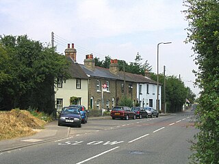
Tilbury is a town in the borough of Thurrock, Essex, England. The present town was established as separate settlement in the late 19th century, on land that was mainly part of Chadwell St Mary. It contains a 16th century fort and an ancient cross-river ferry. Tilbury is part of the Port of London with a major deep-water port which contributes to the local economy.
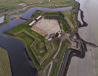
Tilbury Fort, also known historically as the Thermitage Bulwark and the West Tilbury Blockhouse, is an artillery fort on the north bank of the River Thames in England. The earliest version of the fort, comprising a small blockhouse with artillery covering the river, was constructed by King Henry VIII to protect London against attack from France as part of his Device programme. It was reinforced during the 1588 Spanish Armada invasion scare, after which it was reinforced with earthwork bastion, and Parliamentary forces used it to help secure the capital during the English Civil War of the 1640s. Following naval raids during the Anglo-Dutch Wars, the fort was enlarged by Sir Bernard de Gomme from 1670 onwards to form a star-shaped defensive work, with angular bastions, water-filled moats and two lines of guns facing onto the river.
North Ockendon is the easternmost and most outlying settlement of Greater London, England, and part of the London Borough of Havering. It is 18 miles (29 km) east-northeast of Central London and consists of a dispersed settlement within the Metropolitan Green Belt. It was historically an ancient parish in the county of Essex, that was abolished for civil purposes in 1936. North Ockendon is the only area in Greater London outside the M25 London Orbital Motorway. North Ockendon is north of South Ockendon, in Thurrock, Essex.

Purfleet-on-Thames is a town in the Thurrock unitary authority, Essex, England. It is bordered by the A13 road to the north and the River Thames to the south and is within the easternmost part of the M25 motorway but just outside the Greater London boundary. It was within the traditional Church of England parish of West Thurrock. Some industry is located to the south and the area forms part of the Thames Gateway redevelopment area. Purfleet is one of seven conservation areas in Thurrock.
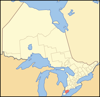
Kent County, area 2,458 km2 is a historic county in the Canadian province of Ontario.
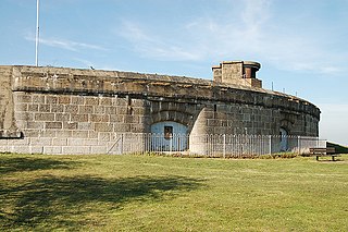
Coalhouse Fort is an artillery fort in the eastern English county of Essex. It was built in the 1860s to guard the lower Thames from seaborne attack. It stands at Coalhouse Point on the north bank of the river, at a location near East Tilbury which was vulnerable to raiders and invaders. It was the last in a series of fortifications dating back to the 15th century and was the direct successor to a smaller mid-19th century fort built on the same site. Constructed during a period of tension with France, its location on marshy ground caused problems from the start and led to a lengthy construction process. The fort was equipped with a variety of large-calibre artillery guns and the most modern defensive facilities of the time, including shell-proof casemates protected by granite facing and cast-iron shields. Its lengthy construction and the rapid pace of artillery development at the time meant that it was practically obsolete for its original purpose within a few years of its completion.
Stanford-le-Hope is a town and Church of England parish situated in the county of Essex, England. Often known locally simply as Stanford, the town is within the unitary authority of Thurrock and located 23.8 miles (38.4 km) east of Charing Cross in London. Its principal claim to fame is that Joseph Conrad lived and wrote there. Unlike some other areas of Thurrock, Stanford-le-Hope is surrounded by countryside and farmland.

Chadwell St Mary is in the unitary authority of Thurrock in Essex, England. It is one of the traditional parishes in Thurrock and a former civil parish. Its residential areas are on the higher ground overlooking the former Thameside marshland. Grays is a town centred 2 miles (3.2 km) west of it. Closer still, 1 mile (1.6 km) south is the modern town of Tilbury which was almost wholly part of the parish until the end of the 19th century. The settlement is frequently referred to simply as Chadwell, particularly before the 19th century.

Thurrock was a local government district and civil parish in south Essex, England from 1936 to 1974.

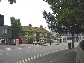
West Tilbury is a village on the top of and on the sides of a 30 metres (98 ft) tall river terrace overlooking the river Thames. Part of the modern town of Tilbury is within the traditional parish of West Tilbury.
Lawford is a village in Essex, England.
East Tilbury is a village in the unitary authority of Thurrock borough, Essex, England and one of the traditional parishes in Thurrock.
Langdon Hills is a township located in the Borough of Basildon district in Essex, England. It is contiguous with the Basildon continuous urban area.
The Port of Tilbury is a port on the River Thames at Tilbury in Essex, England. It is the principal port for London, as well as being the main United Kingdom port for handling the importation of paper. There are extensive facilities for containers, grain, and other bulk cargoes. There are also facilities for the importation of cars. It forms part of the wider Port of London.

The Bata shoe factory in East Tilbury is what remains of an industrial estate in Essex, England, which produced shoes for over 70 years. Founded in 1932 by Tomáš Baťa, the factory was "one of the most important planned landscapes in the East of England" in the 20th century. The factory closed in 2005.

Essex is a county in the east of England, north-east of London. One of the home counties, it borders Suffolk and Cambridgeshire to the north, Hertfordshire to the west, Kent across the estuary of the River Thames to the south and London to the south-west. The county town is Chelmsford, the only city in the county. For government statistical purposes, Essex is placed in the East of England region, where the inclusion of Essex is one of the main differences between the modern and the historical region.