Related Research Articles

Gilpin County is a county located in the U.S. state of Colorado, smallest in land area behind only the City and County of Broomfield. As of the 2020 census, the population was 5,808. The county seat is Central City. The county was formed in 1861, while Colorado was still a territory, and was named after Colonel William Gilpin, the first territorial governor.
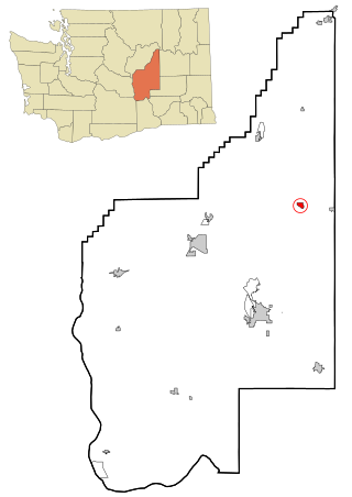
Wilson Creek is a town in Grant County, Washington, United States. The population was 204 at the 2020 census.

The Hoover Wilderness is a wilderness area in the Inyo and Humboldt-Toiyabe National Forests. It lies to the east of the crest of the central Sierra Nevada in California, to the north and east of Yosemite National Park - a long strip stretching nearly to Sonora Pass on the north and Tioga Pass on the south.

Big Creek is a 19.3-mile-long (31.1 km) tributary of the San Joaquin River in the Sierra Nevada, within the Sierra National Forest, central California.
Huntington Lake is an unincorporated community in Fresno County, California. It is located on the west end of Huntington Lake 2 miles (3.2 km) north of Big Creek, at an elevation of 7027 feet.

Yosemite Creek is a 15-mile-long (24 km) creek of the Sierra Nevada, located in Yosemite National Park, Mariposa County, California, United States.

Cedar Crest is an unincorporated community in Fresno County, California. It is located on the north side of Huntington Lake 3.5 miles (5.6 km) northeast of Big Creek, at an elevation of 7077 feet.
Dinkey Creek is an unincorporated community in Fresno County, California. It is located on Dinkey Creek, at an elevation of 5987 feet.
Pineridge is an unincorporated community in Fresno County, California. It is located 4 miles (6.4 km) southwest of Shaver Lake Heights, at an elevation of 4842 feet.

Filmore Township is one of eight townships in Bollinger County, Missouri, USA. As of the 2000 U.S. Census, its population was 508. As of the 2010 U.S. Census, the population had decreased to 488. Filmore Township covers an area of 60.71 square miles (157.2 km2).
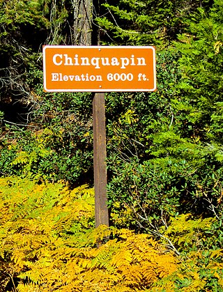
Chinquapin is a former settlement in Mariposa County, California. It was located 8.5 miles (14 km) north-northwest of Wawona. It is located within Yosemite National Park, adjacent to the community of Yosemite West. Chinquapin is the midway point between Yosemite Valley and Wawona, a community inside the park.
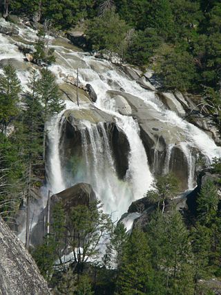
Three Chute Falls is a waterfall on Tenaya Creek in Yosemite National Park, in the U.S. state of California.

Bennettville is a former settlement and ghost town in Mono County, California. It was located on Mine Creek 4 mi (6.4 km) east-southeast of Mount Conness.
Bishop Creek is a stream in Yosemite National Park, United States. It is a tributary of the South Fork Merced River.
Boundary Creek is a stream in Madera County, California, in the United States.
Breeze Creek is a stream in Tuolumne County, California, United States.

Budd Creek is a stream in Yosemite National Park, United States.
Chetwood Creek is a stream in Madera County, California, in the United States.

The Panorama Trail is a marked hiking trail in Yosemite National Park that descends along the south wall of Yosemite Valley from Glacier Point, past several major waterfalls, to Happy Isles. The trail derives its name from the panoramic vistas visible along the route, most notably Panorama Point.
References
- 1 2 3 U.S. Geological Survey Geographic Names Information System: Tiltill Creek
- ↑ Sullivan, Ron (December 7, 2002). "Roots of native names". SFGate. Retrieved 27 March 2018.
37°57′25″N119°43′46″W / 37.95707°N 119.72942°W