Related Research Articles

A digital elevation model (DEM) is a 3D computer graphics representation of elevation data to represent terrain, commonly of a planet, moon, or asteroid. A "global DEM" refers to a discrete global grid. DEMs are used often in geographic information systems, and are the most common basis for digitally produced relief maps.
The MM5 is a regional mesoscale model used for creating weather forecasts and climate projections. It is a community model maintained by Penn State University and the National Center for Atmospheric Research. The MM5 is a limited-area, terrain-following sigma coordinate model that is used to replicate or forecast mesoscale and regional scale atmospheric circulation. It has been updated many times since the 1970s to fix bugs, adapt to new technologies, and work on different types of computers and software. It is used in many different ways: for research and for weather prediction. In research, it is used to compare it to other models, to see what works and what does not work. It is also used for air quality models.

Numerical weather prediction (NWP) uses mathematical models of the atmosphere and oceans to predict the weather based on current weather conditions. Though first attempted in the 1920s, it was not until the advent of computer simulation in the 1950s that numerical weather predictions produced realistic results. A number of global and regional forecast models are run in different countries worldwide, using current weather observations relayed from radiosondes, weather satellites and other observing systems as inputs.
Data assimilation is a mathematical discipline that seeks to optimally combine theory with observations. There may be a number of different goals sought, for example—to determine the optimal state estimate of a system, to determine initial conditions for a numerical forecast model, to interpolate sparse observation data using knowledge of the system being observed, to train numerical model parameters based on observed data. Depending on the goal, different solution methods may be used. Data assimilation is distinguished from other forms of machine learning, image analysis, and statistical methods in that it utilizes a dynamical model of the system being analyzed.

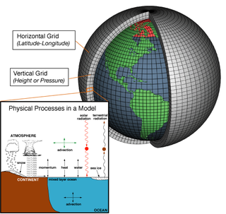
An atmospheric model is a mathematical model constructed around the full set of primitive dynamical equations which govern atmospheric motions. It can supplement these equations with parameterizations for turbulent diffusion, radiation, moist processes, heat exchange, soil, vegetation, surface water, the kinematic effects of terrain, and convection. Most atmospheric models are numerical, i.e. they discretize equations of motion. They can predict microscale phenomena such as tornadoes and boundary layer eddies, sub-microscale turbulent flow over buildings, as well as synoptic and global flows. The horizontal domain of a model is either global, covering the entire Earth, or regional (limited-area), covering only part of the Earth. The different types of models run are thermotropic, barotropic, hydrostatic, and nonhydrostatic. Some of the model types make assumptions about the atmosphere which lengthens the time steps used and increases computational speed.
The Mars Regional Atmospheric Modeling System (MRAMS) is a computer program that simulates the circulations of the Martian atmosphere at regional and local scales. MRAMS, developed by Scot Rafkin and Timothy Michaels, is derived from the Regional Atmospheric Modeling System (RAMS) developed by William R. Cotton and Roger A. Pielke to study atmospheric circulations on the Earth.

The Weather Research and Forecasting (WRF) model is a numerical weather prediction (NWP) system designed to serve both atmospheric research and operational forecasting needs. NWP refers to the simulation and prediction of the atmosphere with a computer model, and WRF is a set of software for this. WRF features two dynamical (computational) cores, a data assimilation system, and a software architecture allowing for parallel computation and system extensibility. The model serves a wide range of meteorological applications across scales ranging from meters to thousands of kilometers.
Model Output Statistics (MOS) is a multiple linear regression technique in which predictands, often near-surface quantities, such as two-meter-above-ground-level air temperature, horizontal visibility, and wind direction, speed and gusts, are related statistically to one or more predictors. The predictors are typically forecasts from a numerical weather prediction (NWP) model, climatic data, and, if applicable, recent surface observations. Thus, output from NWP models can be transformed by the MOS technique into sensible weather parameters that are familiar to the "person on the street".
A wind power forecast corresponds to an estimate of the expected production of one or more wind turbines in the near future. By production is often meant available power for wind farm considered. Forecasts can also be expressed in terms of energy, by integrating power production over each time interval.
The MEMO model is a Eulerian non-hydrostatic prognostic mesoscale model for wind-flow simulation. It was developed by the Aristotle University of Thessaloniki in collaboration with the Universität Karlsruhe. The MEMO Model together with the photochemical dispersion model MARS are the two core models of the European zooming model (EZM). This model belongs to the family of models designed for describing atmospheric transport phenomena in the local-to-regional scale, frequently referred to as mesoscale air pollution models.
Microscale meteorology is the study of short-lived atmospheric phenomena smaller than mesoscale, about 1 km or less. These two branches of meteorology are sometimes grouped together as "mesoscale and microscale meteorology" (MMM) and together study all phenomena smaller than synoptic scale; that is they study features generally too small to be depicted on a weather map. These include small and generally fleeting cloud "puffs" and other small cloud features. Microscale meteorology controls the most important mixing and dilution processes in the atmosphere. Important topics in microscale meteorology include heat transfer and gas exchange between soil, vegetation, and/or surface water and the atmosphere caused by near-ground turbulence. Measuring these transport processes involves use of micrometeorological towers. Variables often measured or derived include net radiation, sensible heat flux, latent heat flux, ground heat storage, and fluxes of trace gases important to the atmosphere, biosphere, and hydrosphere.

The following outline is provided as an overview of and topical guide to the field of Meteorology.
Specialized wind energy software applications aid in the development and operation of wind farms.
Wind resource assessment is the process by which wind power developers estimate the future energy production of a wind farm. Accurate wind resource assessments are crucial to the successful development of wind farms.

In computational science, wildfire modeling is concerned with numerical simulation of wildland fires in order to understand and predict fire behavior. Wildfire modeling can ultimately aid wildland fire suppression, namely increase safety of firefighters and the public, reduce risk, and minimize damage. Wildfire modeling can also aid in protecting ecosystems, watersheds, and air quality.

Terminal Doppler Weather Radar (TDWR) is a Doppler weather radar system with a three-dimensional "pencil beam" used primarily for the detection of hazardous wind shear conditions, precipitation, and winds aloft on and near major airports situated in climates with great exposure to thunderstorms in the United States. As of 2011, all were in-service with 45 operational radars, some covering multiple airports in major metropolitan locations, across the United States & Puerto Rico. Several similar weather radars have also been sold to other countries such as China. Funded by the United States Federal Aviation Administration (FAA), TDWR technology was developed in the early 1990s at Lincoln Laboratory, part of the Massachusetts Institute of Technology, to assist air traffic controllers by providing real-time wind shear detection and high-resolution precipitation data.

Nowcasting is weather forecasting on a very short term mesoscale period of up to 2 hours according to the World Meteorological Organization and up to six hours according to other authors in the field. This forecast is an extrapolation in time of known weather parameters, including those obtained by means of remote sensing, using techniques that take into account a possible evolution of the air mass. This type of forecast therefore includes details that cannot be solved by numerical weather prediction (NWP) models running over longer forecast periods.
Ocean general circulation models (OGCMs) are a particular kind of general circulation model to describe physical and thermodynamical processes in oceans. The oceanic general circulation is defined as the horizontal space scale and time scale larger than mesoscale. They depict oceans using a three-dimensional grid that include active thermodynamics and hence are most directly applicable to climate studies. They are the most advanced tools currently available for simulating the response of the global ocean system to increasing greenhouse gas concentrations. A hierarchy of OGCMs have been developed that include varying degrees of spatial coverage, resolution, geographical realism, process detail, etc.

The Global Wind Atlas is a web-based application developed to help policymakers and investors identify potential high-wind areas for wind power generation virtually anywhere in the world, and perform preliminary calculations. It provides free access to data on wind power density and wind speed at multiple heights using the latest historical weather data and modeling, at an output resolution of 250 meters. It is owned and maintained by the Wind Energy Department of the Technical University of Denmark and in recent years has been developed in close partnership with the World Bank, with funding provided by the Energy Sector Management Assistance Program (ESMAP).