Timnath-heres or Timnath-serah, later Thamna, was the town given by the Israelites to Joshua according to the Hebrew Bible. He requested it and the people gave it to him "at the order of the Lord". He built up the town and lived in it.

The Copper Scroll (3Q15) is one of the Dead Sea Scrolls found in Cave 3 near Khirbet Qumran, but differs significantly from the others. Whereas the other scrolls are written on parchment or papyrus, this scroll is written on metal: copper mixed with about 1 percent tin, although no metallic copper remained in the strips; the action of the centuries had been to convert the metal into brittle oxide. The so-called 'scrolls' of copper were, in reality, two separated sections of what was originally a single scroll about 2.4 metres (7.9 ft) in length. Unlike the others, it is not a literary work, but a list of 64 places where various items of gold and silver were buried or hidden. It differs from the other scrolls in its Hebrew, its orthography, palaeography and date.

Jattir is a town in Judea mentioned several times in the Hebrew Bible. It was known as Iethira during the 4th century CE, when it was a Christian town. It is identified with Horvat Yattir/Khirbet Attir, an archeological site in the southern Hebron Hills, located in modern day Israel.

The LMLK seal appears on the handles of several large storage jars from the Kingdom of Judah, where it was first issued during the reign of Hezekiah around 700 BCE. Seals bearing these four Hebrew letters have been discovered primarily on unearthed artifacts in and around Jerusalem, with some in northern Israel. Several complete jars were found in situ at the ancient city of Lachish, where they were buried underneath a destruction layer caused by Sennacherib, who reigned over the Neo-Assyrian Empire from 705 BCE to 681 BCE. While none of the original stamp seals have been found, some 2,000 impressions made by at least 21 seal types have been published. The iconography of the two- and four-winged symbols are representative of royal symbols whose meaning "was tailored in each kingdom to the local religion and ideology".
Timnath or Timnah was a Philistine city in Canaan that is mentioned in the Hebrew Bible in Judges 14 and in connection with Samson. Modern archaeologists identify the ancient site with a tell lying on a flat, alluvial plain, located in the Sorek Valley ca. 7 kilometres (4.3 mi) north-west of Beit Shemesh, near moshav Tal Shahar in Israel, known in Hebrew as Tel Batash or Teluliot Batashi (plural), and in Arabic as Tell Butashi or Teleilat Batashi (plural). The site is not to be confused with either the as yet unidentified Timna from the hill country of Judah, nor with the southern copper-smelting site of Timna in the Arabah near Eilat.

The Timna Valley is located in southern Israel in the southwestern Arava/Arabah, approximately 30 kilometres (19 mi) north of the Gulf of Aqaba and the city of Eilat. The area is rich in copper ore and has been mined since the 5th millennium BCE. During early antiquity, the area would have been part of the Kingdom of Edom.

Ayta ash Shab is a village located in southern Lebanon, about 1 km northeast of the Israeli border. The majority of its population are Shia Muslims.

Keilah was a city in the lowlands of the Kingdom of Judah. It is now a ruin known as Khirbet Qeyla near the modern village of Qila, Hebron, 7 miles (11 km) east of Bayt Jibrin and about 3 kilometres (1.9 mi) west of Kharas.
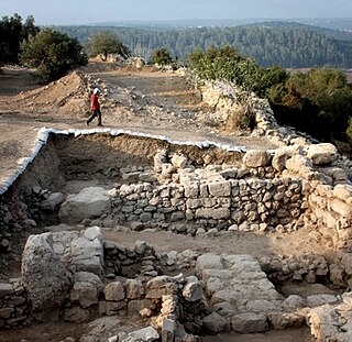
Khirbet Qeiyafa, also known as Elah Fortress and in Hebrew as Horbat Qayafa, is the site of an ancient fortress city overlooking the Valley of Elah and dated to the first half of the 10th century BCE. The ruins of the fortress were uncovered in 2007, near the Israeli city of Beit Shemesh, 30 km (20 mi) from Jerusalem. It covers nearly 2.3 ha and is encircled by a 700-meter-long (2,300 ft) city wall constructed of field stones, some weighing up to eight tons. Excavations at site continued in subsequent years. A number of archaeologists, mainly the two excavators, Yosef Garfinkel and Saar Ganor, have claimed that it might be one of two biblical cities, either Sha'arayim, whose name they interpret as "Two Gates", because of the two gates discovered on the site, or Neta'im; and that the large structure at the center is an administrative building dating to the reign of King David, where he might have lodged at some point. This is based on their conclusions that the site dates to the early Iron IIA, ca. 1025–975 BCE, a range which includes the biblical date for the biblical Kingdom of David. Others suggest it might represent either a North Israelite, Philistine, or Canaanite fortress, a claim rejected by the archaeological team that excavated the site. The team's conclusion that Khirbet Qeiyafa was a fortress of King David has been criticised by some scholars. Garfinkel (2017) changed the chronology of Khirbet Qeiyafa to ca. 1000–975 BCE.

al-Badhan is a Palestinian village in the Nablus Governorate in the North central West Bank, located 7.28 kilometres (4.52 mi) northeast of Nablus, and 1.5 kilometres (0.93 mi) to the north of Elon Moreh. According to the Palestinian Central Bureau of Statistics (PCBS), the village had a population of 3,171 inhabitants in 2017.

Mata is a moshav in central Israel. Located in the Jerusalem corridor about eight kilometers southeast of Beit Shemesh, it falls under the jurisdiction of Mateh Yehuda Regional Council. In 2022 it had a population of 951.
Khirbat Umm Burj was a Palestinian Arab village in the Hebron Subdistrict, sometimes designated in modern maps as Burgin. Its ruins are today located within the borders of Israel. It occupied an extensive site, stretching about 30 dunams on the crest of a hill, rising some 430 metres (1,410 ft) above sea level, and commanding a good prospect of the surrounding region. It was depopulated during the 1948 Arab–Israeli War on October 28, 1948, during the third stage of Operation Yo'av under the command of Yigal Allon. The site is located 17 km northwest of Hebron.

The Tomb of Joshua, i.e. the burial site of the biblical figure Joshua, and that of his companion Caleb are, according to a Samaritan tradition noted in 1877, at Kifl Haris in the West Bank. Religious Jews also identify one of the mausolea at Kifl Haris with that of Joshua and thousands of them go there on pilgrimage on the annual commemoration of his death, 26th of Nisan on the Hebrew calendar.
Khirbet Tibnah is a tell located in the Ramallah and al-Bireh Governorate of the West Bank, between the villages Deir Nidham and Nabi Salih. It was inhabited from the Early Bronze Age to the Ottoman period.

Khirbet Beit Zakariyyah is a small Palestinian village southwest of Bethlehem in the West Bank, perched on a hill that rises about 995 metres (3,264 ft) above sea level. Administratively, it is associated with the village of Artas under the Bethlehem Governorate. It is also located in between the Israeli settlements of Alon Shevut and Rosh Tzurim, both of which were built on land confiscated from the village. The village had a population of 142 in 2017.

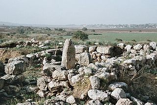
Chezib, also known as Achzib of Judah, is a biblical place-name associated with the birth of Judah's son, Shelah (Genesis 38:5), corresponding to the Achzib of the Book of Joshua (15:44), a town located in the low-lying hills of the plain of Judah, known as the Shefela. In I Chronicles 4:22, the town is rendered as Chozeba. The place is now a ruin.

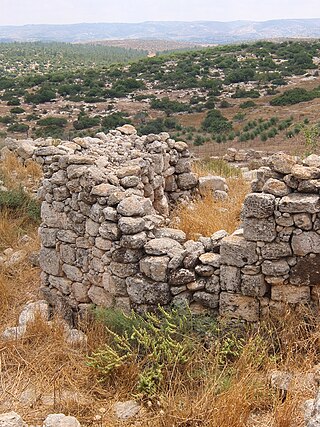
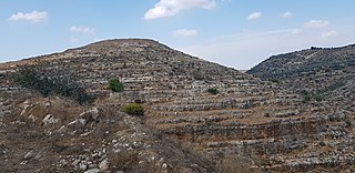
Khirbet et-Tibbâneh (Arabic: خربة التبانة), sometimes referred to by historical geographers as the Timnah of Judah, is a small ruin situated on a high ridge in the Judaean mountains, in the Sansan Nature Reserve, 622 metres (2,041 ft) above sea level, about 3 kilometers east of Aviezer and ca. 7 kilometers southeast of Bayt Nattif.

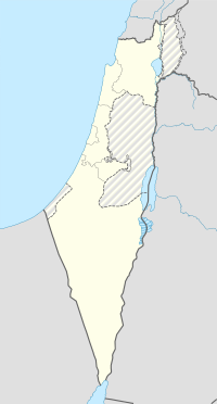
Hebrew-language names were coined for the place-names of Palestine throughout different periods under the British Mandate; after the establishment of Israel following the 1948 Palestinian expulsion and flight and 1948 Arab–Israeli War; and subsequently in the Palestinian territories occupied by Israel in 1967. A 1992 study counted c. 2,780 historical locations whose names were Hebraized, including 340 villages and towns, 1,000 Khirbat (ruins), 560 wadis and rivers, 380 springs, 198 mountains and hills, 50 caves, 28 castles and palaces, and 14 pools and lakes. Palestinians consider the Hebraization of place-names in Palestine part of the Palestinian Nakba.
Judges 14 is the fourteenth chapter of the Book of Judges in the Old Testament or the Hebrew Bible. According to Jewish tradition the book was attributed to the prophet Samuel, but modern scholars view it as part of the Deuteronomistic History, which spans in the books of Deuteronomy to 2 Kings, attributed to nationalistic and devotedly Yahwistic writers during the time of the reformer Judean king Josiah in 7th century BCE. This chapter records the activities of judges Samson. belonging to a section comprising Judges 13 to 16 and Judges 6:1 to 16:31.
Khirbet el-'Ormeh or Horvat Ormah is an archaeological site located in the West Bank, around ten kilometers southeast of the Palestinian city of Nablus. The site contains the remains of a Hasmonean-Herodian fortress consisting of a fortification wall, rectangular towers constructed in the Hellenistic style, and a series of large cisterns for storing rainwater.