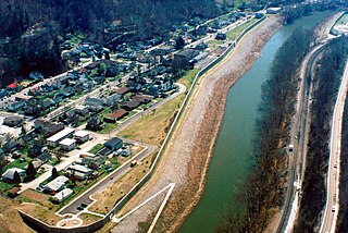
Tims Fork

Last updated

Tims Fork is a stream in the U.S. state of West Virginia. [1]

Stream A body of surface water flowing down a channel

A stream is a body of water with surface water flowing within the bed and banks of a channel. The stream encompasses surface and groundwater fluxes that respond to geological, geomorphological, hydrological and biotic controls.

U.S. state constituent political entity of the United States

In the United States, a state is a constituent political entity, of which there are currently 50. Bound together in a political union, each state holds governmental jurisdiction over a separate and defined geographic territory and shares its sovereignty with the federal government. Due to this shared sovereignty, Americans are citizens both of the federal republic and of the state in which they reside. State citizenship and residency are flexible, and no government approval is required to move between states, except for persons restricted by certain types of court orders. Four states use the term commonwealth rather than state in their full official names.

West Virginia State of the United States of America

West Virginia is a state located in the Appalachian region in the Southern United States and is also considered to be a part of the Middle Atlantic States. It is bordered by Pennsylvania to the north, Maryland to the east and northeast, Virginia to the southeast, Kentucky to the southwest, and Ohio to the northwest. West Virginia is the 41st largest state by area, and is ranked 38th in population. The capital and largest city is Charleston.

Tims Fork was named after Timothy Wallace, a pioneer settler. [2]

See also

Related Research Articles

Kermit, West Virginia Town in West Virginia, United States

Kermit is a town in Mingo County, West Virginia, United States. The population was 406 at the 2010 census. Kermit is located along the Tug Fork, opposite Warfield, Kentucky. The Norfolk Southern Railway's Kenova District runs through town.

Battle of Middle Creek

The Battle of Middle Creek was an engagement fought January 10, 1862, in Eastern Kentucky during the American Civil War.

Lunice Creek is a 7.3-mile-long (11.7 km) tributary of the South Branch Potomac River, belonging to the Potomac River and Chesapeake Bay watersheds. The creek is located in Grant County, West Virginia. Lunice Creek is created by its North and South Forks and empties into the South Branch at Petersburg.

South Williamson, Kentucky Census-designated place

South Williamson is a census-designated place (CDP) in the Appalachian Mountains of northeastern Pike County, Kentucky, United States, on the border with West Virginia. It is separated from Williamson, West Virginia by the Tug Fork River. The community is located near U.S. Route 119 about 23 miles (37 km) east of Pikeville, Kentucky and 28 miles (45 km) southwest of Logan, West Virginia.

Dry Fork (Tug Fork tributary) river in the United States of America

The Dry Fork is a 47.7-mile-long (76.8 km) tributary of the Tug Fork, belonging to the Ohio River watershed. The river is located in McDowell County, West Virginia, and Tazewell County, Virginia, in the United States. The mouth of the Dry Fork into the Tug Fork is located at Iaeger.

Beards Fork, West Virginia Census-designated place in West Virginia, United States

Beards Fork is a census-designated place (CDP) and coal town in Fayette County, West Virginia, United States that was founded as a coal town. As of the 2010 census, its population was 199.

Georges Fork is an unincorporated community in Dickenson County, Virginia, in the United States.

Moses Fork is a stream in Wayne County, West Virginia, in the United States.

Alum Creek is a stream in the U.S. state of West Virginia. It is a tributary of Tug Fork.

Cougar Fork is a stream in the U.S. state of West Virginia.

Marrowbone Creek is a stream in the U.S. state of West Virginia.

Mate Creek is a stream in the U.S. state of West Virginia. It is a tributary of Tug Fork.

Milam Fork is a stream in the U.S. state of West Virginia.

Miller Creek is a stream in the U.S. state of West Virginia. It is a tributary of Tug Fork.

Thacker Creek is a stream in the U.S. state of West Virginia.

Panther Creek is a stream in the U.S. state of West Virginia. It is a tributary of the Tug Fork.

Pocosin Fork is a stream in the U.S. state of West Virginia.

Silver Creek is a stream in the U.S. state of West Virginia.

Spruce Fork is a stream in the U.S. state of West Virginia.

Yantus is an extinct town in Logan County, in the U.S. state of West Virginia.

References

  1. U.S. Geological Survey Geographic Names Information System: Tims Fork
  2. Kenny, Hamill (1945). West Virginia Place Names: Their Origin and Meaning, Including the Nomenclature of the Streams and Mountains. Piedmont, WV: The Place Name Press. p. 626.

Coordinates: 37°56′03″N82°03′47″W / 37.93417°N 82.06306°W / 37.93417; -82.06306

Geographic coordinate system Coordinate system

A geographic coordinate system is a coordinate system that enables every location on Earth to be specified by a set of numbers, letters or symbols. The coordinates are often chosen such that one of the numbers represents a vertical position and two or three of the numbers represent a horizontal position; alternatively, a geographic position may be expressed in a combined three-dimensional Cartesian vector. A common choice of coordinates is latitude, longitude and elevation. To specify a location on a plane requires a map projection.