Tit-Ary (Russian : Тит-Ары) is the name of several rural localities in the Sakha Republic, Russia:

Russian is an East Slavic language, which is official in the Russian Federation, Belarus, Kazakhstan and Kyrgyzstan, as well as being widely used throughout Eastern Europe, the Baltic states, the Caucasus and Central Asia. It was the de facto language of the Soviet Union until its dissolution on 25 December 1991. Although, nowadays, nearly three decades after the breakup of the Soviet Union, Russian is used in official capacity or in public life in all the post-Soviet nation-states, as well as in Israel and Mongolia, the rise of state-specific varieties of this language tends to be strongly denied in Russia, in line with the Russian World ideology.
The classification system of the types of inhabited localities in Russia, the former Soviet Union, and some other post-Soviet states has certain peculiarities compared with the classification systems in other countries.

The Republic of Sakha (Yakutia) (Russian: Республика Саха, tr.Respublika Sakha , IPA: [rʲɪsˈpublʲɪkə sɐˈxa jɪˈkutʲɪjə]; Yakut: Саха Өрөспүүбүлүкэтэ, translit. Sakha Öröspüübülükete, IPA: [saˈxa øɾøsˈpyːbylykete] is a federal Russian republic. It had a population of 958,528 at the 2010 Census, mainly ethnic Yakuts and Russians.
- Tit-Ary, Khangalassky District, Sakha Republic, a selo in Tit-Arynsky Rural Okrug of Khangalassky District
- Tit-Ary, Ust-Aldansky District, Sakha Republic, a selo in Tit-Arynsky Rural Okrug of Ust-Aldansky District

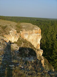
Tit-Ary is a rural locality, the administrative centre of and one of three settlements, in addition to Kharyyalakh and Chkalov, in Tit-Arinsky Rural Okrug of Khangalassky District in the Sakha Republic, Russia. It is located 105 kilometers (65 mi) from Pokrovsk, the administrative center of the district. Its population as of the 2002 Census was 418.
Khangalassky District is an administrative and municipal district, one of the thirty-four in the Sakha Republic, Russia. It is located in the center of the republic and borders Megino-Kangalassky District in the east, Amginsky and Aldansky Districts in the south, Olyokminsky District in the southwest, Gorny District in the northwest, and the territory of the city of republic significance of Yakutsk in the north. The area of the district is 24,700 square kilometers (9,500 sq mi). Its administrative center is the town of Pokrovsk. As of the 2010 Census, the total population of the district, excluding its administrative center, was 24,557.
Tit-Ary is a rural locality, the only inhabited locality, and the administrative center of Tit-Arynsky Rural Okrug of Ust-Aldansky District in the Sakha Republic, Russia, located 60 kilometers (37 mi) from Borogontsy, the administrative center of the district. Its population as of the 2010 Census was 288, down from 298 recorded during the 2002 Census.
| This article includes a list of related items that share the same name (or similar names). If an internal link incorrectly led you here, you may wish to change the link to point directly to the intended article. |